
I purposely planned this trip for when Surry County would (hopefully) be in peak fall color season–and this day didn’t disappoint. A nestled Appalachian Mountains and Blue Ridge Mountains foothills community, Surry County is alive with peaks and valleys and untouched lands. It seems every corner you turn, a majestic mountain or valley view awaits you. Surry County is also part of the Yadkin Valley American Viticultural Area. Because of its locale, the area abounds with more than 50 vineyards and wineries–all featured on the Surry County Wine Trail, including wineries and vineyards throughout the county, such as Stony Knoll Vineyards, Adagio Vineyards, Haze Gray Vineyards, Round Peak Vineyards, Herrera Vineyards, and Shelton Vineyards–the largest vineyard in North Carolina.
Surry County was formed in 1771 from part of Rowan County and was named for the county of Surrey in England, the birthplace of William Tryon, Governor of North Carolina from 1765 to 1771. In 1789, the eastern half of Surry County became Stokes County, and in 1790, the county seat was moved to Rockford where it remained for more than 50 years. The town of Dobson was established in 1853 as the new county seat.
Surry County also contains a small portion of the Sauratown Mountains, marking the western end of the range. (You can join the Friends of Sauratown Mountains, which supports Pilot Mountain and Hanging Rock State Parks.)The western third of the county lies within the Blue Ridge Mountains, which dominate the county’s western horizon with amazing vistas. Do be award of high-wind advisories in this area, as mountain range gaps can cause strong winds to build, which can force automobiles and even large 18-wheeler trucks off the highways. The highest point in Surry County is Fisher Peak in the Blue Ridge Mountains, which rises to 3,570 feet above sea level. However, the best-known peak in Surry County is not the highest. That honor goes to Pilot Mountain, an isolated monadnock (meaning ‘isolated mountain’) and a North Carolina landmark. Pilot Mountain sharply rises some 2,421 feet above the surrounding countryside, and can be seen for miles. Heading north on 52, you’ll discover an amazing approach with a scenic overlook pullover as you approach. Surry County also has three recognized major rivers: the Ararat, the Fisher, and the Mitchell. All three flow southward and are tributaries of the Yadkin River, which forms the southern border of Surry County. The Yadkin River is the northern component of the Pee Dee River, which flows to the Atlantic Ocean near Georgetown, South Carolina.
Before you leave Surry County, be sure to order yourself some Sonker, a dessert specific to this region. There are many different variations, ranging from a cobbler-like appearance to a pseudo-biscuit atop a fruit compote, and both restaurants and families hold their recipes close to the vest. You can also travel the county’s Sonker Trail, including eight restaurants in Elkin and Mount Airy that serve the local treat: Anchored Bakery, Miss Angel’s Heavenly Pies, and Prudence McCabe Confections in Mount Airy; Harvest Grill at Shelton Vineyards and Rockford General Store in Dobson; Southern on Main (had my sonker here), Skull Camp Smokehouse & Brewery in Elkin; and The Tilted Ladder in Pilot Mountain.

Pilot Mountain State Park
The day started in Pilot Mountain with a visit to the mountain itself. This morning was heavily overcast with slight precipitation. I was disappointed on the approach because Pilot Mountain was obviously 100 percent in the clouds–so no amazing views from the top today. Visibility at the top of Pilot Mountain was only a hundred feet or less, but it made for an interesting experience: peaceful, quiet, and very few people. Pilot Mountain, a metamorphic quartzite monadnock, is one of the most distinctive natural geological features in North Carolina. A knob-like structure, it is a remnant of the ancient chain of Sauratown Mountains. The Saura Native Americans, the region’s earliest-known inhabitants, called the mountain “Jomeokee”, meaning “great guide” because they used it as a navigation aid.
One billions years ago, Pilot Mountain was part of a shallow sea and the area experienced volcanic activity. Approximately 700 million years ago, magma invaded the layers of sea sediment and cooled to produce granite. The are continued to undergo a long period of violent geological activity, weathering, and erosion, which eventually turned the igneous rock into a quartzite protective cap, which protects the underlying rocks from further erosion.
Pilot Mountain has two distinctive features, named Big and Little Pinnacle. Big Pinnacle (also called “The Knob”) has high and colorful bare rock walls, with a rounded top covered by vegetation, reaching approximately 1,400 feet above the surrounding terrain. Visitors can take a paved road to the park visitor center and campgrounds, then up to a parking lot on the ridge. Trails from there allow access to the main Little Pinnacle Overlook and other viewing stations as well as the Jomeokee Trail (which includes a few rock climbing areas) around the entire base of the knob–though you will need to be sure-footed to traverse it.
Pilot Mountain is part of Pilot Mountain State Park, which extends to the Yadkin River via a corridor of land, and it is associated with nearby Horne Creek Living Historical Farm. The curved depression between the ridge slope to the Little Pinnacle and then to the round knob of the Big Pinnacle gives the entire mountain an even more distinctive shape from a distance. Other interesting rock formations are to the east at privately held Sauratown Mountain, and the higher complex at Hanging Rock State Park (in Stokes County).
You’ll also find picnic areas here and other trails ranging from 0.1 miles to 4.3 miles, including Sassafras trail and Grindstone Trail which connects the popular campground to Ledge Spring Trail. Fans of Pilot Mountain can select a special First in Flight-Pilot Mountain National Landmark state license plate. And you’ll find a few attractions in the town of Pilot Mountain as well…

Pilot Mountain
Discover wine, fun, and friendship at JoLo Vineyards among the locals (219 Jolo Winery Lane). Shop at the Pilot Mountain Country Store (108 West Main St.), check out the Beroth Oil & Gas Memorabilia Museum (100 East Main St.), and enjoy the Pilot Mountain Train Mural (114 West Main St.) by artist Lisa Floyd–all within feet of one another and within perfect viewing distance of Pilot Mountain.
Incidentally, president of Scripps Networks Interactive and creator of Home & Garden Television (HGTV) is from Westfield, just north of Pilot Mountain. Westfield also has ties to Guilford County’s New Garden Friend’s Meeting Quaker establishment.
And be sure to stop into the town of Pilot Mountain, at the foot of the mountain base, where you’ll find some quaint, local country shops, including Mount Pilot Country Store and a community wall mural: Pilot Mountain Train Mural.
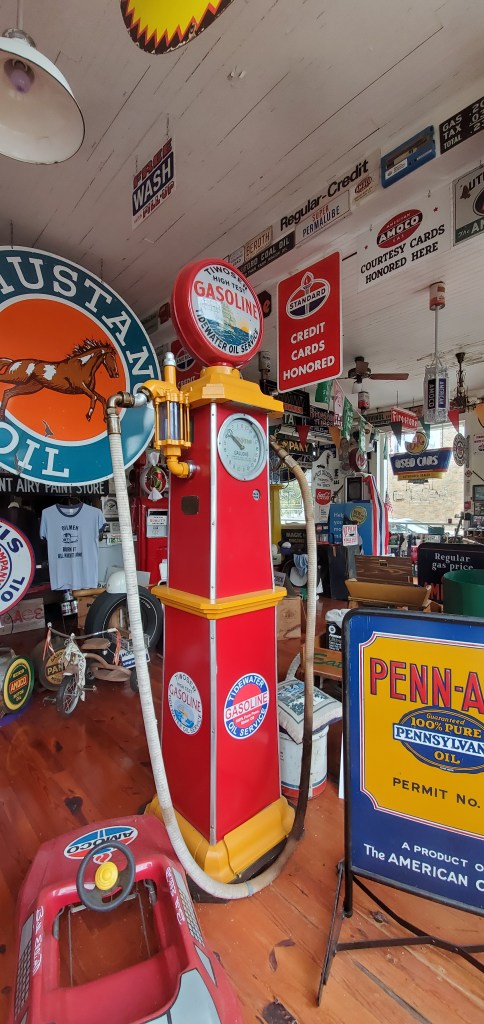
Beroth Oil & Gas Memorabilia Museum
This museum may be open to appointments only, but there are many treasures visible through the windows.

Pinnacle
Horne Creek Living Historical Farm
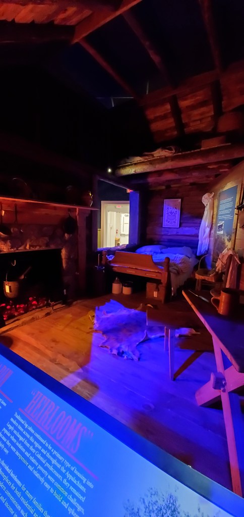
Located here is Horne Creek Living Historical Farm (308 Horne Creek Farm Rd.), is an actual farm and a Piedmont Living History Farm that is operated by turn-of-the-century technology to showcase what life in northwestern North Carolina was like at the time. Here, you can experience what farm life was like in days gone by while touring the property with animals and several buildings, including a tobacco curing barn, cannery site, smokehouse, chicken lot, dry house, farm house, and more. The farm is operated by the state of North Carolina Department of Cultural Resources. Be sure to stop in the gift shop on your way out. Sections of the Pilot Mountain State Park that reach the rapids of the Yadkin River are located in the Shoals community. Admission is free, but donations are welcome.
Mount Airy
Named for a nearby plantation, Mount Airy was settled in the 1750s as a stagecoach stop on the road between Winston-Salem, North Carolina, and Galax, Virginia. Mount Airy was incorporated in 1885 and the City’s official seal was established in 1977, which depicts major industries that are home to Mount Airy, including furniture, textiles, and the granite quarry. In 1994, Mount Airy was named an All-American City.
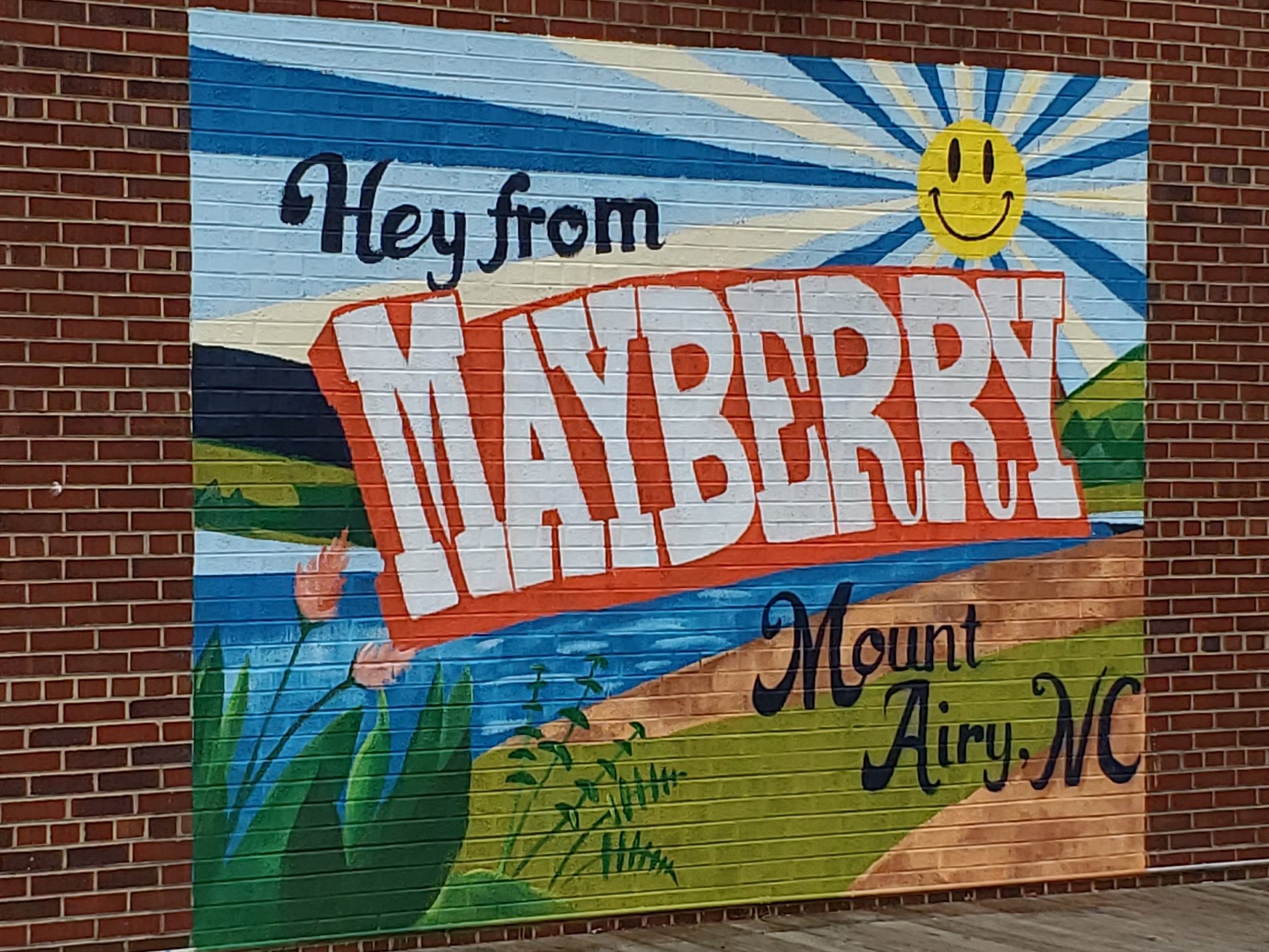
Actor Andy Griffith was born in Mount Airy, and the town is believed to have been the basis for Mayberry, the setting of the TV shows “The Andy Griffith Show” and “Mayberry RFD”. The community holds an annual “Mayberry Days” celebration during the last weekend of September: 30,000 attended in 2009, and 50,000 attended for the show’s 50th anniversary in 2010. The University of North Carolina at Greensboro estimates the town receives $5 million each year as a result of its association with Mayberry tourism. Surviving members of the cast, along with family members of other cast members, often visit. Several Ford Galaxie police cars, painted to resemble those used on the show, give rides to guests via Squad Car Tours (located at Wally’s Service Station, 625 South Main St.). Your visit isn’t complete without a ride in one of these old-timey Barney beauties! Many town establishments pay tribute to their Mayberry heritage, including Floyd’s barber shop, Snappy Lunch, and Aunt Bea’s Room.
The Autumn Leaves Festival is held the second weekend in October, attracting more than 200,000 people to the city during the festival weekend. Vendors sell food and other items, and there is a stage for musicians. The town is also home of old-time music legend Tommy Jarrell, bluegrass gospel legends The Easter Brothers, and country singer Donna Fargo. Mount Airy was also the residence of Chang and Eng Bunker (1811–1874), famous Siamese conjoined twins (originally from Siam) joined by a band of cartilage at the chest (xiphopagus). They are buried at White Plains Baptist Church about 2 miles from Mt Airy Main street. Many of their descendants still live in the Mount Airy area. (See the entry about their gravesite for more.)
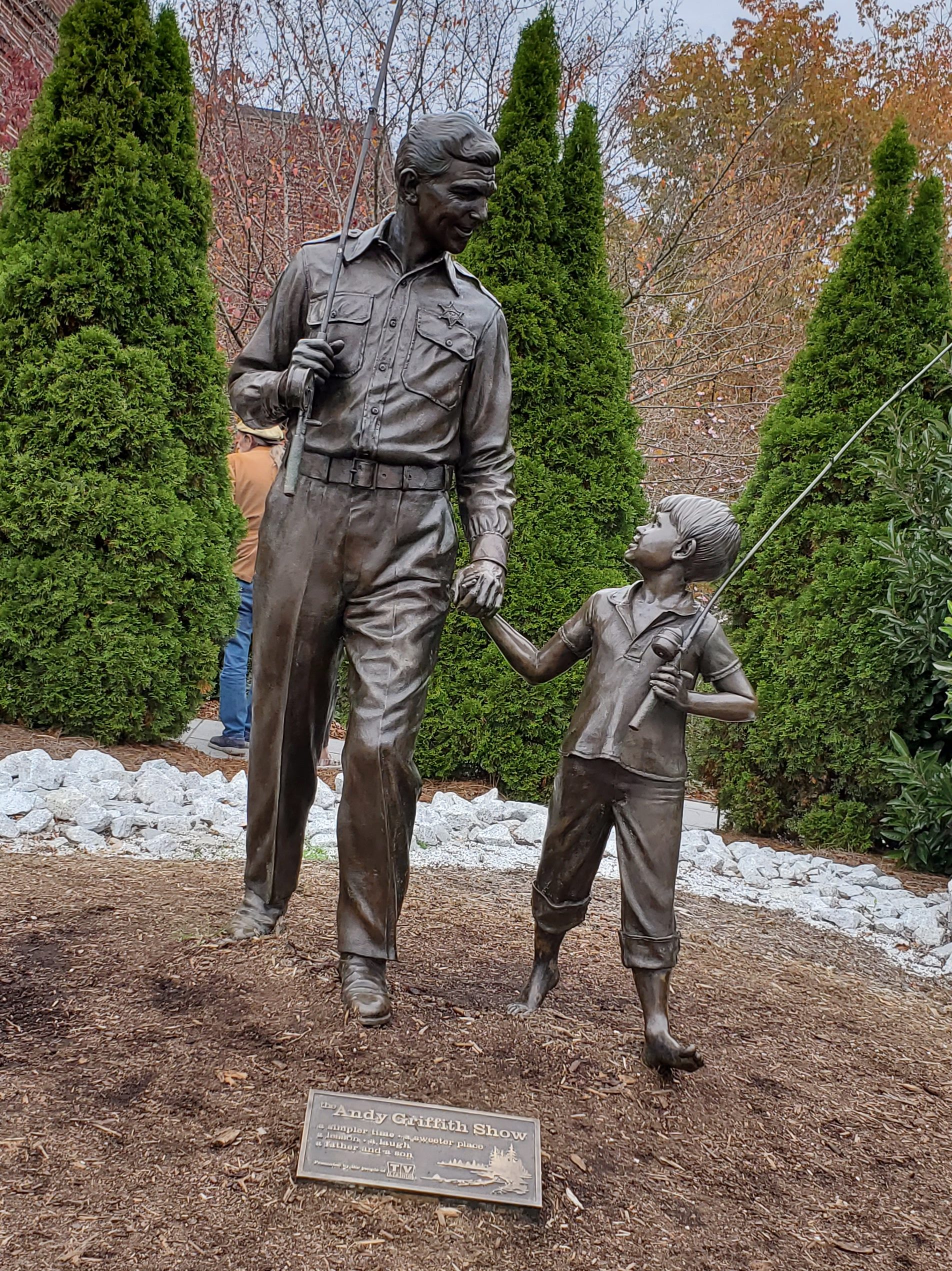
Andy Griffith Museum
The Andy Griffith Museum (218 Rockford St.), founded in 2009 by Emmett Forrest, is open 7 days a week and attracts 200 visitors a day. The 2,500-square-foot museum, located half a mile from Griffith’s childhood home, houses the world’s largest collection of Andy Griffith memorabilia. Tour the inside museum and view outdoor statuary, including “Andy and Opie Taylor”.
Mount Airy Museum of Regional History
Journey into the past at this hometown heritage museum (301 North Main St.), open 7 days a week, except during winter. Peruse through 35,000 square feet of permanent and regularly changing local, historical, and cultural exhibits, including a children’s gallery and three floors of exhibits, plus a top floor observation deck over the city. The museum recounts the history of this area once known as “The Hollows” because of its saucer-like depression circled by mountains. From early-history conflicts and cabin living to railroad growth and a firetruck exhibit to 1924 Roadsters and an exhibit on Chang and Eng Bunker, local musicians, and more. Support memberships are welcome here.
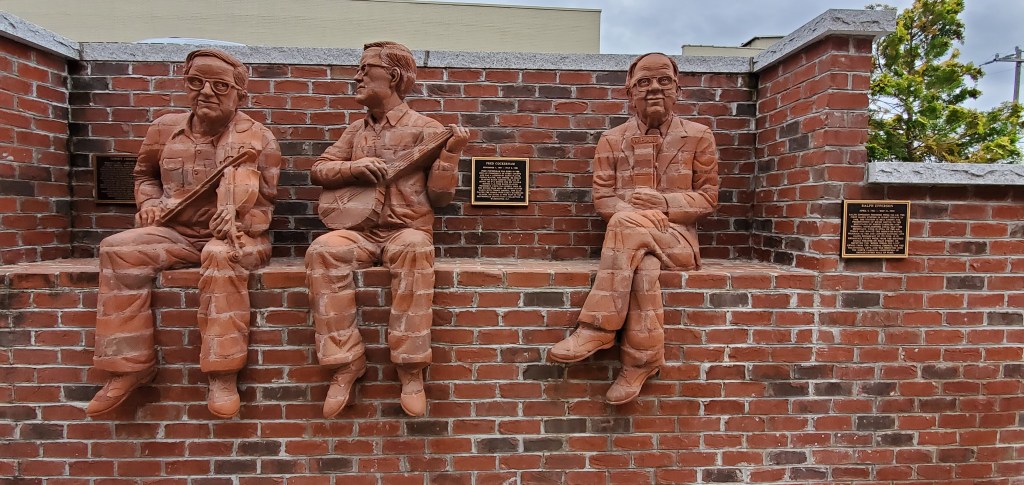
The Whittling Wall
Directly beside the museum, discover The Whittling Wall, created in 2018 by NC artist Brad Spencer to pay homage to the region’s local icons: The Whittler, Tommy Jarrell, Fred Cockerham, Ralph Epperson, Donna Fargo, L.H. Jones, Floyd E. “Flip” Rees, and The Mill Worker.
Toast
There’s nothing major to see here, but the post office called Toast has been in operation since 1929 and has an interesting back story. The name “Toast” was supplied by the Post Office Department. E. P. McLeod, the school principal, supposedly came up with the name while buying groceries at Hutchens Store one evening in 1927.

White Plains
Just down the road from Mt. Airy, you’ll find White Plains and the gravesite of world-famous conjoined twins Chang and Eng Bunker–the original Siamese Twins. Born May 11, 1911, the twins emigrated to the United States from Siam (now Bangkok, Thailand) at the age of 17. The twins quickly became famous as they were featured in circus sideshows around the world. They eventually settled down in North Carolina when their exhibition tour ended. In 1843, they married sisters Sarah and Adelaide Yates and were married for 31 years until the twins’ deaths. Eventually, they had to build two homes for the sisters and their children as the sisters got to fighting a lot. The twins would alternated time between the two homes.
They had a total of 21 children between their two wives (9 boys and 12 girls) and several hundred grandchildren. The twins died on January 17, 1874. Chang had been ill for several months and died during the night. Eng died shortly after. An autopsy revealed that they share a liver and bloodstream. As for their last name, the story goes that when they were applying for American citizenship, officials said that the twins must have a family name. The man behind them, a Mr. Fred Bunker, offered them his name.
At the gravesite behind a nondescript white church (White Plains Baptist Church), you’ll find a supply of brochures describing their history. Their gravesite still gets several visitors a day, and there were two others viewing the gravesite upon my arrival.

Dobson
Dobson was established as the county seat in 1853, replacing Rockford after all land in Surry County south of the Yadkin River was used to form Yadkin County. Tabitha Ann Holton, who became the first licensed female lawyer in the Southern United States in 1878. She practiced law in Dobson from 1878 to 1886. Here, you’ll find Shelton Vineyards, Stony Knoll Vineyards, and Herrera Vineyards. Shelton Vineyards is known as the largest vineyard in the state and holds many events year-round, including live entertainment and concerts, dinners, auto shows, festivals, and the Running the Vines 5K/10K.

Rockford General Store
“Hey, y’all, give us a call!” This is a must-stop local store in Dobson (closed Mondays and Tuesdays). Here, you’ll find a bevy of old-fashioned candies, local fare, and a kitchen serving up a few country treats–including daily Sonker variations.
Mulberry
A small, pass-through community, this area is also interestingly referred to as Jot-Um-Down.
Elkin
The flowing together of the Yadkin River and Big Elkin Creek has drawn people to the area of what is now Elkin, since the coming of the Paleo-Indians 10,000 years ago. The Sioux Indians settled along the Yadkin River as early as 500 BC. The first English colonists came in the mid-eighteenth century along with some colonists from Ireland. Cherokee Indians were also in the area, although the Cherokees had been active in the French and Indian War, they had joined in treaties with the English in 1763, followed by the events of the American Revolution.
Alexander Chatham opened a small woolen mill in 1877 that grew to become Elkin’s largest industry for many decades, The Chatham Manufacturing Company. Along with other mills in the area it has dwindled. The Northwestern North Carolina Railroad arrived in 1890, and the town was ready to take the opportunities the railroad brought for commercial and industrial expansion. Its strategic location near the Yadkin River and the Big Elkin Creek–and as a stop on the railroad–caused prosperity that produced brick stores, many industries, and fine houses.
The beginning of industry with the cotton mill, the Civil War involvement, the coming of the railroad, the town’s coping with the depression of the 1930s, and the two world wars heavily influenced the town’s development. Chatham Manufacturing was famous for making World War II wool blankets for soldiers. And you’ll find a Civil War marker on West Main Street across from the Elkin Library.
The Elkin Municipal Park was the location during the Revolutionary War of a mustering field. Troops gathered to march on the Overmountain Victory Trail towards Wilkesboro then on to Morganton, NC, before they headed south to victory. There is a viewing site along Hwy 268, just west of the Recreeation Center that tells the story on an information panel.
Cedar Point, Downtown Elkin Historic District, Gwyn Avenue-Bridge Street Historic District, and the Hugh Chatham Memorial Hospital are listed on the National Register of Historic Places.
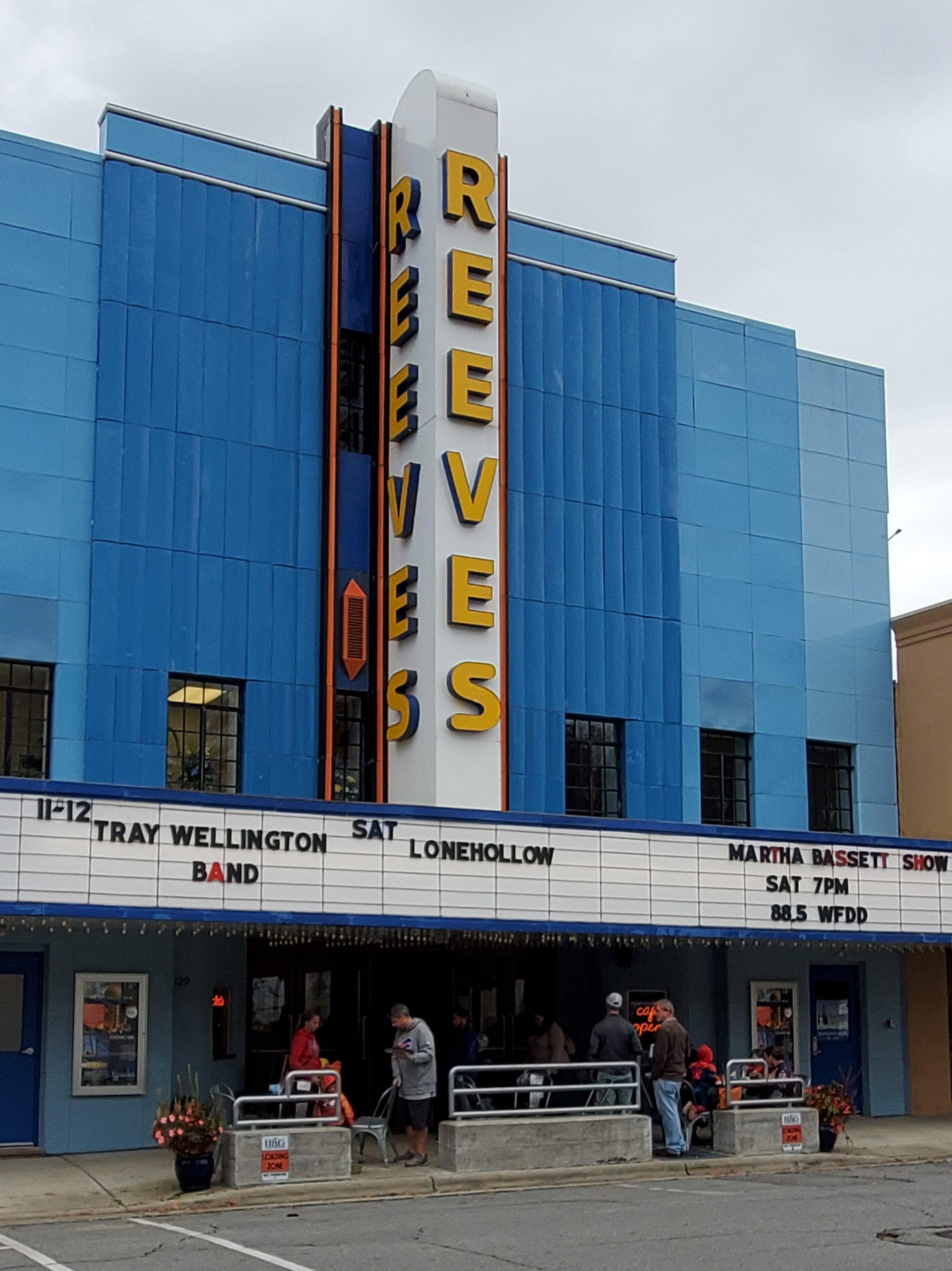
Elkin had the biggest cruising community on the east coast during the 1960s, 1970s, and 1980s. USA Today once featured Elkin and its cruisers on the front page of the national newspaper. However, a crackdown by local police in the late 1990s temporarily ended the once-vibrant weekend cruising scene leaving downtown Elkin deserted on weekend nights until cruising returned to downtown Elkin on Saturday, October 10, 2009 for the first time in almost 20 years. Since 2012, Cruise! events have become a summertime monthly event and continue each year. Cruise events involve parking along Main Street as well as cruising around the downtown streets, including past the Reeves Theater.
Elkin is also famous for the annual festivals and regional events: Yadkin Valley Wine Festival (3rd weekend in May), NC Trails Days (first weekend in June), Elkin Roots Music Fest (mid-late June), Take a Break from the Interstate 100-yard Road Market (last weekend in July), Reevestock Music Fest (first weekend in August), Yadkin Valley Pumpkin Festival on Main Street (4th Saturday in September), including record-breaking pumpkin and watermelon weigh-ins and a car show, quilt show, music, kids play areas, farmers market, and more. Then there’s the Light Up Elkin and holiday parade (first weekend in December).
In Elkin, you’ll find quaint downtown shops and restaurants, the Pirate’s Landing restaurant (161 Interstate Way), plus Adagio Vineyards, Slightly Askew Winery, and Elkin Creek Vineyard.
Crutchfield
This pass-through community is named for Charlie Crutchfield, a worker who died during the construction of a railroad trestle bridge in the area. Crutchfield, who had no relatives, was buried on the Yadkin County side of the river.
Siloam
Another pass-through community, Siloam has some interesting history. Four people were killed and 16 people injured when the one-lane steel span bridge connecting Yadkin and Surry counties in Siloam collapsed on February 23, 1975. The collapse brought national attention to bridge safety and was reported in national magazines, including Reader’s Digest, and on The CBS Evening News.
The Atkinson-Needham Memorial Bridge, which was built at the site of the old bridge, was named in honor of the four victims: Samuel Hugh and Ola Marion Atkinson and Judy Needham and her 3-year-old daughter, Andrea Lee. Among those rescued from the collapse was former Surry County Sheriff Graham Atkinson, who was 10 at the time.
According to a National Transportation Safety Board report, the accident started about 9:25 p.m. when a car struck a timber railing on the bridge, causing the bridge to collapse into the rain-swollen river. In heavy fog, six more vehicles within a 17-minute period drove off the bridge. By the 1970s, state officials had hung a sign on the second-hand bridge that read, “Local Traffic Only.”
The bridge, which had originally been used near High Rock Lake, was reassembled in Siloam in 1938. It was listed as deficient and needing repair or replacement in a 1974 state report. Troy Doby, the state secretary of transportation, said later that “it should have been replaced, but it was a question of money.” Weeks before the collapse, Hugh Atkinson had urged state officials to tear it down. The Atkinson family later found a letter in his coat pocket that he had written to the governor’s office urging action on the bridge.
Next stop… Rowan County!
