As one of the smaller counties in North Carolina, we were comfortable able to tour through the area in a day. If you have enough time, you may want to pair this county with Granville County or Franklin County.
A little history on the area… the Occonachee Native Americans were the first inhabitants of what would eventually become Vance County in 1881. John Lederer is known as the first white explorer of the region along with his Native American guide in 1670.
Originally part of colony of Virginia, King Charles of England redrew the colony lines in 1665. What is now Vance County became part of the Province of Carolina and then the Province of North Carolina in 1725. In 1826, the first armed forces academy, the Bingham School, was built by Captain D. H. Bingham in Williamsborough, North Carolina. It served for a short time as a training school for military officers.
In 1871, a hotel called the “Glass House” was opened near the community of Kittrell. It was so named because of the glass porches surrounding the hotel. It was a popular resort for hunters and later tuberculosis patients until it burned down in 1895.
As the area that is now Vance County prospered in the mid to late 1880s, efforts took place to create a county named “Gilliam” and then later as “Dortch”. However, Vance County was eventually formed, by the white Democratic-dominated legislature in 1881 following the Reconstruction Era, from parts of Franklin, Granville, and Warren counties. In fact, 73% of the land area of Vance County was taken from Granville County. Vance County is named after Zebulon Baird Vance, who served as Governor of North Carolina (1862–65 & 1877–79) and then United States Senator (1879–94).
Williamsboro
Established by Nathaniel Williams and his wife Elizabeth Washington, he town of Williamsborough cropped up along the east-west and north-south stagecoach lines. Williamsborough served as a temporary capital of North Carolina between the summer of 1781 and February 1782, after the capture of Governor Thomas Burke during the American Revolution. Williamsborough was original called “Lick” because it was a watering hole for cattle and then “Nutbush” because of the nearby creek of the same name.
However, when the Raleigh and Gaston Railroad was built in 1840, it bypassed Williamsborough. This, along with the end of slavery after the U.S. Civil War and the demise of plantation life, led to the decline of the town.
Historic sites in or near Williamsboro include the Belvidere historic plantation, built in 1850; Bingham School, the first armed forces academy; Burnside Plantation House, originally built in 1800; the Pool Rock Plantation, built in 1757; and St. John’s Episcopal Church built in 1757 — and is the oldest frame church in the state.
Townsville
Formerly known as Lynesville before 1851, Townesvillle was established in approximately 1821 in Granville County. The town name was changed to Townsville in 1892 without the ‘e’. Historic sites in Townsville include Machpelah, which was listed on the National Register of Historic Places in 2007, a historic home and farm built in about 1880.
Middleburg
Middleburg is located roughly halfway between New York and Atlanta, which possibly explains the town’s etymology. Tiny Broadwick, pioneer parachutist and inventor of the ripcord, was born and lived here.
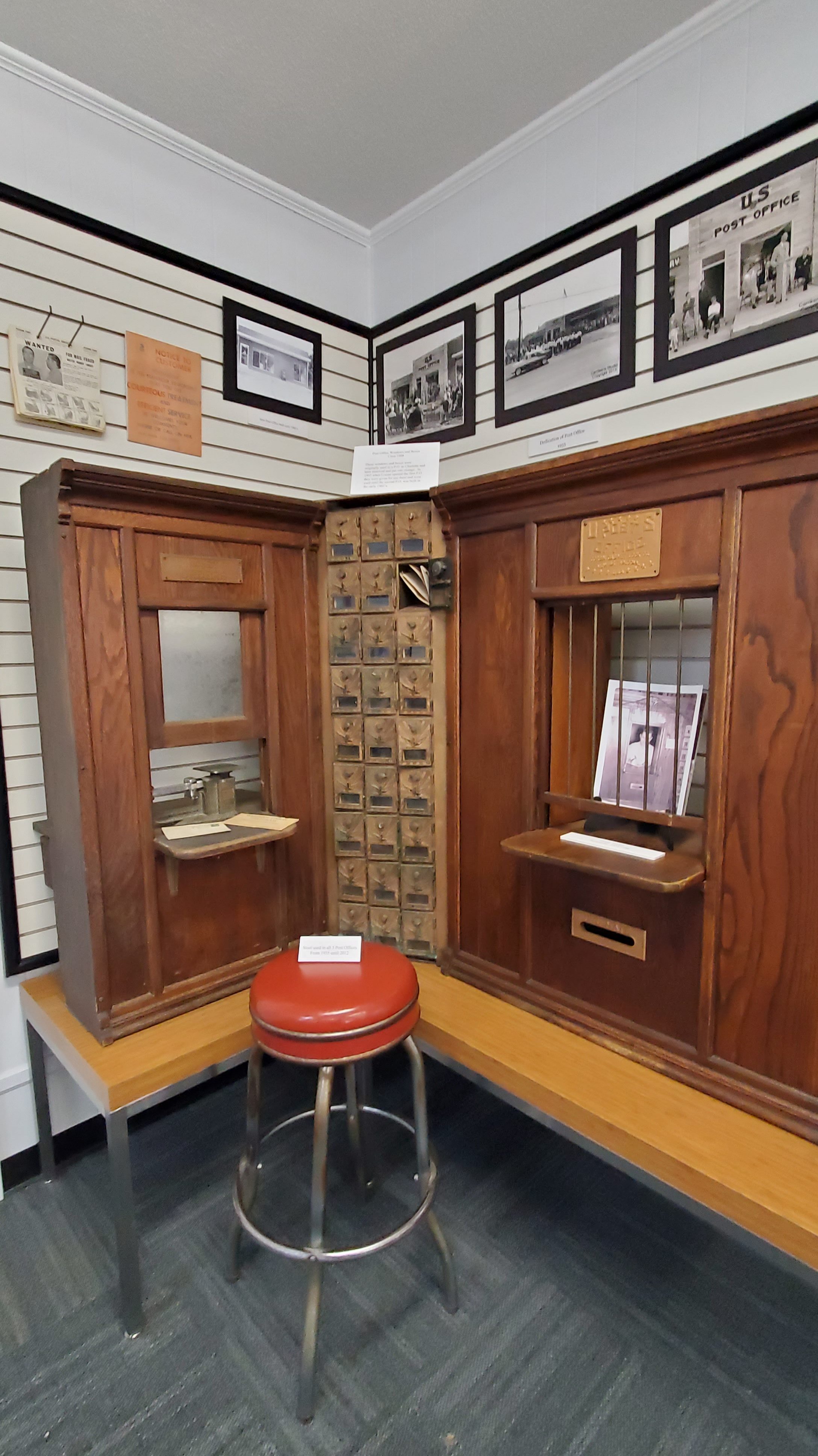
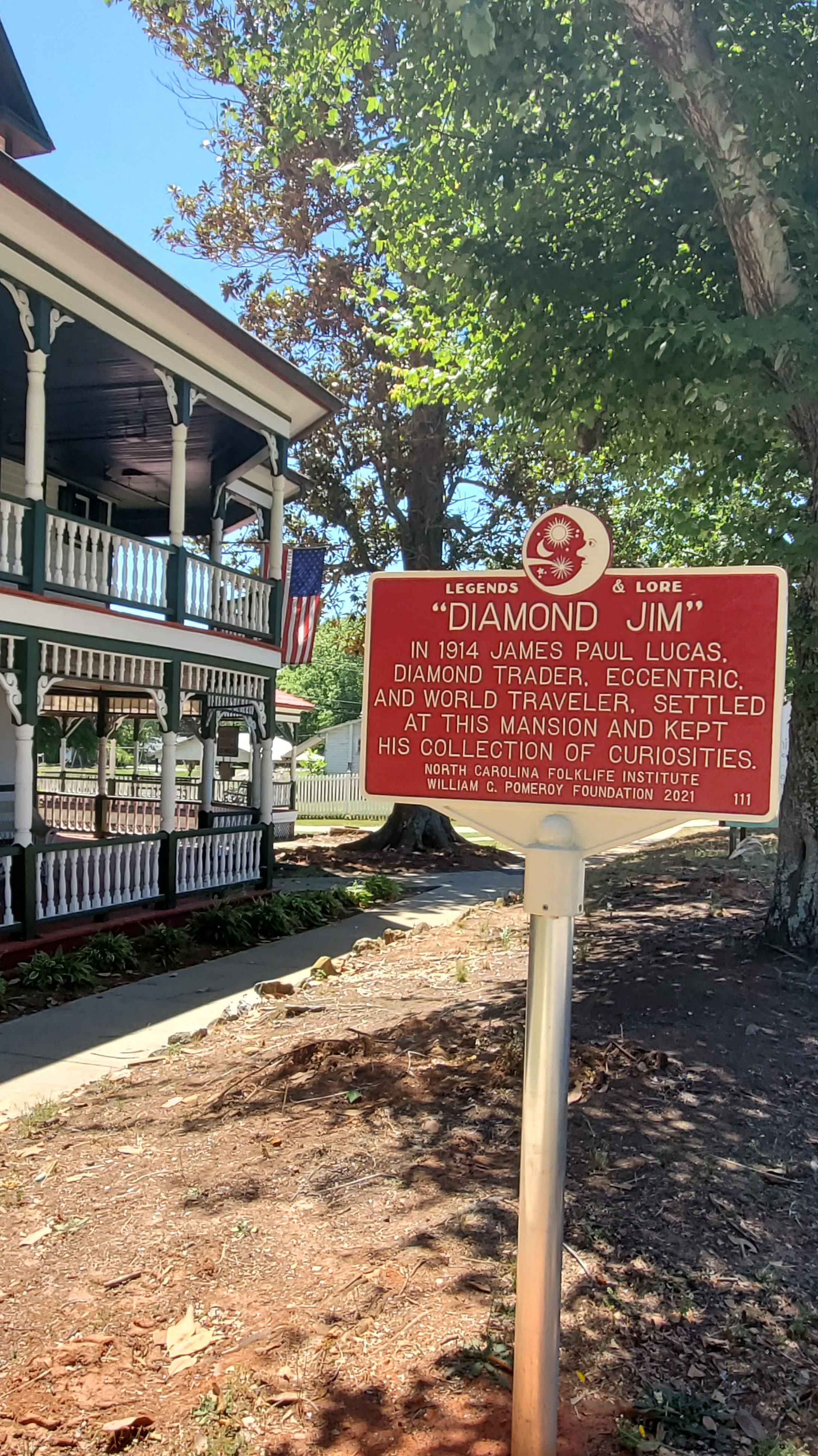
Henderson
Henderson is the county seat of Vance County. The city was named in honor of former North Carolina Supreme Court Chief Justice Leonard Henderson, who lived nearby and was a friend of early settler Lewis Reavis. Prior to the creation of Vance County in 1881, Henderson was located in far eastern Granville County.
Henderson is located on the S-Line, the former main line of the Seaboard Air Line Railroad now owned by CSX Transportation. The city was last served by passenger rail in 1986, at which time Amtrak’s long-distance Silver Star was re-routed through Rocky Mount and part of the S-Line was abandoned. Restoration of the line is planned as part of the Southeast High Speed Rail Corridor project.
Giant Concrete Legs
While in Henderson, be sure to stop at the Giant Concrete Legs (near the intersection of King Street and Chester Lane in south Henderson), a roadside public art sculpture created by Ricky Pearce. It’s definitely an oddity, with each of the 40-foot legs spread open in a suggestive manner. The legs were made with a process called earth casting. The sculpture’s shape is actually dug from the ground, which creates an earthen mold. Concrete is then poured into the shape, then dug from the ground once cured. Pearce’s muse for these legs was none other than Marilyn Monroe. Across the street, you’ll find a giant pair of high-heeled shoes and the High Heels Gate as an entrance to a mobile home park. To the left of the gate, you’ll also find another pair of shoes. Pearce has created other pieces throughout the continental United States.
Famed people from the area include the following:
Charlotte Hawkins Brown, educator and founder of the Palmer Institute
Ben E. King, soul and pop singer, best known as the singer and co-composer of “Stand by Me”
Shirley Owens, singer, member of the Shirelles
Charlie Rose, television talk show host and journalist, born and raised in Henderson
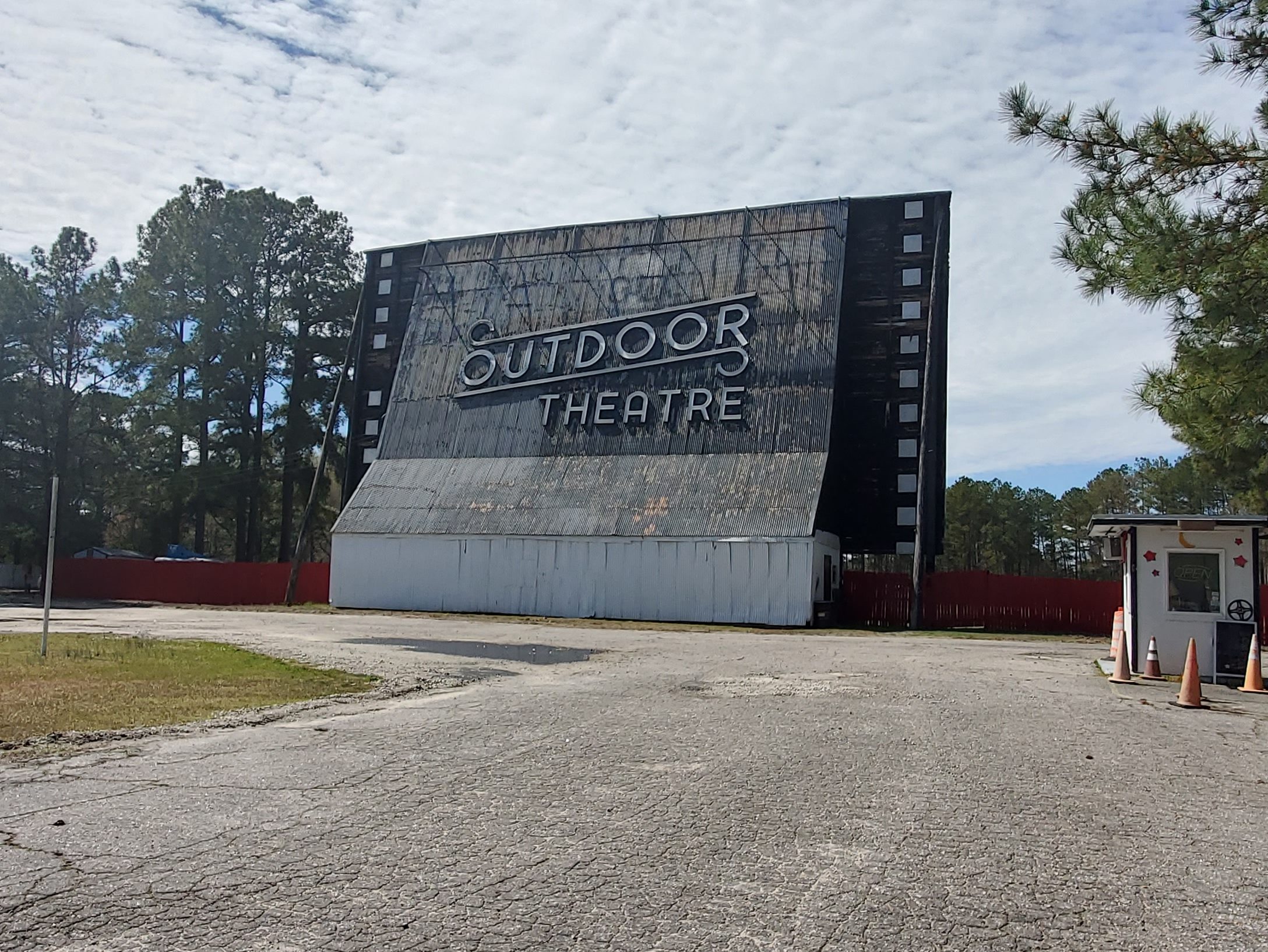
Raleigh Outdoor Theatre In Henderson, The Raleigh Outdoor Theatre (3336 Raleigh Rd) is still in operation.
Kittrell
Kittrell, chartered in 1885, may have been originally called Kittrell’s Depot. Kittrell’s Depot was a railroad depot named for George Kittrell and his wife, Elizabeth Boswell Kittrell, who donated the land for a Raleigh and Gaston Railroad station.
The smallest horse in the world lived here. Thumbelina was a dwarf miniature horse and the smallest horse on record. She stood 43 centimeters tall (about 18 inches) and weighed 26 kilograms, and received the title of world’s smallest from Guinness World Records. Thumbelina was born in St. Louis, Missouri on May 1, 2001 and died in 2018.
Kittrell was also home to two famous luxury health hotels during North Carolina’s ‘”Golden Age” of spas, healing springs, and health resorts: the Davis Hotel and Kittrell Springs Hotel.
Stanly County was formed in 1841 from the part of Montgomery County west of the Pee Dee River. The county was named for John Stanly of New Bern (1774–1834), who served several terms in the North Carolina House of Commons and two terms in the U.S. House of Representatives.
The county was originally populated with by small tribes. Artifacts and settlements have since been discovered, dating back nearly 10,000 years. Large-scale European settlement of the region came in the mid-18th century via two primary waves: immigrants of Dutch, Scots-Irish and German descent moved from Pennsylvania and New Jersey seeking enhanced religious and political tolerance, while immigrants of English backgrounds came to the region from Virginia and the Cape Fear River Basin in Eastern North Carolina.
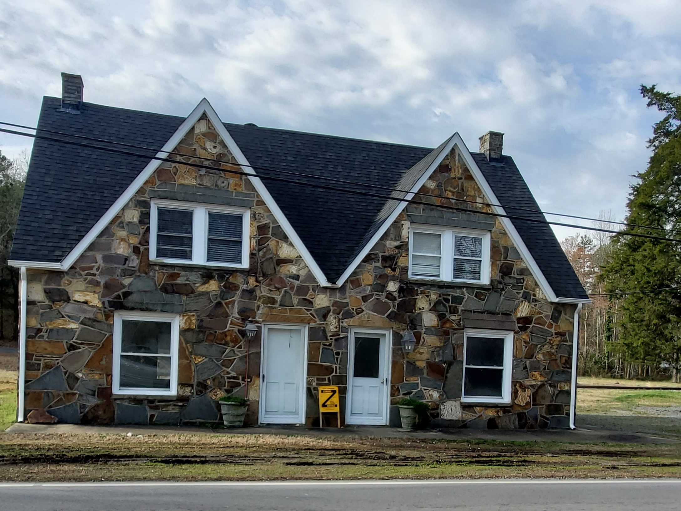
Today, Stanly County is largely rural with hidden gems, including the historic charm of many original stone houses and buildings that still dot the area. The Misenheimer and Richfield areas produced quality stone workers who worked on projects all over the state. You’ll find a number of residential and commercial buildings in these areas, which exhibit the period stone work. Nearby Albemarle Mountains has been a concentrated region of many supposed Big Foot sightings. So, you may stumble upon Sasquatch-related statuary and signage.
Misenheimer In 1825, Matthias Tobias Barringer discovered gold nuggets along a section of Long Creek that ran through his farm. He found $8,000 worth of gold, and eventually the country’s first gold vein in quartz. Newspapers in 24 states reported the find, and North Carolina’s gold rush began.
In the late 1800s, Misenheimer was a stop called Gladstone on a railroad spur that served a nearby early tourist destination, Misenheimer Springs. At the time Gladstone was home to Gladstone Academy and the old original school building still stands. The Barringer Gold Mine, which began operations in 1825, was also located in Gladstone. The place drew the interest of the Mitchell Home School as it sought a new location. In 1909, when the Mitchell Home arrived, industries such as mining had largely disappeared from the area.
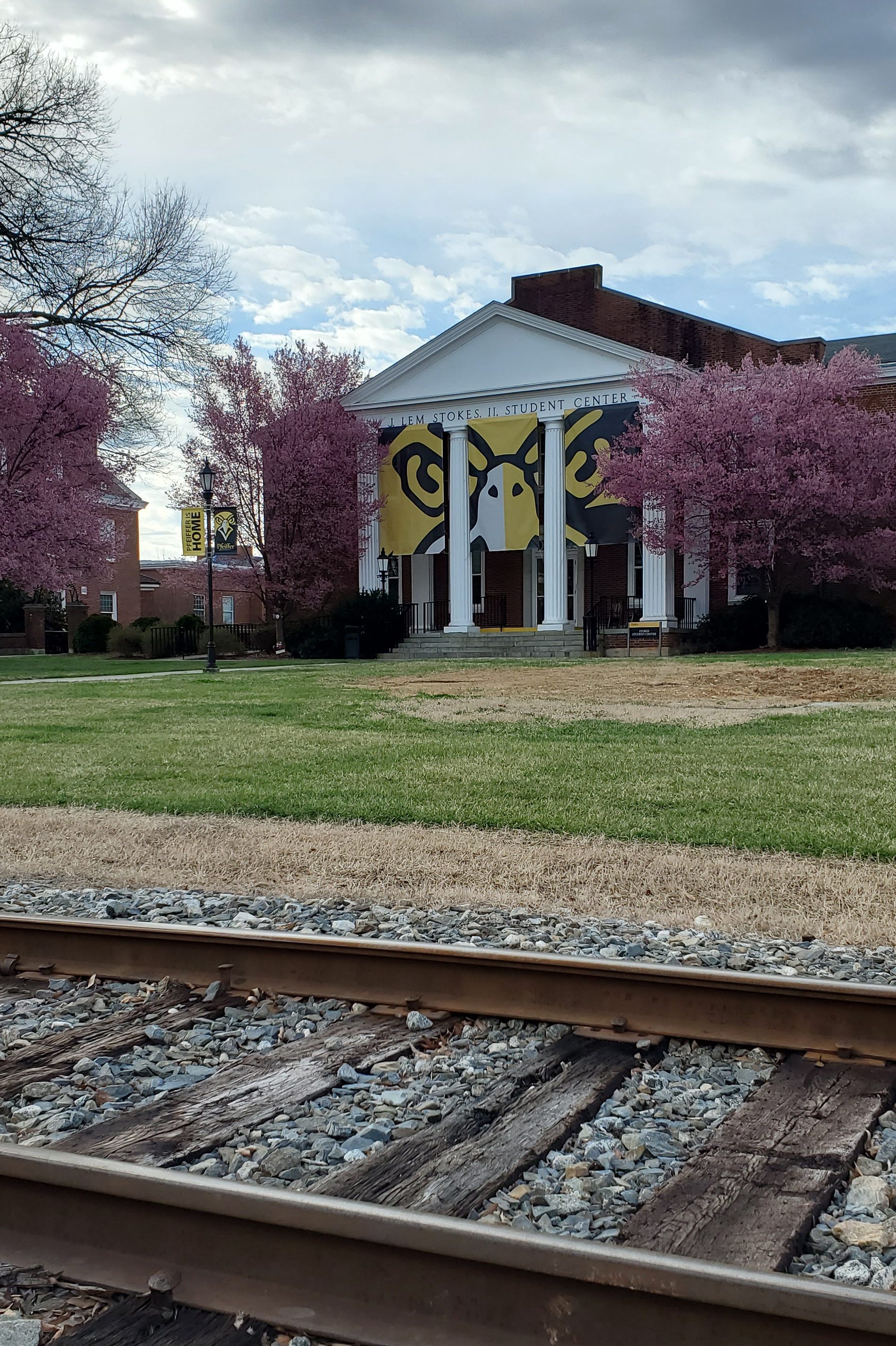
In 1909, the community was renamed Misenheimer, so that the visitors to the springs would not be confused by the name at the train stop. Mitchell Home evolved into what is now Pfeiffer University.
Pfeiffer University Founded in 1885, Pfeiffer University campus is divided by train tracks. Take a walk through campus and stroll past buildings built in the late 1930s that are on the National Historic Buildings Register.
Gladstone Academy
Located about 0.5 miles from Pfeiffer University, the Gladstone Academy (Wesley Chapel Road) was established in the mid 1880s as a finishing school for young women. The school was run by the Episcopal branch of the United Methodist Church. In the early 1890s, the Academy Building that now exists on Wesley Chapel Road was built. The building served as a school until 1916 when Mitchell School (now Pfeiffer University) came to the area. The building was then converted to a church and served as such until the 1930s. It then began to be used for different purposes and then fell into disuse. The building was purchased by the Village of Misenheimer a few years ago and the Village has spent considerable money to stabilize and improve the building. It is a work in progress.
Richfield Richfield was originally called “Ritchie’s Field,” for the prominent Ritchie family who established the post office, sawmill, roller mill, cotton gin, and streets of the settlement. The town of Richfield began as a settlement of German immigrants in the late 1800s. The town was chartered in the 1890s as Ritchie’s Mill. Cicero Ritchie laid out the streets, which ran one half mile from the square in each direction. On September 30, 1893 Postmaster George Ritchie opened the new post office and the town was renamed Richfield.
Sadly, many local buildings were destroyed by fire over the early years, so in 1956 the community purchased it’s first fire truck. Richfield celebrated its first centennial in September of 1993.
New London New London was founded as the unincorporated settlement of Bilesville, north of Albemarle, circa 1830, and named after Thomas “Uncle Tommy” Biles, a local landowner and farmer. At the time, the land was part of Montgomery County until Stanly County was formed in 1841, and Thomas Biles, Jr. and Elizabeth Betsy Sides Biles had moved to their farm at the highest elevation in then Montgomery County. Near the area where the first Carolina Gold Rush took place, gold was found near Bilesville and the first mine was opened in 1859, though it closed during the Civil War.
In 1923, less than three years after the adoption of the Nineteenth Amendment granting women the right to vote, the town elected Mrs. T. V. Staton as their mayor, becoming the first female mayor, as well as the first female to serve in municipal government in the state. The mine was reopened for a time starting in 1934, and throughout the 1920s and 1930s, modern amenities such as telephone service, electrical service, paved roads, and a state highway were built in town. Town sewer and water service was only completed in 2002.
At the outbreak of the Civil War, the mine lay undisturbed until sometime in the 1870s when an English mining company known as New London & States Co., Ltd. purchased the mine property. The English company sent Capt. William Nance to be in charge of the operation. With the gold and other industries going full speed, W. A. Judd from England, now in charge of the mining operations suggested the name be changed from Bilesville to “New London.”
Mr. Judd impressed a community gathering as he described how he thought this rich settlement could grow as big as his native London, England, as the residents were already building large fine homes. With the coming of the railroad, industry would increase and be more productive. The state legislature was petitioned for a change of name, the request was granted and New London was officially incorporated March 25, 1891.
Another of New London’s large businesses, Culp Lumber Company, was begun when John L. Culp came from Cabarrus Country and started a large livery stable and later began the lumber operation. Then when Parker Gold Mine became too expensive to operate in 1894, the English sold the property and returned to England.
While in New London, be sure to visit the New London Park and New London Museum (226 South Main Street), housed in a building built in 1920 as a bank.
Albemarle
This place-name is derived from the English surname Albemarle. According to a 1905 publication by the United States Geologic Survey, based on research by University of North Carolina-Chapel Hill, it was named specifically for General George Monck, the first Duke of Albemarle and one of the original proprietors of the colony of Carolina.
The Albemarle region’s early economic growth was fueled by agriculture (with cotton as the primary crop), regional mercantile trade and a short-lived gold rush in the nearby Uwharrie Mountains, all later supplanted by textile manufacturing.
The Yadkin Railroad began rail service to Albemarle from Salisbury in 1891. In 1911, the Winston-Salem Southbound Railway (WSS) constructed its own line through Albemarle to support the booming textile and market, eventually driving the Yadkin Railroad into obsolescence. The WSS still provides freight service through Albemarle, but since 1933 there has been no passenger service to the city. The Old Market Street Station on the WSS line has been restored, and is now the site of a popular local farmer’s market.
Albemarle was recognized by the National Trust for Historic Preservation as a National Main Street City in 1993. The town is also known as the home of Kellie Pickler of American Idol fame.
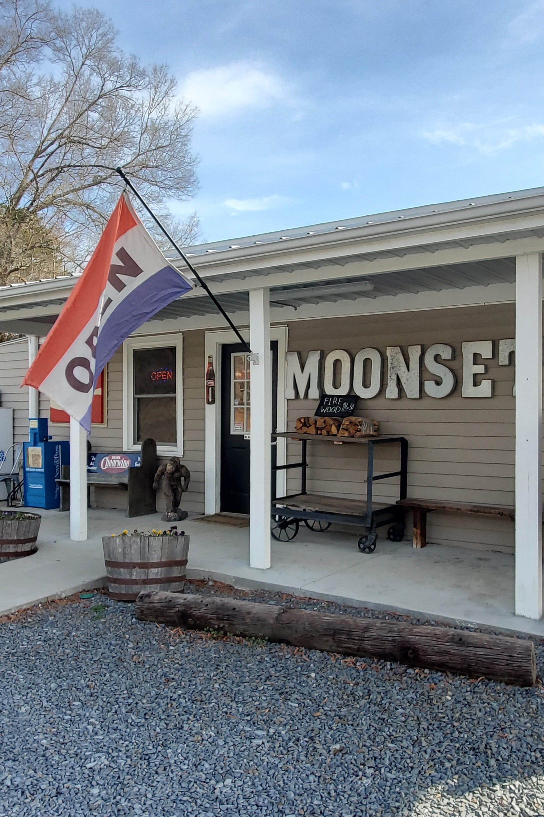
Moonset General Store 32254 Valley Drive, Albemarle
Morrow Mountain Scenic Vista 49104 Morrow Mountain Rd
Carolina Treetop Challenge 114 Rock Creek Park Drive
Stony Mountain Vineyards 26370 Mountain Ridge Rd
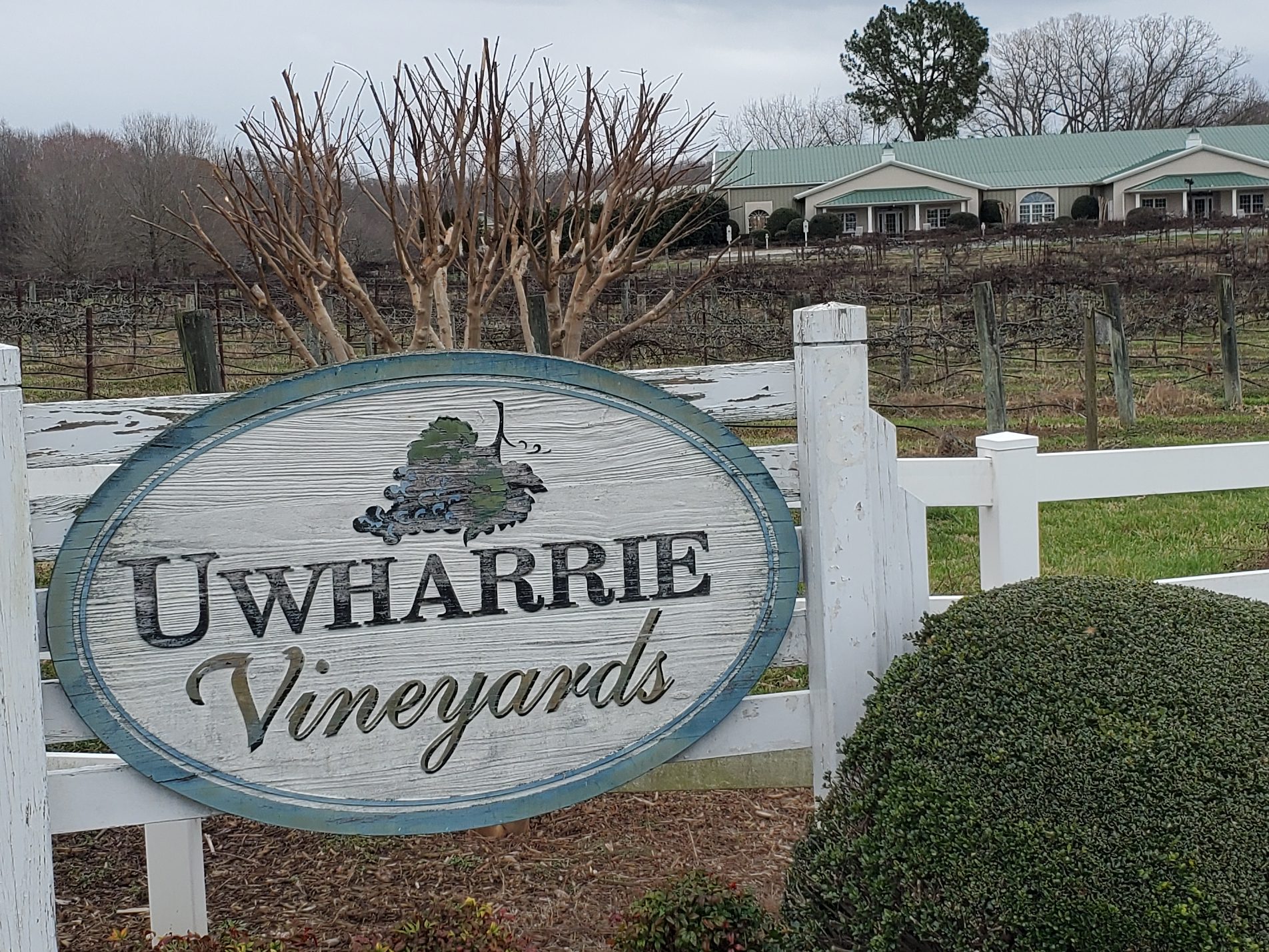
Uwharrie Vineyards 28030 Austin Rd
Red Cross The name “Red Cross” came from the slick and red clay making it hard to travel during wet weather. Dan Hinson owned one of the largest stores at the crossroads of Hwy 205 and 24/27 (Red Cross Road), built in the early 1900s, and it’s still standing today. The store built in the early 1900s.
Locust The city of Locust is one of my all-time favorite discoveries and hidden gems in the state. If you’re every travelling through Stanly county, a visit to Locust should be a must on your list.
The City of Locust was established in western Stanly county in the late 1860s by German, Scotch Irish, and English immigrants. The community was known as the “Crossroads”. Many travelers came through on the way to Cabarrus, Anson, and Mecklenburg counties. A central well was dug close to the locust tree to serve the citizens of the community as well as travelers and their livestock as they were traveling through. As many as 25 families would do their washing there in a single day, since it was the only source of water.
In 1869, the population in the “Crossroads” community had increased enough to warrant an application for the establishment of a post office. The community members held a meeting to decide a new name, and a young girl in the community, Miss Maggie Howell, happened to look out at a wooded plot where a large locust tree was in full bloom. Beyond the locust tree, plowed fields laid flat and the reddish clay dirt of the Charlotte Road stretched out level. Miss Powell suggested the name “Locust Level”. And so it was called until May 29, 1894. Then ‘Level’ was dropped, and the town is now called Locust.
Upon entering locust, you’ll be greeted by a larger-than-life metal horse sculpture. Today, Locust (“A City with a Soul”) is a quaint community with a new housing development built around the town’s central green and shopping district, complete with a few retail shops, a craft brewery, and an ice cream shop. Walk around the shops and drive through residential areas… you may find yourself drawn to the quaint, peaceful surroundings.
Locust Historical Society Museum 2884 Officer Jeff Shelton Dr, Locust NC
Stanfield In 1912, the railroad line between Charlotte and Raleigh was completed, and the town of Stanfield was established. The town was named after an engineer who helped complete the railroad through the present day town.
Stanfield had a Community Song to the tune of “Carolina In the Morning”.
“In 1914 railroads passing through and forming the Town of Stanfield,
Bringing with them ways for folks to travel and to build a new town, Stanfield.
Schools and churches, stores and business thrived in those days.
People moved to be a part of new ways.
Nothing could be finer than to be in Stanfield now when it is growing.
A small town deep within the country and a lot of hospitality.
Building plans for future growth to make our life all happy, wise, and healthy.
So if you’re looking for a place that you can call home. Come on out to Stanfield, you’ll nevermore roam.
You will like our country town – we have interests all around in Stanfield.”
Oakboro The town of Oakboro began at a natural salt lick called Big Lick. When the railroad passed through in 1913, the town moved closer to the railroad and became “Furr Town”. In 1915, the name was changed to Oakboro. The Oakboro Cotton Mill was a major employer in the 1940s and 1950s while cotton was still “king” of the South. Today Oakboro is known for its annual Independence Day parade and for hosting a classic car cruise-in on the fourth Friday of every month. Bruton Smith, CEO of Speedway Motorsports, is from the area.
Oakboro Regional Museum of History 231 N. Main Street
Oakboro Railroad Museum 128 Aquadale Road
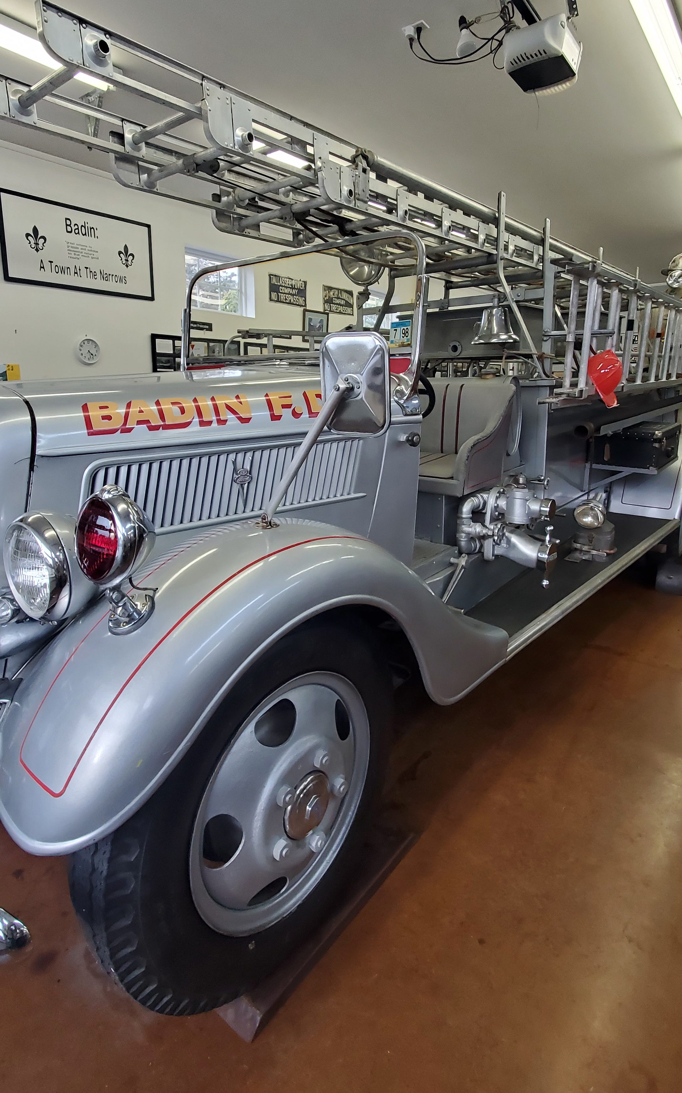
Badin
Badin is called ‘The Town Aluminum Built.’ The town was originally built for the sole purpose of making aluminum, with the falls of the Yadkin River providing the 24/7 power needed for the French Southern Aluminium Company.
In the spring of 1913, French company, L’Aluminium Français, began work on a dam at the narrows of the Yadkin River, which becomes the Pee Dee River a few miles downstream, to provide power for an aluminum smelter. At the time of construction in 1913, the Narrows Dam was the highest spillway dam in the world and the largest dam in North Carolina, and it had the largest hydroelectric units in the world.
The small town, designed to house both company workers and engineers, was built along the newly formed lake and named for company president Adrien Badin. The project was abandoned at the start of World War I, and picked up a few years later by an American company (ALCOA), which finished the project.
Badin also boasts the Hardaway Site, and national historic landmark (1990) overlooking the Yadkin River, is the site of numerous archeological digs with some artifacts, such as arrowheads and other tools, found as much as four feet deep. Removal and cataloguing began in 1948.
Badin Museum 60 Falls Rd.
Badin Quadraplex Museum 64 Falls Rd
Badin Firehouse Museum 60 Falls Rd
Norwood Norwood is nestled in a beautiful area between the Pee Dee and Rocky Rivers next to the Uwharrie Mountains and beside Lake Tillery to the east. Celebrations throughout the year include Arbor Day in April, Picnic in the Park in October, and the annual Christmas parade. The nearby Fork Stables host Outdoor Heritage Days and two weeks of equestrian cross country, dressage, and show jumping competitions.
The first settlements in the Norwood area began in the 1740s with settlers from Delaware and other middle Atlantic colonies following Indian trails and rivers. The town of Norwood was incorporated in 1881 and named after the Norwood brothers’ store, an early establishment in the Center community that housed the area’s post office.
As with many communities, railroads changed the face of Norwood. The arrival of the Yadkin Railroad in 1891 allowed greater access to larger markets across the state and nation. Eventually, two new railroads would serve Norwood; the original Norfolk Southern and the Winston-Salem Southbound. Until 1928, one could ride from Norwood to Albemarle and Badin in a rail car on the Yadkin Railroad. The Winston-Salem Southbound in the early 20th century saw a large number of passengers until improved roads and competition from the automobile ended the service in 1933.
In the early 20th century, Norwood’s business district suffered a major disaster. A downtown fire spread up the east side of Main Street consuming all of the wooden buildings until it stopped at the two-story brick building housing Harris-McAulay Mercantile (now M. B. Irvin Unlimited). The fire was so intense that it blew out all the showcase windows of the U.B. Blalock building across the street (where the Family Dollar building now stands). When the downtown was rebuilt most buildings were built in brick.
The Great Depression affected the town into the 1940s. Businesses and farms failed, and property was sold at the courthouse steps for delinquent taxes. Norwood’s only bank at the time also failed.
Full disclosure: I have been behind in posting and finally able to get caught back up. However, I have found that all but a select few photos from this county and the next (Stokes County) that I had posted to my personal Facebook are completely missing from my phone; they apparently disappeared during a phone update. I am devastated. So, until I can get back to these counties, I will have to rely on the few photos I have and supplement with some public domain photos. Please accept my sincerest apologies.
Franklin County was formed in 1779 from the southern half of Bute County and is named for Benjamin Franklin, who was serving as foreign minister to France at the time. It is a part of the Research Triangle.
The “Franklin County Song” was selected in a 1929 contest by the county historical association as the song most suitable for public occasions. The words were written by Fred U. Wolfe, an agriculture teacher at Gold Sand. Sung to the tune “Maryland, My Maryland” (“O Christmas Tree”), the song was incorporated in the Bicentennial programs of 1979.
With loyalty we sing thy praise,
Glory to thy honored name!
Our voices loud in tribute raise,
Making truth thy pow'r proclaim.
Thy past is marked with vict'ry bold;
Thy deeds today can ne'er be told,
And heroes brave shall e'er uphold
Franklin's name forevermore.
We love thy rich and fruitful soil,
Wood, and stream, and thriving town.
We love the gift of daily toil,
Making men of true renown.
Thy church and school shall ever stand
To drive the darkness from our land—
A true and loyal, valiant band,
Sons of Franklin evermore.
A shrine of promise, pow'r and truth,
Lasting righteousness and peace,
A land of hope for toiling youth,
Yielding songs that never cease.
Let ev'ry son and daughter stay
The hand of vice that brings decay.
When duty's voice we shall obey,
Franklin's name shall live for aye.
Franklinton, NC
Franklinton is in midst of 5-year downtown revitalization plan, but it seems to be on pause or doesn’t have much in forward momentum for the moment.
Franklinton, was established as Franklin Depot in 1839 on land owned by Shemuel Kearney (1791–1860), son of Crawford Kearney and Nancy White. A home constructed by grandfather Shemuel Kearney (1734–1808) was originally located south of town and is currently the second oldest residence in Franklin County, built in 1759. The building was purchased in 2009 and moved to nearby Louisburg for restoration. Franklin Depot changed its name to Franklinton in 1842 when the town was incorporated. Like Franklin County, Franklinton was also named for Benjamin Franklin.
Tragic story: In December 1919, an African-American veteran of World War I named Powell Green got involved in an altercation with a white man named R.M. Brown over smoking in the movie theater, and Green allegedly killed Brown. The police arrested Green, but then a lynch mob seized him, pulled him behind a car for two miles, and hung him from a tree.
Franklinton was once home to Albion Academy, a co-educational African-American school started by clergyman Moses A. Hopkins in 1879. Once a State Normal & Industrial School (trade school), it eventually became a graded school and later merged with the B.F. Person School in 1957 to become B.F. Person-Albion High School. When schools were fully integrated, the upper grades consolidated with Franklinton High School in 1969. Mary Little was the first African-American teacher to begin teaching at the newly integrated Franklinton High School, who taught there till her death in 1984. The B.F. Person-Albion High School was renamed Franklinton Elementary School.
Also located in Franklinton is the historic Sterling Cotton Mill, founded by Samuel C. Vann and first opened in 1895. Remaining in the Vann family for many years, the mill was purchased in 1972 by Union Underwear Company, manufacturers of Fruit of the Loom fabric products. Sterling Cotton Mill eventually closed in 1991. It was placed on the National Register of Historic Places in 1996.
Burlington Industries, another well known textile and fabric maker at the time, had a facility located in Franklinton known as Vamoco Mills. It closed in 1989 and was demolished in 2007. A third mill was also located in Franklinton which has since closed.
On April 4, 1963, the entire town of Franklinton was threatened by a large wildfire which consumed roughly 9,500 acres of woodlands and destroyed several homes north and west of town. A similar incident occurred on February 10, 2008, covering nearly the same area (though not as widespread), about 1,000 acres. A few homes were damaged during that event. U.S. Highway 1 was temporarily closed adjacent to the affected area while firefighters battled the fires. No injuries were reported. High winds and dry conditions were factors in both incidents.
In 1996, Franklinton, North Carolina became the home of Opio Holy Spirit Academy a private school providing an academic arena for both academically gifted and students who face academic challenges from grades K-12. The school was established and directed by Lenora E. Attles-Allen a former elementary school teacher from Boston, Massachusetts. Allen’s work became known and respected in Wake, Granville, Vance, and Franklin counties as well as her dedication to the Franklin County Community Restitution Program. Opio Holy Spirit Academy closed its doors for the last time after the final High School commencement ceremony in 2012.
Franklinton has been a Tree City USA community since 1985.
Youngsville
Youngsville has a small downtown area with a VERY busy and heavily travelled road that passes right through the center, which it makes it challenging to build a downtown that’s both walkable and social. Even so, there are some cute shops here, such as Archer + Pratt (138 E Main St.) , The Tin Pig (127-100 E Main St.), Tobacco Road Primitives (102 SW Railroad St.) , and a few others along with a handful of restaurants and a delightful coffee shop — all within sight of one another. Youngsville was my favorite stop of the day simply because of the quaintness they’ve achieved despite the drive-through traffic.
The settlement was originally established as Pacific around 1839 on land owned by John “Jack” Young. It was renamed Youngsville in his honor when the town was incorporated in 1875.
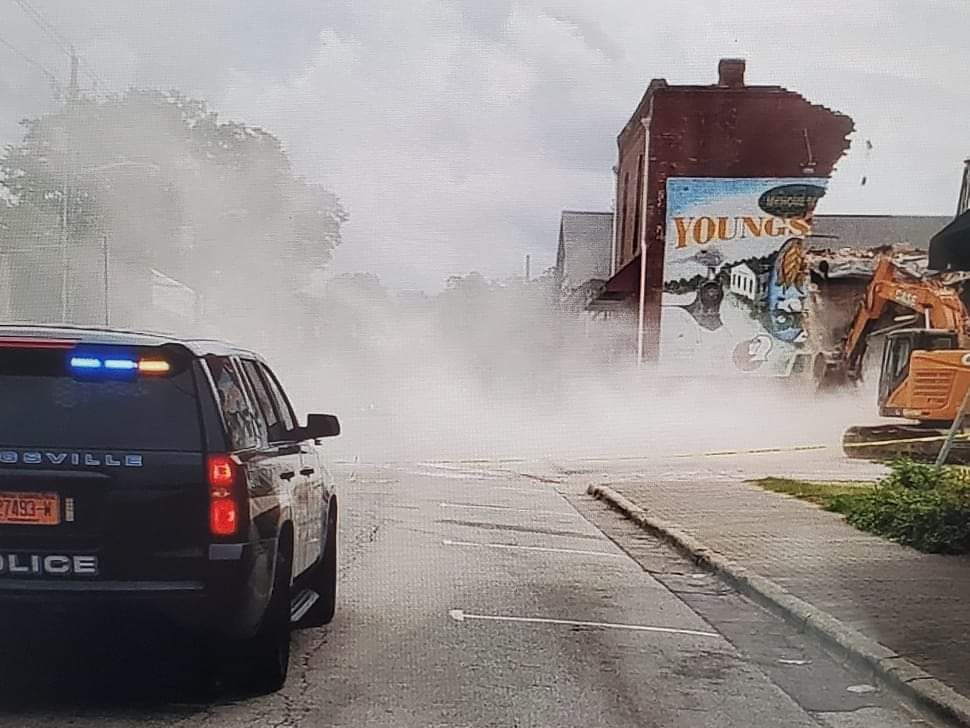
IMPORTANT NOTE: The photo above may have been one of the last taken of the Youngsville wall mural intact, as the building shockingly collapsed on Labor Day 2022 — two days after my visit! Archer + Pratt was luckily mostly unaffected and was allowed to continue operations once the cleanup was done and the remaining attached structures were deemed safe. The main building that collapsed had been recently purchased and was expected to become a restaurant. See below.
Bunn
Founded 1913 and located in the southeastern part of Franklin County, Bunn is named for Green Walker Bunn, who first settled southeast of the current town in the late 1800s. The rural town was established on land purchased around 1909 by the Montgomery Lumber Company and incorporated four years later.
The town is surrounded by farms where surrounding acres of land are filled with tobacco and soybean farms. Some fields are farmed directly by families that have been in the area for generations, while other acres are leased. The pick-your-own fields in the area draw visitors to Bunn during the spring and summer.
Vollmer Farm
Stop by Vollmer Farm (677 North Carolina 98 Hwy E) for some local goodies, flowers, plus enjoy an ice cream treat on the rocking chairs outside and play a game of checkers.
Louisburg
Nestled on the banks of the Tar River, the town of Louisburg is a charming, small town in the heart of the North Carolina Piedmont with rolling terrain dominated by abundant creeks and granite rock outcroppings. Louisburg is the county seat of Franklin County and is located in the geographic center of the County.
The Act of 1779 creating the town spelled it Lewisburg. This may have been a transcription error, but many maps of the era also spelled the town as Lewisburg. However, most contemporaries in Franklin County insisted that the correct spelling was/should have been Louisburg. The US Postal Service had it identified as Louisburgh from 1795 to 1890, when the final “h” was dropped. Apparently no one bothered to challenge the USPS until around 1890.
A Revolutionary War veteran, William Ferrell (S3355), asserted in 1833 that Louisburg was formerly known as Massey’s Bridge.
Louisburgh was granted a US Post Office on April 1, 1795, and its first Postmaster was Mr. Thomas Rowlett. It has been in continuous operation ever since.
Louisburg was established on land purchased for the erection of a courthouse in 1779. Benjamin Franklin’s negotiations with France helped secure financial and military support to the infant country, support that eventually led to the independence of the United States. As a result of this U.S.- France alliance, the Town of Louisburg was named in honor of King Louis XVI of France, who was aiding the American Revolution at the time.
Louisburg soon became to hub for business activity for Franklin County, especially as the main point of agri-business of the time as cash crops such as cotton, wheat, and eventually tobacco were marketed in town. Soon the town enjoyed an influx of merchants, doctors, attorneys, and craftsmen, which also led to the movement of wealthy families to the area. Such demographic shifts resulted in strong, established social and religious organizations that are still alive and vibrant today.
Tragic story: In June 1965, the local newspaper and radio station publicized the names and addresses of African-American families who had applied to attend white schools in Franklin County. The families were attacked on numerous occasions by white extremists, who fired into their homes or destroyed their cars. In the summer of 1966, a series of cross burnings were perpetrated by the Ku Klux Klan in Franklin County, including one in front of the County Board of Education in Louisburg.
Louisburg College
With a legacy of 215 years, Louisburg College evolved from three earlier institutions: Franklin Male Academy, Louisburg Female Academy, and Louisburg Female College. Louisburg College is the oldest chartered two-year, church-related, co-educational college in the nation.
Located in Louisburg, North Carolina, the school focuses on getting students ready for the next step to a four-year school offering baccalaureate degrees. The three degree programs offered are an Associate in Arts (general college degree), an Associate in Science (general science degree), and an Associate in Business degree.
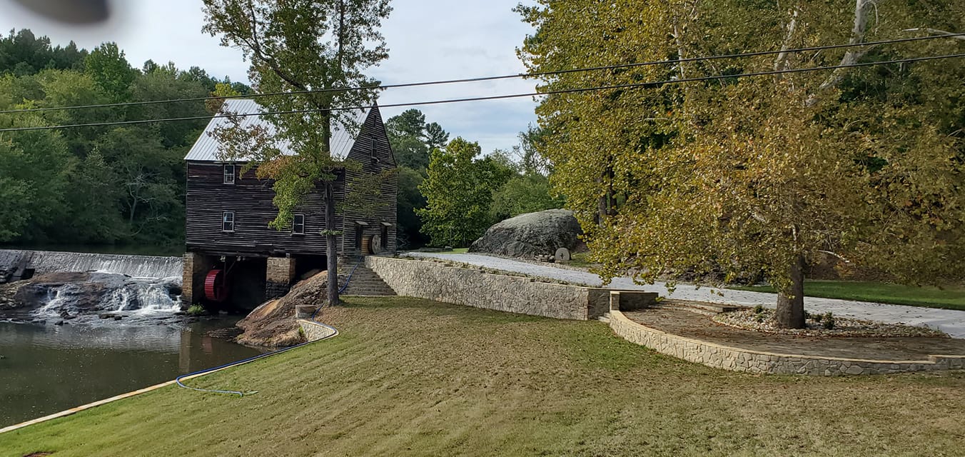
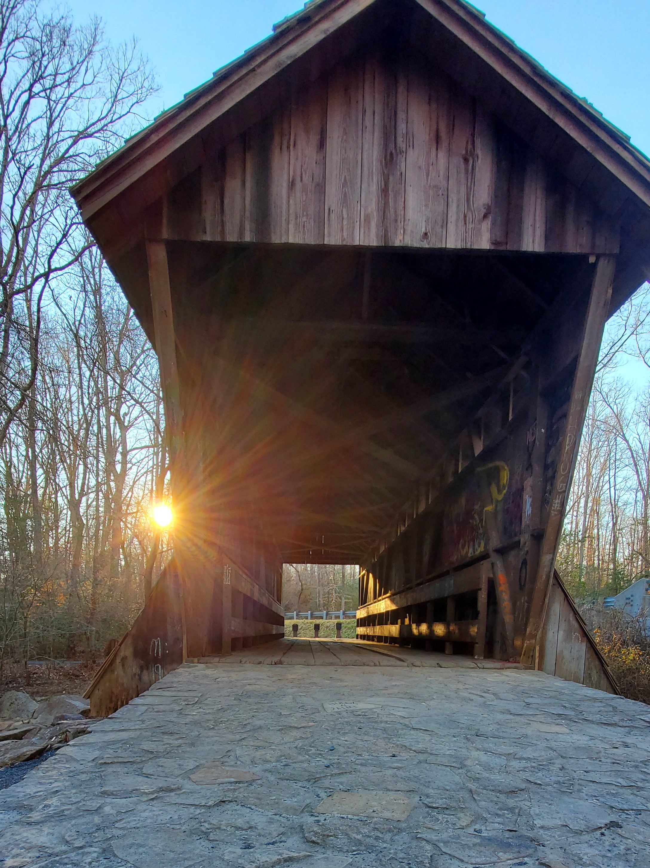
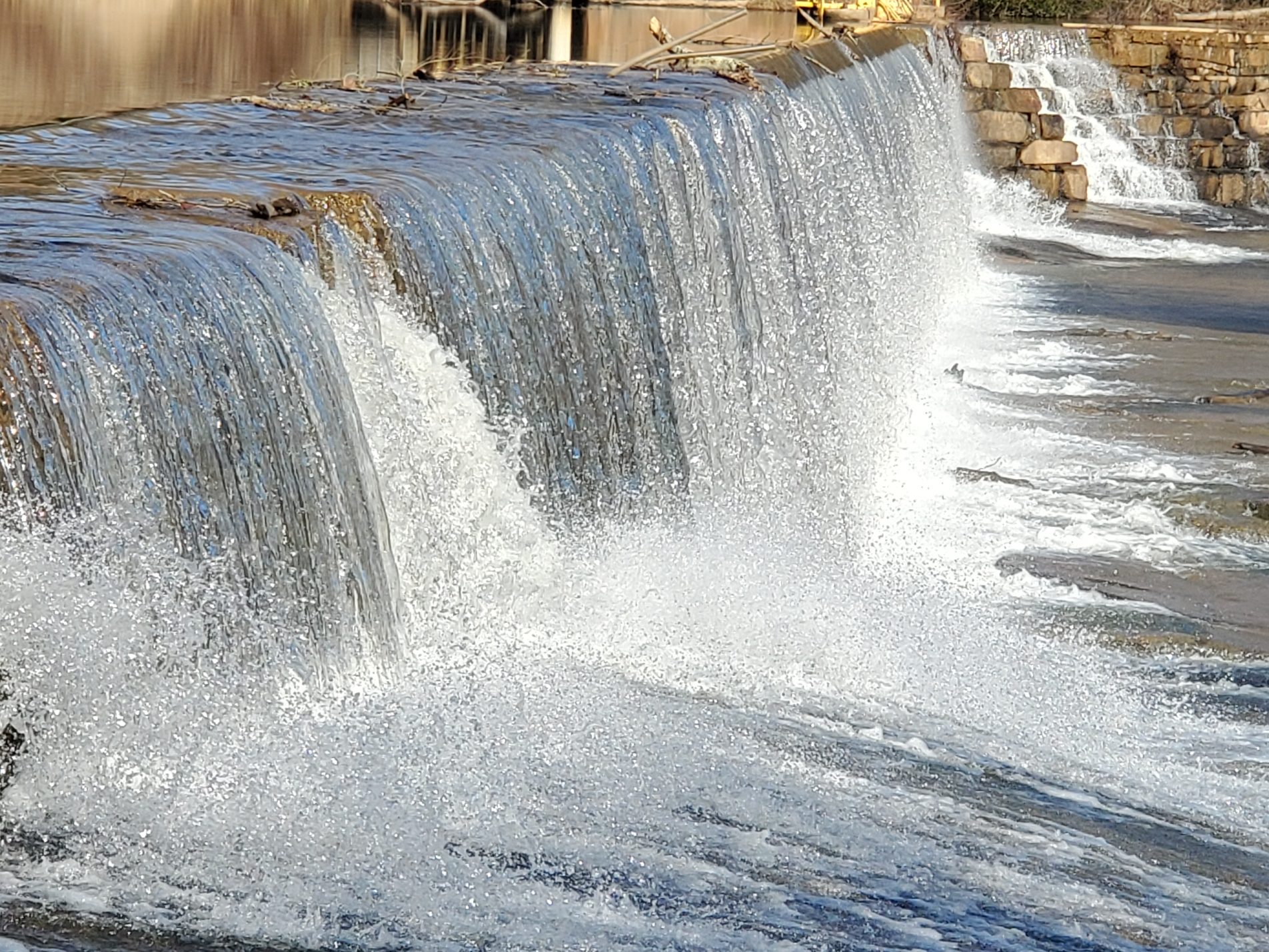
Laurel Mill
Laurel Mill dates from the mid-1800s. The dam stretches between two large rock outcrops, and impounds water from Devil’s Cradle Creek, Flatrock Creek, and outlets from several farm ponds. The combined flow becomes Sandy Creek below the dam.
The dam does not appear to have much height when viewed from the road, causing one to wonder how much force could be generated. However, the power for a water wheel is not a function of the water’s flow. Rather, it is the weight of the water in the wheel’s “buckets” which produces energy.
Laurel Mill (Perry’s Mill Pond) is not open to the public. However, it can be viewed (and photographed) from the bridge over Sandy Creek, as well as from the road on the east and west banks. The structure was placed on the National Registry of Historic Places in 1975. (See this post’s feature photo.)
DIRECTIONS: From US-401 in Louisburg, take NC-561 east for several miles. Turn left onto Laurel Mill Road at the sign pointing to Laurel Mill School. At the intersection with Jones Chapel Road, bear right, across the bridge. The mill will be immediately on the left.
From the mill, SR1436 continues eastward, through gently rolling hills, and rejoins NC-561 near Centerville. Along the way, it passes lovely farms, several old homesteads, and Perry’s School which dates to 1927, but which ceased being an educational facility in 1990.
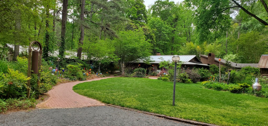
DeHart Botanical Gardens
Stop by here for a stroll through the woods and some unexpected discoveries (3585 US 401).
Located on the North Carolina-South Carolina border, Cleveland County is two counties west of Charlotte. The county was formed in 1841 from parts of then Lincoln and Rutherford counties. It was named for Benjamin Cleveland, a colonel in the American Revolutionary War, who took part in the Battle of King’s Mountain. From 1841 to 1887, “Cleaveland” was the spelling used, and the present spelling was adopted in 1887.
Casar
According to locals, Casar was originally incorporated as Race Path in 1890. In 1903, the name was to be changed to Caesar, but the story goes that Joe Meade with the U.S. Postal Service sent the town’s application for incorporation and the name came back misspelled. So, the town officially became Casar.
Belwood
Belwood was incorporated in 1978. The name of the town means “beautiful woods.”
Fallston
Fallston was settled in the 1880s and incorporated in 1893, and named for John Z. Falls, Sheriff of Cleveland County.
Lawndale
Lawndale developed in the late 19th century around the Cleveland Mills plant established by Major H.F. Schenck. The town was named for the green lawns of the houses where many of the mill’s workers lived. Schenck’s daughter and son-in-law opened the Piedmont Academy in 1897, and rail service to Shelby began two years later. Lawndale was incorporated in 1903.
Baker Buffalo Creek Vineyard And Winery
A visit to this county uncovered one of my favorite finds to date! Did you know… right here in NC, we have the one and only–seen on packaging and TV commercials–Hillshire Farms barn! Yes, it’s true. The beautifully kept 3-story red barn is located at Buffalo Creek Vineyards in the Fallston/Lawndale areas of Cleveland County. It was the last stop of the day for this travel blogger–and the history of this winery was a total unexpected surprise!!
Oh, and can enjoy wine tastings while on site as well as live music and food trucks when scheduled. Bring your lawn chair and enjoy with family and friends!
(P.S. The logo is no longer on the side of the barn, but the tree from the commercials still stands. Plus, on the other side of the barn, you’ll find a large lean-to, which has been reimagined as a chapel–complete with church pews. Yes, you can get married at the Hillshire Farms Barn in NC!)
Polkville
The Polkville Rodeo is an annual event that takes place in the Mintz Arena at Polkville Baptist Church. This event is sanctioned by the International Professional Rodeo Association (IPRA) and is presented by F-K Rodeo Company of Charlotte. Advance tickets are available at local businesses as well as those sold at the gate. All proceeds go to benefit church members in their desires to participate in mission trips and disaster relief efforts.
Kingstown
Named in honor of Martin Luther King, Jr., Kingstown was incorporated in 1989. The town was originally known as “Kingston,” but adopted its current name to avoid confusion with Kinston, North Carolina.
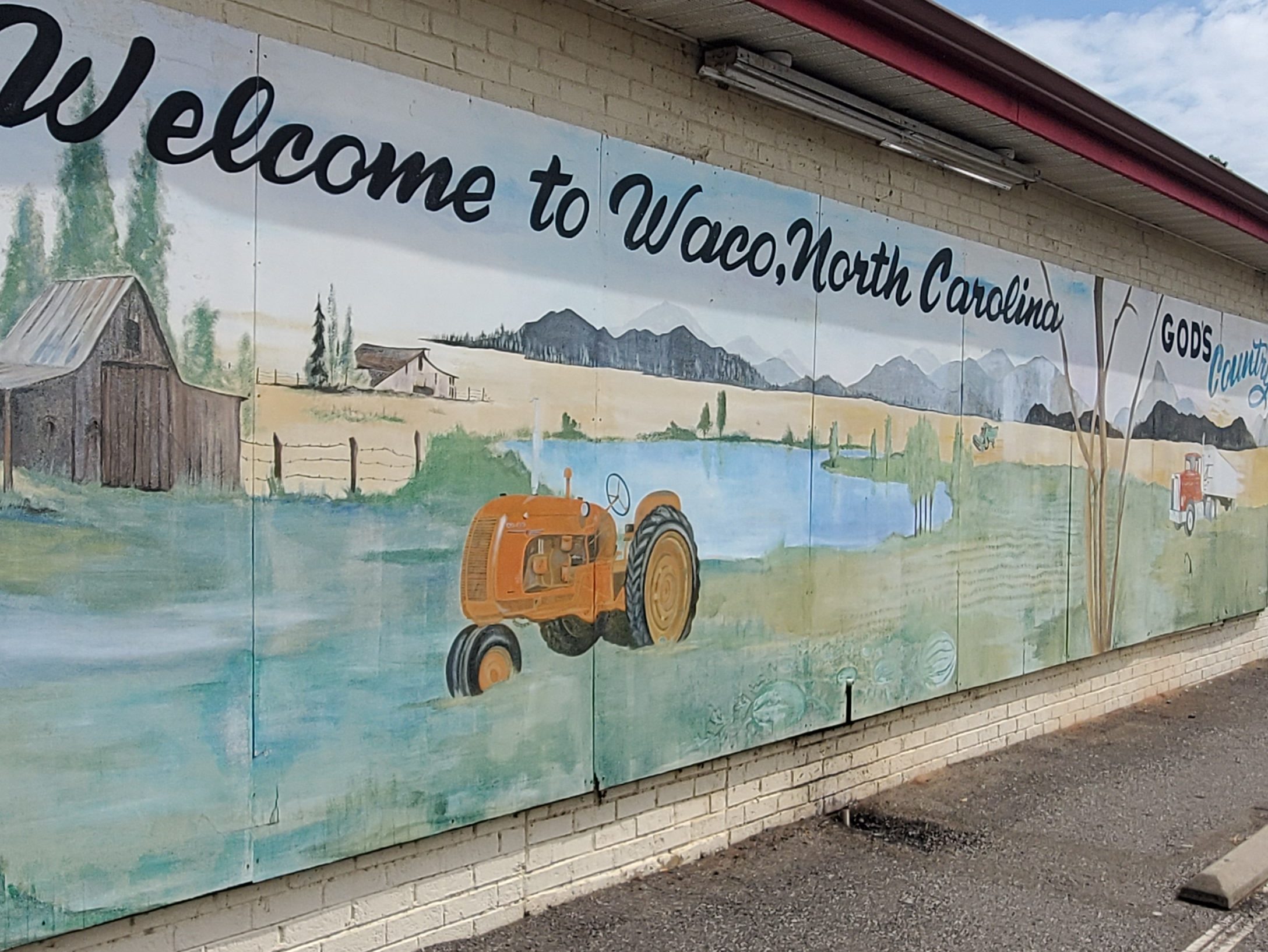
Waco
Named after Waco, Texas, the Waco post office has been in operation since 1880. Floyd Patterson, heavyweight boxing champion, is from the area.
The Town of Waco is located in the eastern portion of Cleveland County in the Piedmont region of North Carolina. The community was first known as “Ramsey Crossings,” after local farmer, Joe Ramsey. In 1879, a movement was started to establish a post office. At the height of the movement, a young man in his twenties, George Washington Kendrick, returned from the Brazos Area of Texas and suggested the town be called “Waco,” after a city along the Brazos River. The community liked its sound, and accepted it as the town’s official name.
In 1880, Kendrick was sworn in as the town’s first postmaster. By the late 1800s, Waco was an active farming town that supported a busy railroad depot, feed and seed stores, a bank, post office, two churches, and several general mercantile stores. Farmers and families traveled by wagon or on horseback from as far as 20 miles to come to Waco to sell their goods and purchase items they needed. In 1880, solicitations were made to build a school, and the Waco Academy was constructed. Although the building changed over the years, the school stood on the same piece of land until finally closing its doors more than 100 years later. Cotton fields covered the landscape for some time (and you can still find some today), intertwined with pastures for cattle. Many families looking for a quiet place to raise a family were drawn to Waco. Out of those families have come doctors, lawyers, educators, pastors, politicians, entertainers, athletes, and beauty queens.
The original “Waco Post Office” and the “Peoples Bank of Waco” is one of the oldest structures in Waco and has been restored by the McNeely Family, who are well-known throughout the community and the county.
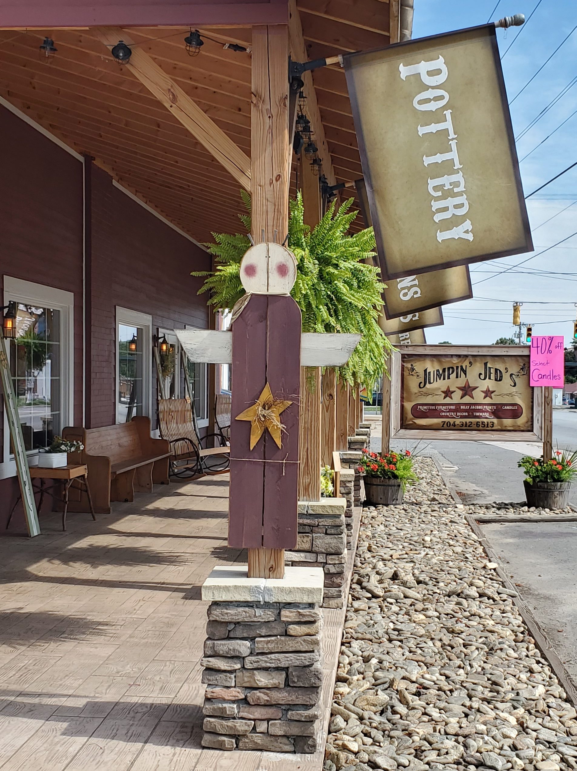
Shelby
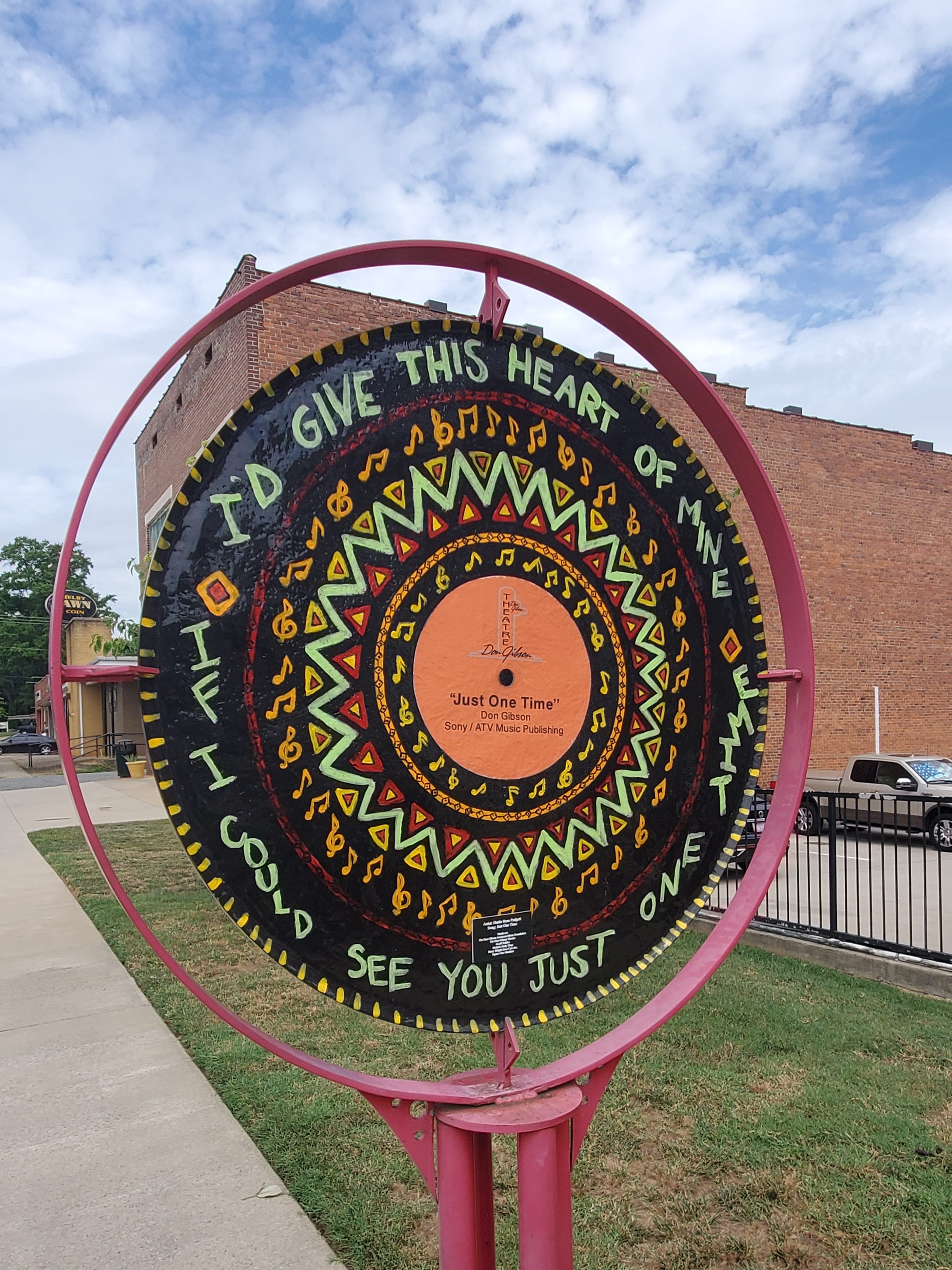
Shelby is the county seat and the main hub for the county. Drive through the town on any Wednesday or Saturday and you’ll find a bustling downtown farmers market as well as both residents and visitors strolling through the streets, shopping at local gift boutiques, and enjoying a meal or treat at a local food establishment. Throughout the uptown Shelby area, you’ll also find a number of 2-sided, hand-painted, vinyl record replica public art pieces, which artfully memorialize native son Don Gibson’s popular songs.
Other public art pieces throughout the community include an Earl Scruggs wall mural painted on the side of Newgrass Brewing; Bobby Bell, a local Black football star, is portrayed in his football-playing days; and Don Gibson takes up the side of the Don Gibson Theater.
The area was originally inhabited by Catawba and Cherokee peoples and was later settled between around 1760. The city was chartered in 1843 and named after Colonel Isaac Shelby, a hero of the battle of Kings Mountain (1780) during the American Revolution. Shelby was agricultural until the railways in the 1870s stimulated Shelby’s development. Textiles later became its chief industry during the 1920s when production of cotton in Cleveland County rose from 8,000 to 80,000 bales a year. Cotton production peaked in 1948 with Cleveland County producing 83,549 bales, making it North Carolina’s premier cotton county. In the 1930s, Shelby was known as “the leading shopping center between Charlotte and Asheville.” People from surrounding counties came to Shelby to shop, since there were numerous types of local and chain stores. By 1947, Shelby was a true thriving town with the mills paying among the highest wages in the South. In the 1950s, droughts, insect infestations, and government acreage controls resulted in the decline of cotton as Cleveland County’s primary crop.
The architecture of Shelby is noteworthy in that despite being in a rural area, there are magnificent homes and buildings with unique character. Some buildings are county landmarks, such as the Historic Campbell Building and others are listed on the National Register of Historic Places: Banker’s House, Joshua Beam House, Central Shelby Historic District, Cleveland County Courthouse, East Marion-Belvedere Park Historic District, James Heyward Hull House, Masonic Temple Building, Dr. Victor McBrayer House, George Sperling House and Outbuildings, Joseph Suttle House, Webbley, and West Warren Street Historic District.
Shelby was home to a group of political leaders in the first half of the 20th century that have become known as the “Shelby Dynasty.” These men wielded power through the local, state, and federal governments. The most notable men of Shelby’s political leadership were brothers James L. Webb and Edwin Yates Webb and brothers-in-law O. Max Gardner and Clyde R. Hoey. (The current Gardner-Webb University situated in Boiling Springs was named for these men.) As governors, NC representatives, and US congressman, the group impacted Shelby life and Shelby’s reputation throughout the state.
Shelby’s community of art, music, and government all take place in Uptown Shelby historic district. Uptown Shelby is home to a large square, local businesses, and a variety of restaurants surrounding The Courthouse Square. Re-branded as “uptown” in the 1970s in order to bring town-people back off the highway and away from the mall, this area has been named a “Main Street” by the National Trust for Historic Preservation.
The local pavilion hosts a twice-a-week Farmers Market on Wednesdays and Saturdays, as well local concerts. Monthly summer festivals like Shelby Alive and Seventh Inning Stretch, hosted by the American Legion World Series, brings regional music acts to perform in the city. With a low cost of living and a vibrant small town environment, Uptown Shelby has experienced growth in street-level occupancy, while hosting opportunities for active living. Be sure to stop by Newgrass Brewing, multiple restaurants, and other local businesses that attract day trippers and shoppers from across the region. Party of the city brand, live music is a part of community with the Earl Scruggs Center and the Don Gibson Theatre.
Other public attractions include walking trails like the Carolina Thread trail and the Broad River Trail as well as public events. Reoccurring events include the Fall Livermush Festival, The Cleveland County fair (the largest county agricultural fair in North Carolina), The 7th Inning Stretch, The Art of Sound, Arts on the Square, and various fundraisers. (P.S. Various restaurants, including Shelby Cafe, serve their own versions of livermush [a mixture of pork products, corn meal, and spices], which is a traditional local and regional favorite. The food originated from German settlers, who traveled south through the Appalachian Mountains in the 1700s.
Of note, parts of the Hunger Games was filmed here. Robert Harrill (the Fort Fisher Hermit), country music singer Patty Loveless, heavyweight boxing champion and Boxing Hall of Famer Floyd Patterson, and banjo player/composer on Hollywood Walk of Fame Earl Scruggs all hail from the area.
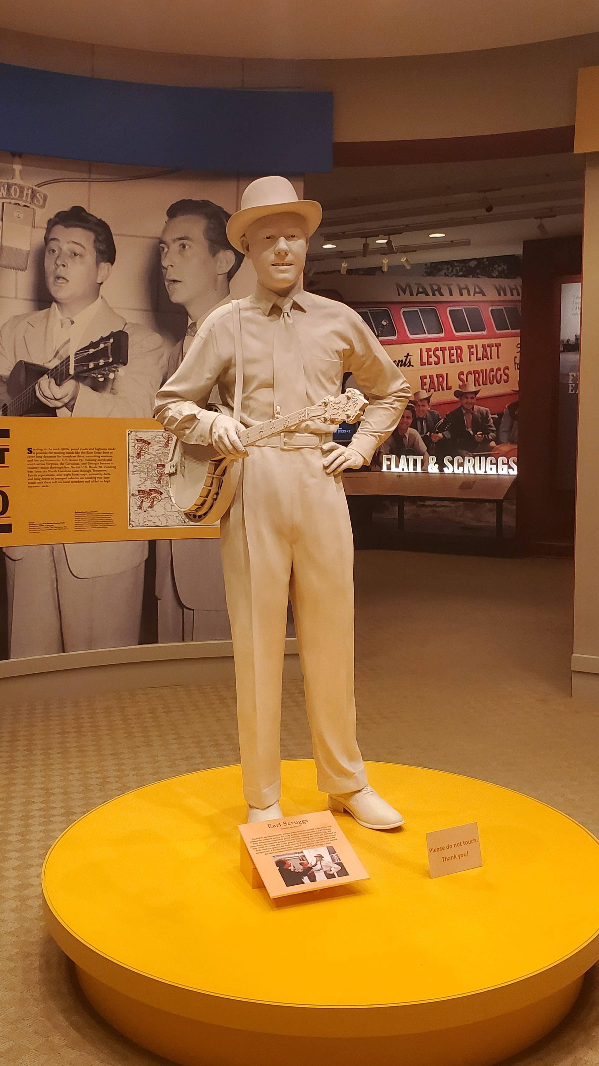
Earl Scruggs Center The Earl Scruggs Center (103 S. Lafayette St.), housed in the former county courthouse, combines the life story of legendary five-string banjo master and Cleveland County native Earl Scruggs with the unique and engaging story of the history and cultural traditions of the region in which Scruggs was born and raised. It was in the nearby Flint Hill community where Scruggs learned to play banjo and began the three-finger playing style that has come to be known around the world as “Scruggs Style.”
The Earl Scruggs Center explores Scruggs’ innovative career and the community that gave it shape while celebrating how he crossed musical boundaries and defined the voice of the banjo to the world. Engaging exhibits, special event space, and rich programming provide a uniquely rich experience for visitors. (Admission is $12.)
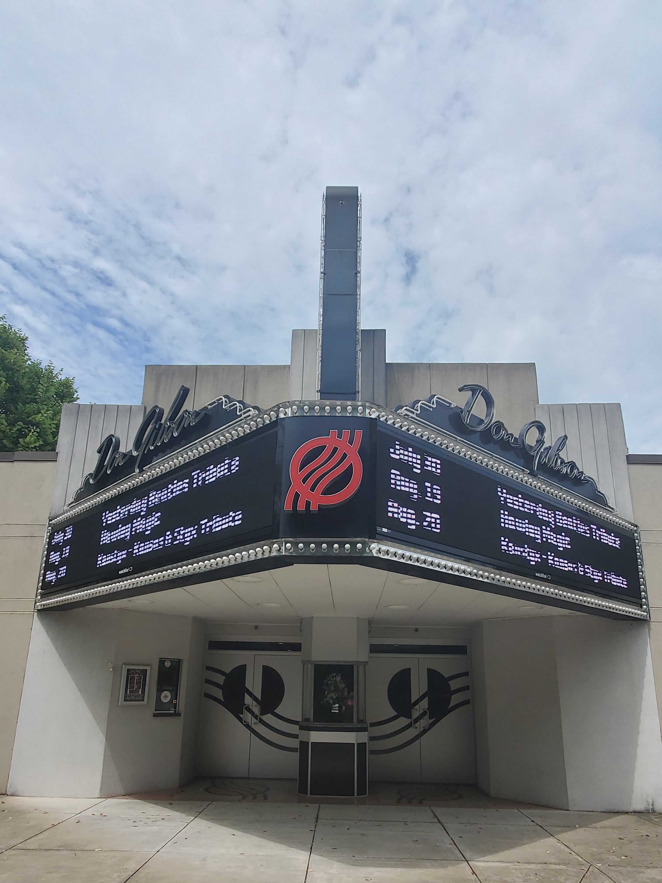
Don Gibson Theater Stop by for a peek and to take photos of this classic theater, which is still in operation today (318 Washington St.).
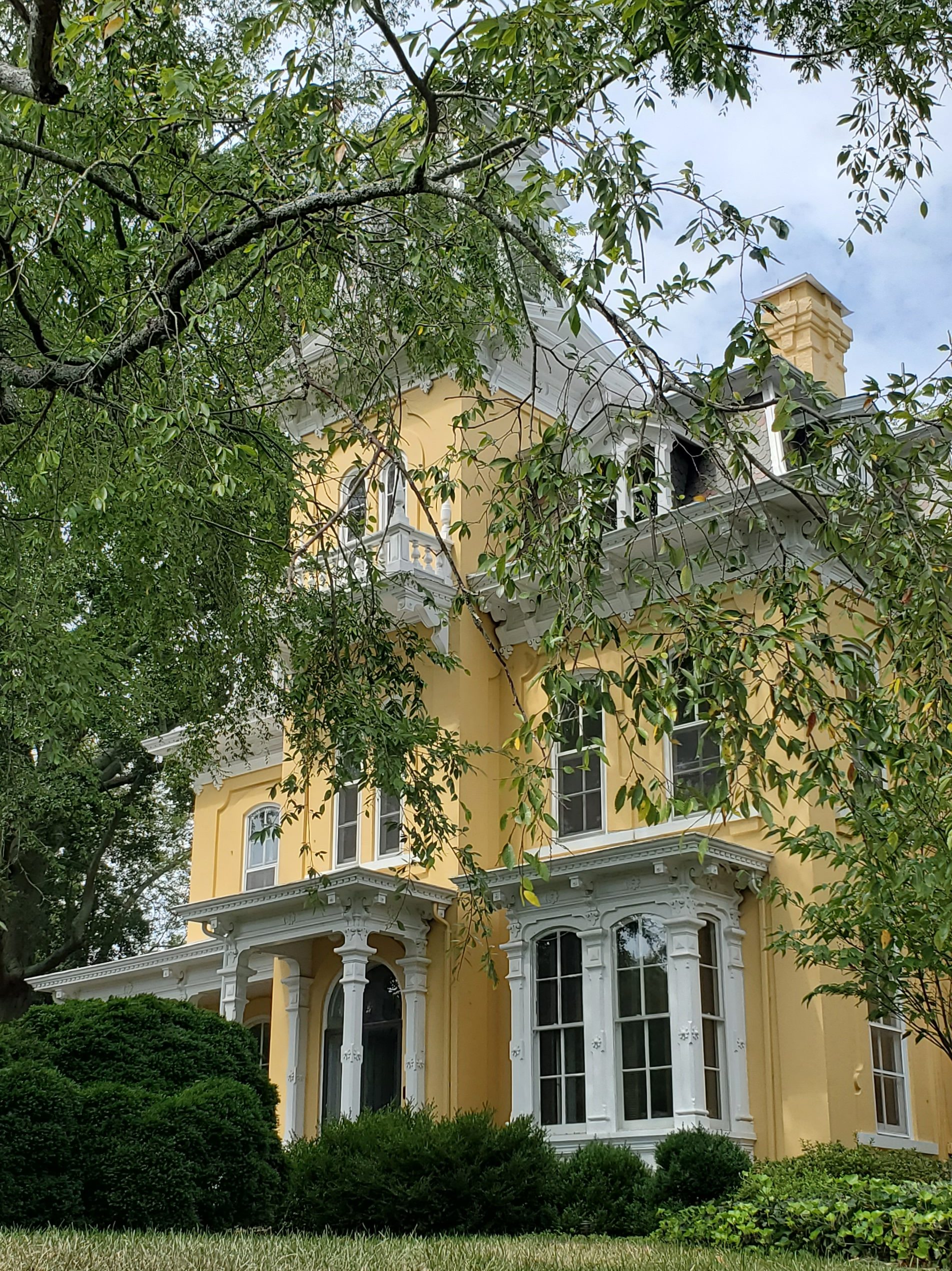
Banker’s House
Don’t leave Shelby without seeing the beautiful bright yellow Banker’s House. You can’t miss it if you drive by.
Shelby City Park
Just a few miles outside of uptown Shelby, you’ll find Shelby City Park, which includes playgrounds and a merry-go-round as well as sports fields.
Cleveland County Arts Council Stop by the Cleveland Arts Council building (111 S. Washington St.) to view both permanent and rotating displays.
Boiling Springs
The town of Boiling Springs is home to Gardner–Webb University (named for the aforementioned Gardner and Webb families, who were prominent in the area). The town is named after the natural spring found on the university’s property, which feeds a small lake. People began settling the area around the namesake boiling springs in 1843. The first families to settle were the Hamricks, the Greenes, and the McSwains.
One of the first buildings constructed was Boiling Springs Baptist Church, built in 1847 about 100 yards from the springs. Boiling Springs was known as a sleepy community, with no railroads, no industries, few stores, and no paved streets. At the turn of the 20th century, Kings Mountain Baptist and Sandy Run Associations began looking for a place to build their denominational high school and chose Boiling Springs because it was geographically situated between the two associations and because the Boiling Springs community made concerted efforts to attract the school. The Boiling Springs High School boarding institution opened for business in 1905. School authorities felt that neither intoxicating drinks nor cigarettes should be sold near the school, so in 1911 the town was incorporated in order to ban the sale of such items. Town limits were decided by drawing a mile and a half radius from the school’s original bell tower.
Incorporation of the town proved to be a major step forward because it provided a government that could function and enable the town not only to grow but to furnish water, police and fire protection, paved streets, and garbage collection for both the town and the school. As time progressed, the growth of the town was largely tied to the growth of the Boiling Springs High School, which became the Boiling Springs Junior College in 1928, Gardner Webb Junior College in 1942, and, finally, after achieving status as a senior college and developing several graduate programs, Gardner–Webb University in 1993.
Voters approved ordinances to allow for the sale of beer, unfortified wine, and malt beverages within town limits in 2018.
Boiling Springs has remained a small town with character and charm. The Baptist boarding school is now Gardner-Webb University and has celebrated its centennial year.
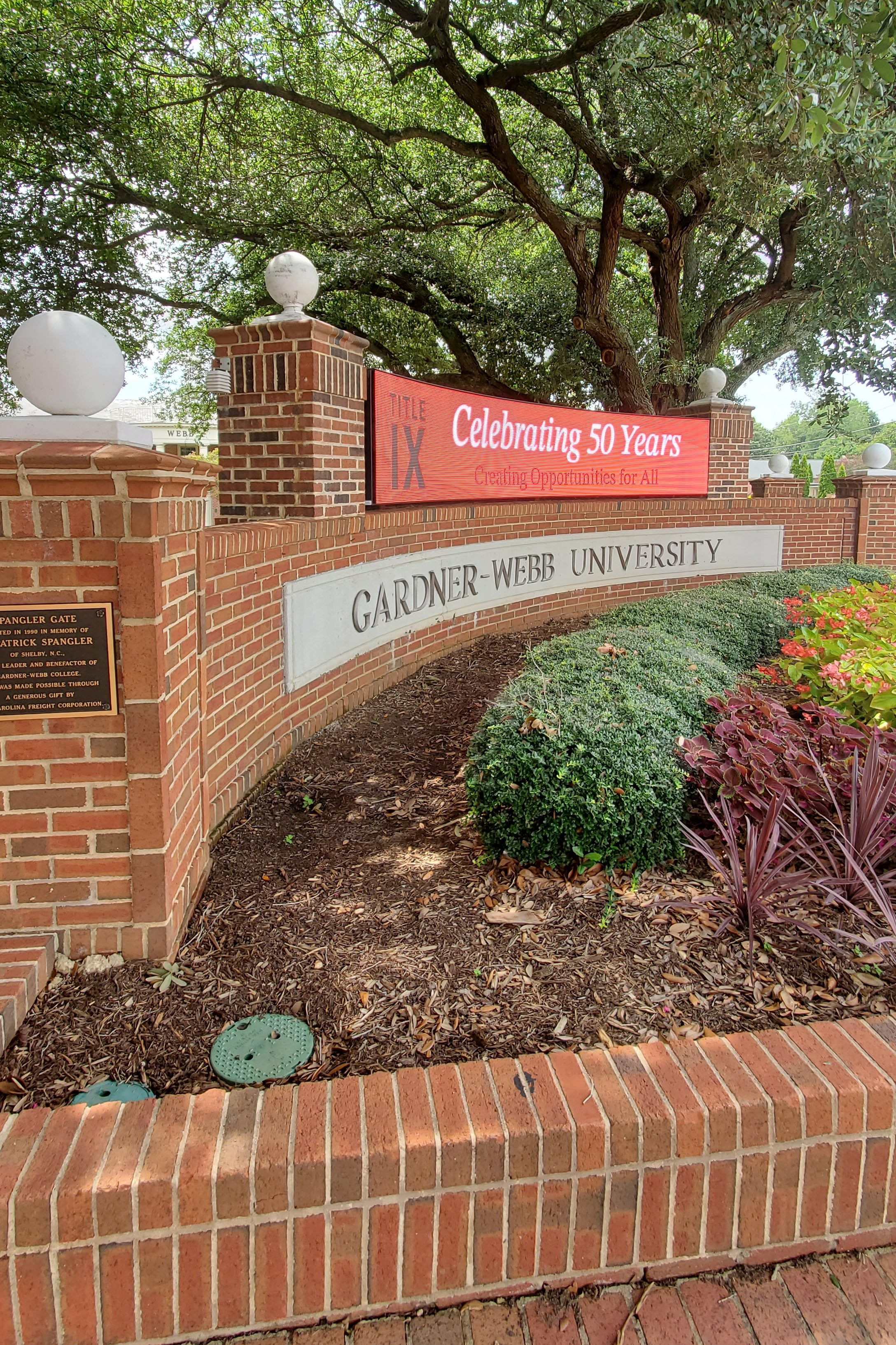
Gardner-Webb University
Visit one of the town’s namesake boiling springs. Beautifully restored and located on the campus of Gardner-Webb University, the spring became a community gathering place when the area was first settled in the 1840s.
Earl
Earl was incorporated in 1889 and was named for local landowner Abel Earl (and not Earl Scruggs as one might think).
The Town of Earl (ToE) is a small rural village first settled in the late 1700s. With the coming of the railroad in 1870s the town was a center of rural and agricultural commerce for southern Cleveland County as well as upper Cherokee County, SC, boasting three general stores, a blacksmith, assorted service businesses, and a cotton gin. When Farm-to-Market roads were improved in the mid-20th century and textile industrialization occurred, Earl again became a quiet rural village with little commerce.
As the Interstate Highway System developed in the last quarter of the 20th century, the emerging South Eastern Piedmont Megalopolis from Atlanta to Raleigh on I-85 spawned bedroom and support communities for the urban centers along the route. Located virtually equidistant from Charlotte and Greenville (55 minutes to city centers), the Earl community has seen residential growth taking advantage of its proximity (6 minutes) to I-85 as well as commuters to Shelby, Boiling Springs (home of Gardner Webb University), and other towns seeking a short commute with easy, big city access from a more rural setting.
Patterson Springs
Patterson Springs was originally a small farming community called “Swangs,” with only a train depot and a post office. William George Patterson bought the land that held three springs from the “Epps” family. Patterson hoped that the supposed healing powers of these springs would help heal his son, Billy, who had poor health. Eventually, news of the supposed healing powers of these springs spread, and Patterson created a 30- to 40-oom resort to house travelers and merchants. The resort, which was one of several in the area, mainly attracted people from North Carolina, South Carolina, and Georgia. When the attendees of the resort were not at the springs, Patterson offered lawn bowling and a dance every Saturday night. In 1885, the name “Swangs” confused the railroad people, so they convinced the post office to change it to Patterson Springs and the government officials agreed. In 1915, a school building was created, housing all eleven (not 12) grades. Another was built in 1923, which housed grades one through eight, while the High School students attended No. 3 High School. In the 1960s, the post office closed; then in the 1970s, both schools closed. The train depot no longer exists.
Grover
Grover is classified as a small town where railway and highway routes Interstate 85 and U.S. Highway 29 cross the state line between North Carolina and South Carolina. It was previously named Whitaker and legally was in South Carolina. The name change to Grover in 1885 was in honor of President Grover Cleveland. Gingerbread Row (Cleveland Avenue – NC Highway 216) has an antique look with many restored homes in beautiful colors.
A railroad-dominated town started when the Atlanta Charlotte Airline Railway placed a turntable for engines to be spun. They operated from the 1880s to the 1920s and Southern Railway (U.S.) continues to carry passengers to this day (now known as Norfolk Southern). Mail drops and pickups by train occurred several times per day in Grover often with the mail bag put on a hook while the train came through at speed. Amtrak also operates on the line (under permission) and carries passengers from Atlanta to Charlotte, Richmond, Boston, and New York City. George W. Bush made a rail stop in Grover during his U.S. Presidential campaign.
Grover is also home to international companies like Eaton, Commercial Vehicle Group, Southern Power, 84 Lumber, Uniquetex, and–interestingly–the U.S. Presidential Culinary Museum and Library.
Grover was the town of entry by The Marquess, Lord Charles Cornwallis when he invaded North Carolina with his cavalry, artillery, and army. The butcher of New Jersey, Major Patrick Ferguson, also camped near parts of present-day Grover, prior to battle on King’s Mountain, a local mountain range named after the King Family that lived there. The famed Hambright (Hambrecht) family dynasty crown jewel mansion that welcomed people to Grover for 30 years from 1948 to 1978 is now The Inn of the Patriots, since 2008.
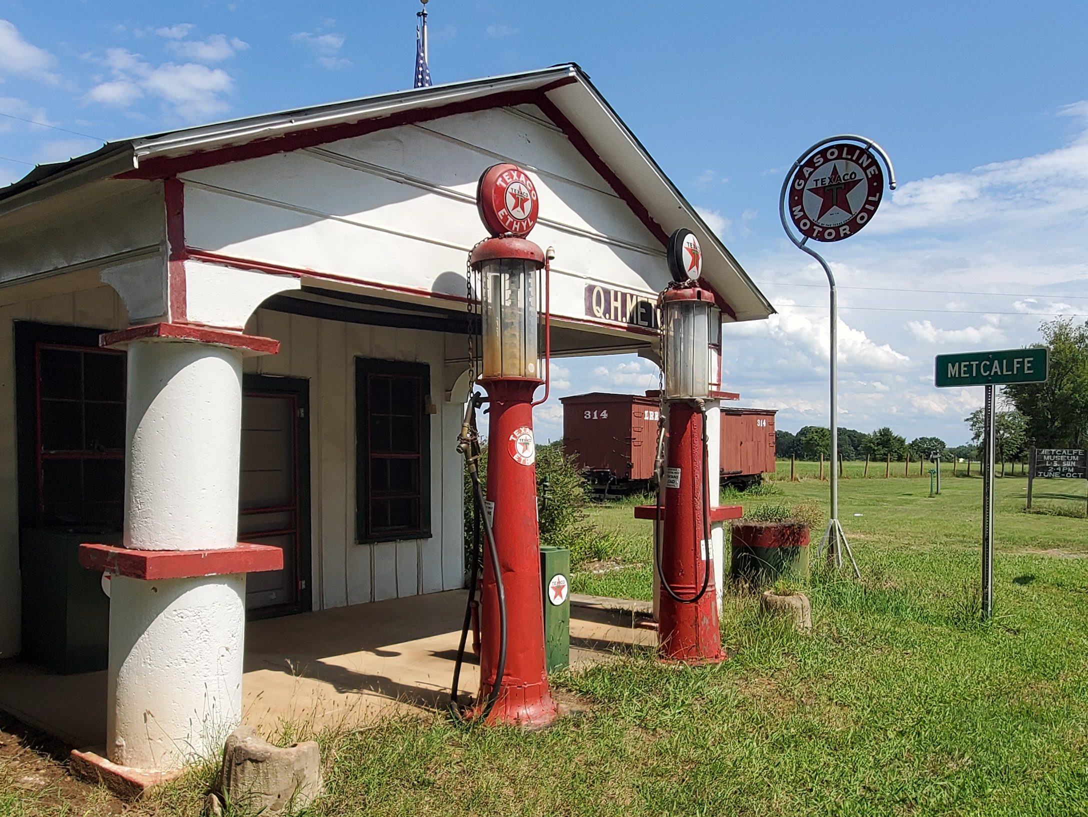
Metcalfe Station Metcalfe Station, located on N.C. 226 North (2940 Polkville Road, Shelby), served as the stop between Lawndale and Shelby for the narrow gauge railroad that connected Cleveland Mills to the major railways. In the station’s later years, it was serviced with Texaco gasoline to supply gas for automobiles that were becoming more popular. If you take the time to stop by the Metcalfe Station, you’re in for a treat and a historical lesson. The store served cold drinks and a few groceries and treats in its day. Inside (when open) you can sign the registry and see many vintage items. From this site Mr. Q. H. Metcalfe supervised section crews for the Lawndale Railway and Industrial Company, 1899-1943.
A group of volunteers refurbished the station and an original railroad boxcar and was opened to the public in 2001. The land, original buildings, and boxcar were donated in memory of Quincy Hague Metcalfe by the Gene Metcalfe family. Max Lail, a member of the Lawndale Historical Society, greets visitors at the Metcalfe Station when it is open. The station is open on Sunday from 2 to 4 p.m., June through October.
Kings Mountain
During the Revolutionary War, Patriot militia defeated Loyalist militia in the Battle of Kings Mountain. Originally the settlement was called White Plains, but the city was incorporated on October 16, 1874, and the name was changed to Kings Mountain. It was decided that “Kings Mountain” would be a more appropriate name since the community was close to the site of the historic 1780 Battle of Kings Mountain in York County, South Carolina, a turning point in the American Revolutionary War by Thomas Jefferson. Liberty Mountain, a play performed at the local theater, recounts the events of the battle. The downtown area is home to the museum, police station, and the Mauney Memorial Library.
W.A. Mauney was the first citizen of Kings Mountain. He was the first man to establish a home, opened the first store, was the first postmaster, builder of the first cotton mill, and pioneered in the banking business of that general section. W.A. Mauney also cut many paths and roads through the wilderness.
In 1870-72 the building of the Charlotte-Atlanta Airline Railway was the impetus for the founding of the City of Kings Mountain. Farmers had no vision of turning the land into town lots or industrial sites, but men of other parts of the county and adjacent areas saw the possibilities for development. Freno Dilling moved his sawmill from Cherryville to the site of the present Kings Mill on N Piedmont Avenue in May 1872. The first railroad track was laid in the fall of that same year. The Dilling sawmill supplied some of the cross ties and his well furnished water to the railroad engines.
While in Kings Mountain, be sure to visit the Kings Mountain Historical Museum (100 E Mountain St.) and the Kings Mountain Little Theater (202 S Railroad Ave.), then hike or bike the Kings Mountain Gateway Trail.
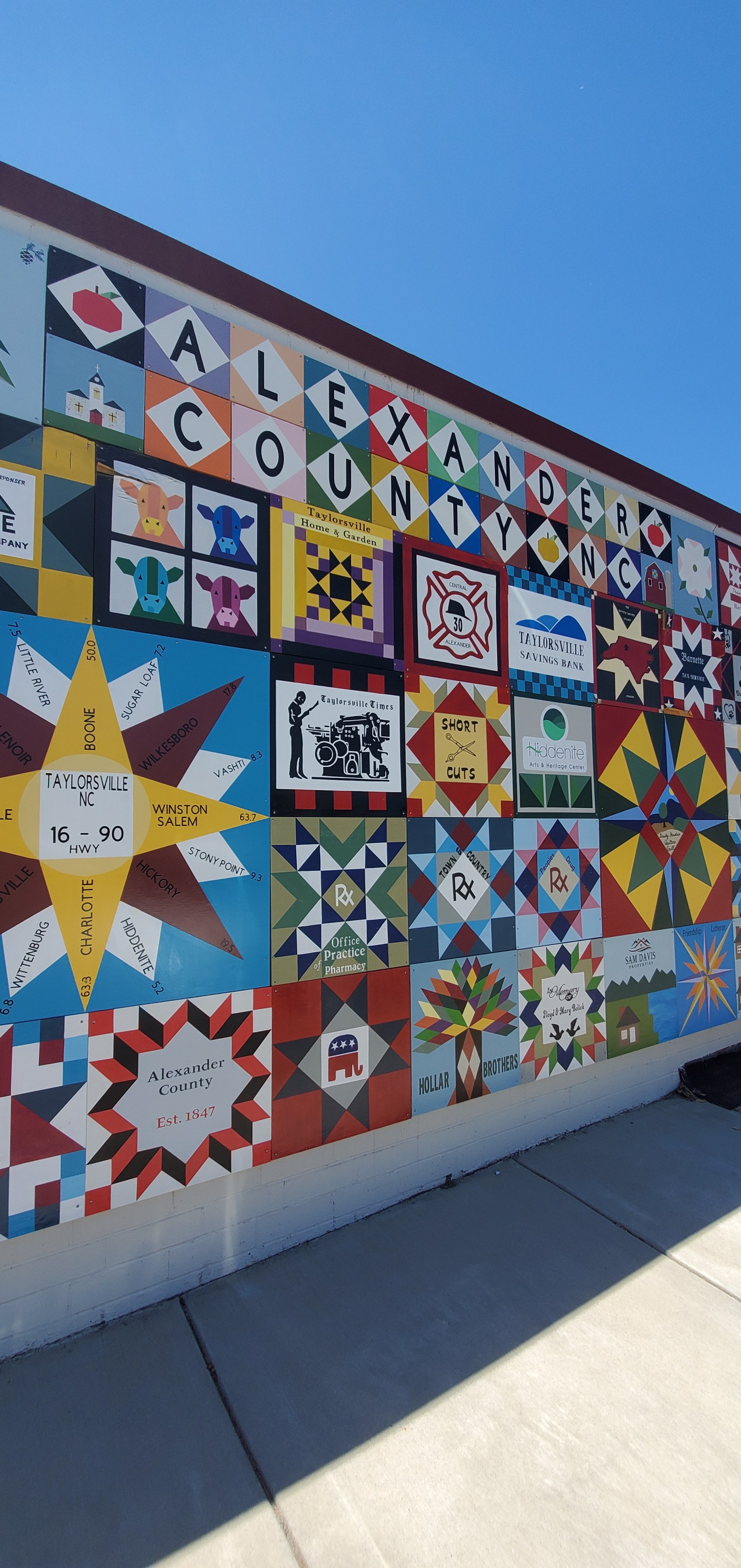
Called the Gateway to the Brushy Mountains, Alexander county is named in honor of the Alexander family who were leaders in Colonial North Carolina. And Taylorsville is the namesake of either John Louis Taylor, Carolina agriculturist and political philosopher, or General Zachary Taylor, the 12th president of the United States. The County was established in 1847, the year of the first sale of land in the county seat (Taylorsville). With the proceeds from the sale, the first courthouse was built on the present site. When the Civil War began, Alexander County was 14 years old. The 1860 population was 5,837; yet Alexander County ranked high per capita in the number of Confederate soldiers serving in the war. The Alexander Railroad Company is an active short line rail system operating between Taylorsville and Statesville and connecting with Norfolk Southern.
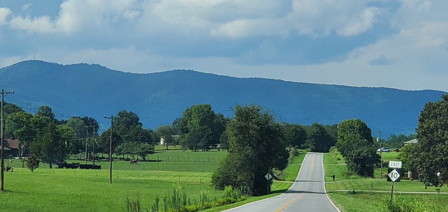
This county offers many amazing views of the foothill mountains and valleys that pop into view around nearly every twist and turn of a country road. It’s truly worth your time to spend a day getting lost in this county–for the views alone.
Stony Point
A Stoney Point Post Office was established on February 17, 1826 in Iredell County (at the time), with James Thompson as postmaster. The name was changed to Stony Point in 1832. The Stony Point populated place has existed in both Alexander and Iredell Counties since 1847, when Alexander County was created.
Hiddenite
Hiddenite was once noted as a health resort because of its sulfur springs. The town of Hiddenite was incorporated in 1913, but its charter was repealed in 1919. Hiddenite was named for William Earl Hidden (1853–1918), a mineralogist sent to North Carolina by Thomas Edison to look for platinum. Hidden discovered the gem that came to be known as “hiddenite” in 1879 in mines nearby. Until recently, it was found only in Alexander County, North Carolina, but in recent decades it has been subsequently found in both Madagascar and Brazil. Prior to the arrival of W.E. Hidden, the community was known as White Plains; this is how the area appears on a map of 1871.
The Hiddenite Gem Mines and surrounding areas also yield emeralds, sapphires, and many other precious stones. Sluicing and digging for precious gems is a popular recreational activity that draws many visitors to the area.
Hiddenite Celebration of the Arts
The Hiddenite Celebration of the Arts is held on the fourth Saturday in September. The Celebration invites people to see and participate in arts and crafts from different cultures. The main culture is the folk ways of North Carolina, but Hispanic and Hmong folkways are also celebrated. The annual 13.1-mile Hiddenite Half-Marathon is held at the same time.
Emerald Hollow Mine
Called the Gem Capital of the World, Emerald Hollow Mine (484 Emerald Hollow Mine Dr.) is the only Emerald Mine in the world open to the public for prospecting, found in the Brushy Mountains of Hiddenite. This is recognized as one of the most unique and interesting geological locations in North America. You’ll find numerous people sleucing, creeking, and digging for gems any day of the week, and especially on the weekends. One note, that if you do want to partake, you will need to purchase a permit, which can be obtained on property and upon your arrival.
More than 60 different types of naturally occurring gems and minerals are found in this area–and a treasure trove of gemstones can be found at the gem mine museum and gift shop. Many are very rare and include emerald, aquamarine, sapphire, garnet, topaz, amethyst, citrine, rutile, and tourmaline. They also have an abundance of world-class smoky and clear quartz crystals. Hiddenite being the 4th rarest gemstone in the world, can only be found in this small town of Hiddenite, North Carolina.
Rocky Face Mountain Recreational Area
Rock climber or not, stop by the Rocky Face Mountain Recreational Area (3451 Rocky Face Church Rd) for an amazing view of the small mountain’s rock face, which will jump out of nowhere, it seems, as you round the corner before the park. You’ll find climbers scaling the rock wall daily, and you can also picnic and walk the paths of this nature preserve. It’s definitely selfie worthy too!
Hiddenite Arts & Heritage Center’s Lucas Mansion Museum
The Hiddenite Arts & Heritage Center’s Lucas Mansion Museum (316 Hiddenite Church Rd) pays homage to the trademarks of this area with rotating exhibits featuring hiddenite and gem mining, emerging and regional artists, local craftspeople, a 3,000-piece doll and toy collection on the third floor, and more–all in the beautiful Victorian-era Lucas Mansion. As you tour through the home, be sure to peek out the windows for a beautiful view of the grounds below. The mansion is on the National Registry of Historic Places due to this amazing architectural feat. In 1914, the owner wanted to double the size of the mansion. But instead of spreading out the footprint on land, the two-story house was cut in half by inserting a new second floor between the two existing floors in order to make it the now three-story mansion that it is today. Amazing! The 22-room mansion also features a unique fire system and a bell system (so that residents could communicate between floors). Be sure to stop in the museum gift shop to take home a memory of your visit.
Vashti
Although you won’t find any activities or attractions here, I highly encourage you to type Vashti into your map locator and drive to the center point of this area for some absolutely amazing views of these North Carolina foothills. You never know what beautiful vista awaits you around the corner!
(P.S. This photo does it no justice.)
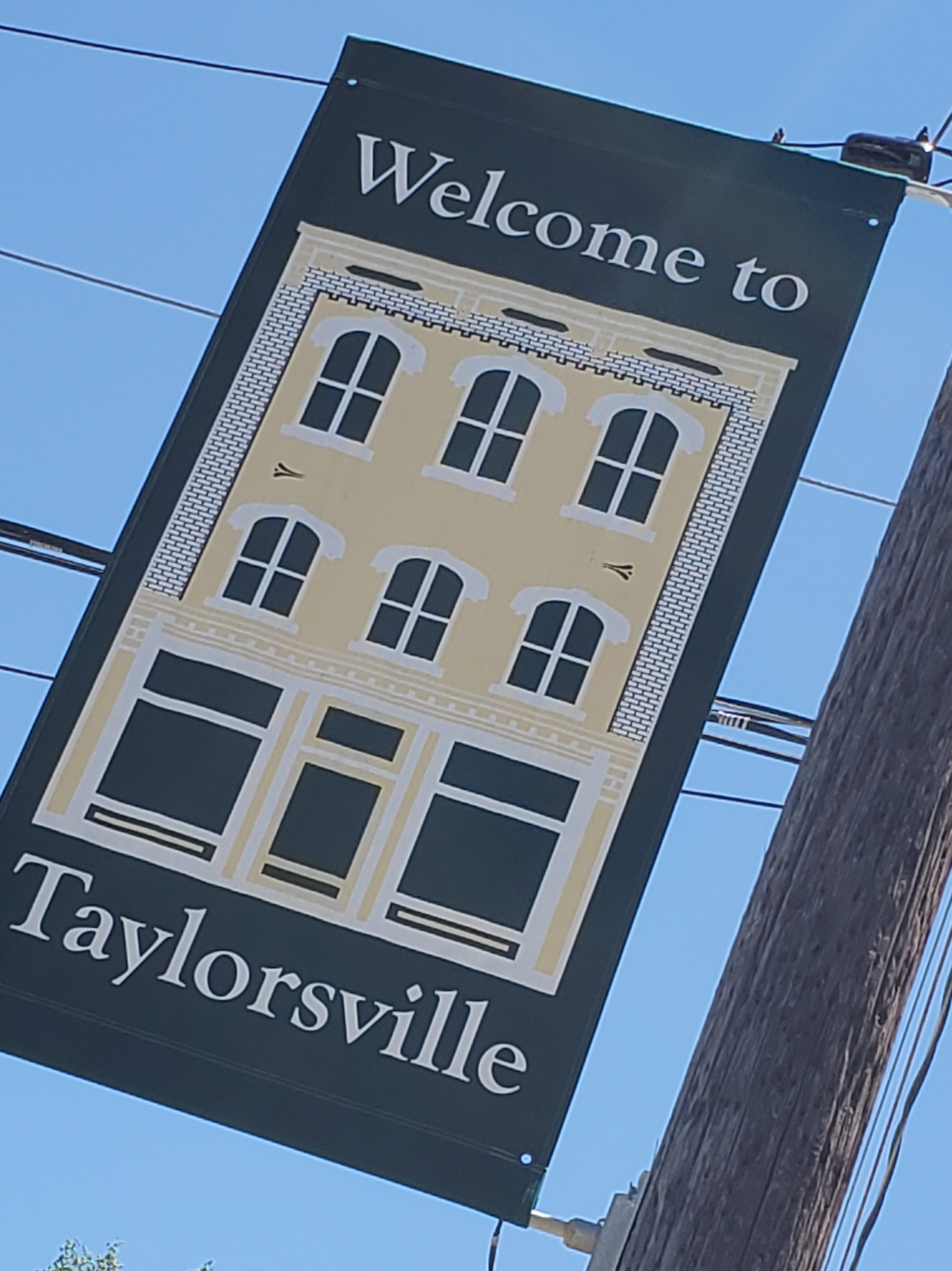
Taylorsville
Taylorsville, NC is nestled in the foothills of the Brushy Mountains in beautiful Western North Carolina and is the county seat of Alexander County. The town of Taylorsville was formed in 1847 along with Alexander County and named in honor of General Zachary Taylor, who at that time was in Mexico engaged in the Mexican–American War.
The land for the town was donated by J.M. Bogle who gave 22 acres, William Matheson who gave 13 acres, and James James who gave 113⁄4 acres for a total of 463⁄4 acres. Most of the land was woodland, and the road from Statesville to Morganton passed to the south of town.
A commission of Alexander C. McIntosh, R.L. Steel, Sion Harrington, J.H. Newland, and George Swain, treasurer, was appointed to lay out the town of Taylorsville and sell lots to raise money for the building of a courthouse and jail. An auction of lots was held August 11, 1847, and 47 lots were sold. The second sale took place on November 30, 1847, and 10 lots were sold. At a third auction on March 8, 1848, five lots were sold. The total amounted to $6,674.75.
The town of Taylorsville was incorporated in 1851. And John Watts served as its first mayor, appointed by the commissioners. The boundaries of the incorporated town were square, with each side measuring 160 poles or one-half mile long.
Harry Gant, former NASCAR Cup Series driver, is from the area as well as Jerry Rushing, a bootlegger and inspiration for The Dukes of Hazzard.
The Old Jail Museum
Today the Old Jail, built in 1913 as a two-story brick structure with a pyramidal roof, houses a small museum honoring the former jailers and their families who lived in the jail supervising the prisoners. Except for the addition of a wing at the East elevation in 1930, the building has retained much of its original period detailing. Of note are the quoins, which frame the main building, and are unusually stylish details for a jail. This is one of the oldest public buildings of Alexander County–and one of the oldest jails still standing in North Carolina. Four of the 10 original jail cells are still intact and are located upstairs.
The Old Jail (72 Main Ave Dr) is also home to ACAAI’s Genealogical Research Library. The collection includes local census, obituary files, family records as well as books, periodicals, microfilm, photographs, and other research media.
Alexander Railroad Company’s “June Bug”
Alexander Railroad Company, a locally owned, operated, and maintained short line railroad, offers weekday carload freight service along the Highway NC 90 corridor between Statesville and Taylorsville. The railroad’s offices are located in the old depot in Taylorsville.
According to legend, the railroad’s locomotives are painted green and gold in honor of local attorney and State Senator Romulus Z. Linney’s impassioned speech to NC Legislature in 1887, supporting a railroad charter to extend the existing Charlotte-Statesville AT&O line into Taylorsville.
To demonstrate the mineral wealth of this route, Linney referred to the recently discovered Hiddenite stone, claiming, “A well-wintered June Bug can carry away $1,000 worth of this valuable gem, which rivals the diamond in sparkling beauty, tied to its hind leg!” The legislation passed, and the railroad and its locomotives have been nicknamed “The June Bug” to this day.
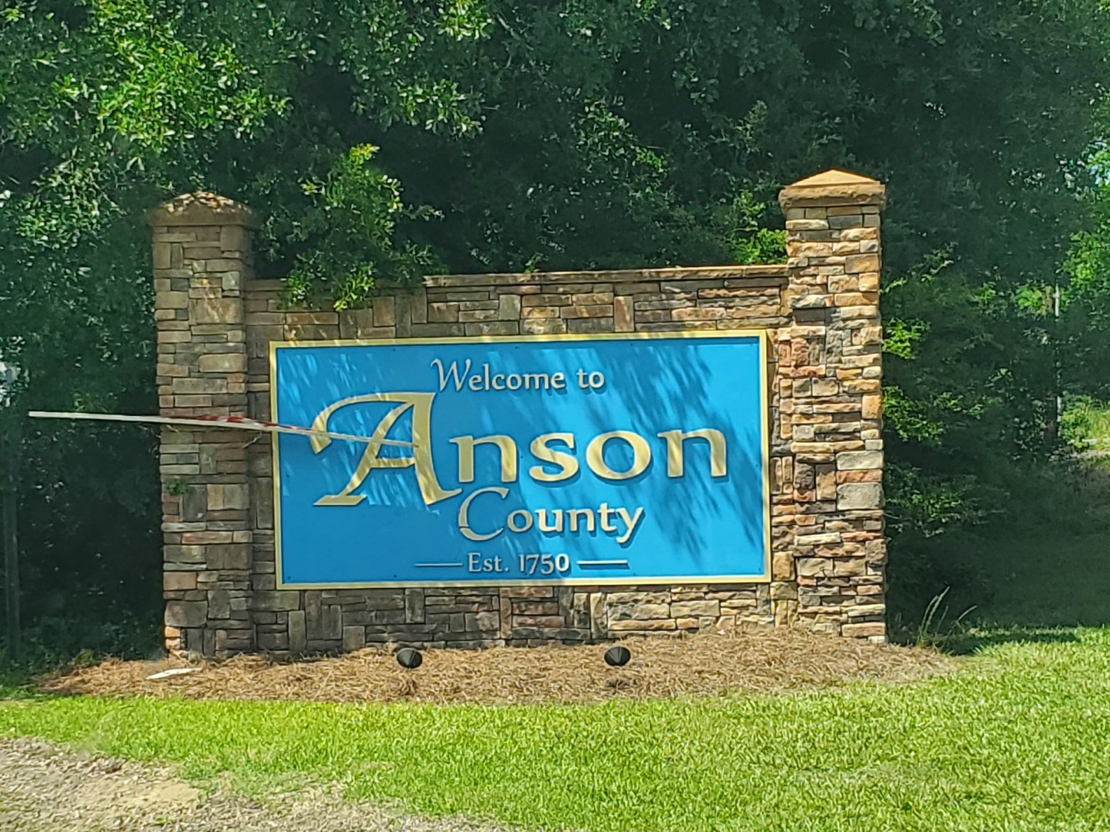
Enjoy a scenic day throughout the rolling hills of Anson County, NC.
Named for George Anson, Baron Anson, a British admiral, who circumnavigated the globe from 1740 to 1744 and later became First Lord of the Admiralty, Anson County was formed in 1750 from Bladen County.
While neighboring Bladen was occupied by Native American tribes(Waccamaw), Anson County was originally occupied by Catawba Siouan tribe as a large territory with undefined northern and western boundaries. In 1753, the northern portion of the county became Rowan County. In 1762, the western part of Anson County became Mecklenburg County. In 1779, the northern part of the remaining of Anson County became Montgomery County, and the portion east of the Pee Dee River became Richmond County. Then, in 1842, the western part of Anson County was combined with the southeastern part of Mecklenburg County to become Union County.
Interesting fact: Steven Spielberg filmed “The Color Purple” mostly in Lilesville, and a large white farmhouse (the Huntley house, located in Lilesville, an old farmhouse located few miles off Highway 74) was used extensively as the main exterior location in the film.
Peachland
The Town of Peachland was officially incorporated on March 31, 1895, but Peachland’s history actually dates back to the late 1700s. Some of the town’s street names reflect the New Jersey heritage of its founding fathers: Passiac, New England, New York, Park, and Boston. Passaic Street was the original Highway 74, built in 1923-24, before the existing four-lane US Highway 74 was constructed to bypass the downtown area. In March 1895, the North Carolina General Assembly ratified an act to incorporate a small town in western Anson County; and the Town of Peachland was officially formed on March 31, 1895.
The community’s rich history dates back to the late 1700s when Charlotte lawyers enroute to the Anson County Courthouse in Wadesboro would camp overnight near a spring because the trip by horseback took more than a day’s travel time. The route became known as Lawyers Road and the water source was called Lawyers Spring.
Originally, the community was known as Mulcahy. But in 1888, community fathers gathered to discuss renaming the unincorporated town to Fruitland. Eventually, the name “Peachland” was suggested, a nod to the natural beauty of Pad Gray’s peach orchard, located south of town.
Local lore alludes to the panning of gold in the area during Anson County’s own “gold rush.” Several mining operations popped up in Anson County during that time, and the gold was shipped to a mint in Charlotte for coinage prior to the Civil War.
Prior to incorporation, a one-room schoolhouse was constructed in the Lawyers Spring area. And the first elected mayor of Peachland was Vernon Allen. An early map, drawn by Eward Brown for inclusion in Peachland’s Centennial Celebration publication, pinpoints the location of local businesses, such as Griffin Drugstore, James Shoe Repair Shop, Redfern Store, Crowder’s Blacksmith Shop, Preslar’s Barber Shop, Cohn Grocery, a cabinet shop, Tucker’s Corn Meal Store, Caudle and Meggs Grocery Store, Leak and Marshall Grocery, Lowery Seed Store, Crowder’s Pool Hall, the Bank of Peachland, a Southern Bell telephone company office, an auto repair shop, Brown’s Garage, Huntley Gin and Lumber, the Peachland Depot, Baucom’s Fertilizer Co., Peachland School, and Peachland Elementary.
Perhaps the most notable Peachland resident was Dr. Parks Turner Beeman. He is remembered for his epitaph, “I Fed Fever,” that is inscribed on his tombstone in the family cemetery near Peachland. He favored the practice of feeding patients who had a fever, stating a feverish patient is weak enough without making him suffer malnutrition too.
Interesting fact: On April 1, 1995, a time capsule was buried with the stipulation that it would be opened on April 1, 2045 – Peachland’s 150th birthday.
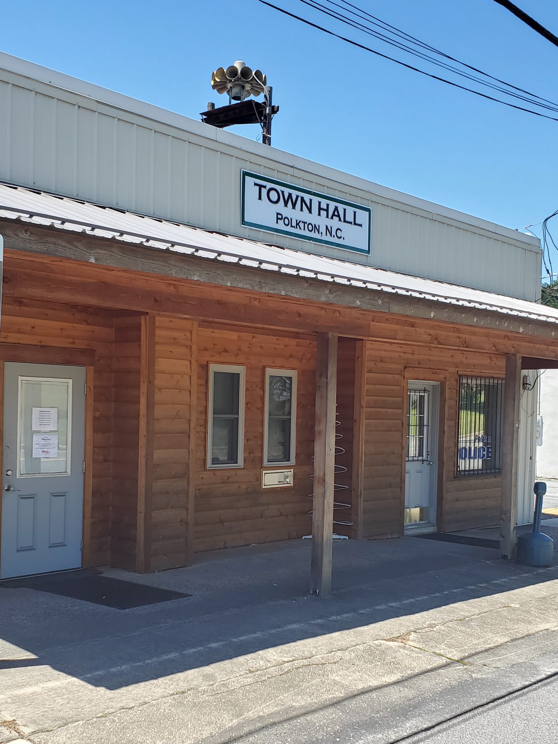
Polkton
The town is named after its founder, Leonidas Lafayette Polk, and incorporated in 1875. The Billy Horne Farm was listed on the National Register of Historic Places in 1989. Polkton began as the farm of Colonel Leonidas Lafayette Polk, the noted agrarian crusader. Founder L.L. Polk (1837-1892) laid out the streets for the town in 1870 and Polkton was incorporated in 1875.
Wadesboro
This county seat city has a downtown area called Uptown Wadesboro, due to its geographical positioning as the highest point in town. The town of Wadesboro dates back to 1783 when it was founded by Capt. Patrick Boggan and Col. Thomas Wade (the town’s namesake), famous Revolutionary patriots.
A settlement had grown along the banks of the Pee Dee River but a more centralized location was needed for the county seat. The new site was found and Patrick Boggan purchased the 70 acres of land. Streets were laid out and named for Revolutionary War notables, including Generals George Washington, Nathaniel Greene, Daniel Morgan, and Griffith Rutherford; Colonels Thomas Wade and William Washington; and Governors Richard Caswell and Alexander Martin. The town was first called New Town, then later changed to Wadesborough and finally Wadesboro. The land on which New Town was established comprises the main business district today.
The Boggan-Hammond House on East Wade Street is the town’s oldest home. Built by Capt. Patrick Boggan for his daughter, Nellie, wife of William Hammond, it is now a historical museum maintained by the Anson County Historical Society (open on special occasions or by appointment).
In the early days of the town, taverns flourished and stagecoach travelers stopped in Wadesboro to pass the night at places like Buck’s Tavern, which was located on the present site of the First United Methodist Church at Greene and Morgan Streets. On September 26, 1787, Andrew Jackson spent the night at Buck’s Tavern in uptown Wadesboro in order to obtain a license to practice law.
On April 2, 1868, a great fire swept through Wadesboro destroying the courthouse and about 30 other buildings. Nearly all of the Superior Court, county court, and marriage records were destroyed in the blaze. But with the brick walls still intact, the fifth courthouse was built in its ashes. The sixth courthouse, standing today on Greene Street between Wade and Martin, was built in 1912.
In 1894, George Little, later joined by his brother, Henry Wall Little, opened a hardware store on South Greene Street. The store, H.W. Little and Co., is still owned and operated by the Little family at 109 S. Greene. Prior to the Great Depression, the store was the marketing center for cotton, Anson County’s main crop, and kept track of world prices at the New York Cotton Market with Western Union delivering a market bulletin every 15 minutes.
Wadesboro was a thriving textile town until the early 1990s when it felt the effects of the decline in the US textile industry as did other textile towns in North Carolina. Through the mid 1900s, Wadesboro was a hub for citizens of the county and was a bustling town with crowds of people walking the downtown streets. Traveling into town from the surrounding countryside, Ansonians would take in a double feature at the Ansonia Theatre, get a haircut, have lunch at the tea room, drink a milkshake at the Parson’s Drug soda fountain, and patronize the dry goods and hardware stores of local merchants. Visitors today can still see echoes of Wadesboro’s past in the buildings and architecture of the Uptown business district and surrounding residential streets.
The Anson County Historical Society offers a walking tour brochure of our historic downtown district. The brochure is available at the Historical Society office (206 E. Wade St., 704-694-6694) or at the Anson County Chamber of Commerce for $5.
Interesting facts: In 1900, scientists determined that Wadesboro would be the best location in North America for viewing an expected total solar eclipse. The Smithsonian Astrophysical Observatory, then based in Washington, D.C., loaded several railroad cars with scientific equipment and headed to the town for the event on May 28, 1900. Incidentally and inadvertently, this blogger was visiting the town on May 28, 2022, within an hour of the time of the total eclipse in 1900.
Gary Porter, former driver of the Carolina Crusher and Grave Digger Monster Truck, ran in the Monster Jam series is from the area.
Horror film Evil Dead II was filmed in Wadesboro, and the Huntley House became the production office for the film. Most of Evil Dead II was filmed in the woods near that farmhouse, or J.R. Faison Junior High School, which is where the interior cabin set was located.
Rotary Planetarium and Science Center
The Rotary Planetarium and Science Center is a cooperative effort of the Anson County School System and the Wadesboro Rotary Club. The center is available to all students and has programs open to the public at various times of year.
A wildlife diorama identifies more than 30 animal species native to the Piedmont. The Life Science Room is home to assorted creatures such as Frodo the Gecko. A “hands-on” exhibit is the 2,000-square-foot “Lives of the Tree” where visitors can learn to identify leaves, study tree rings, and see the effects of soil erosion. A Hubble Telescope exhibit gives the visitor the opportunity to view images of galaxies, nebulae, and dying stars.
The center takes visitors by appointment only by calling ahead (520 Camden Rd., 704-694-7016).
Galleries and Local Pottery
You’ll find locally made pottery at Granny Hollow Pottery, Price’s Place, and the gallery at the Anson County Arts Council (110 S. Rutherford St.). The Anson County Arts Council has an art gallery featuring local artists at its gallery/office, also on Rutherford Street. The Arts Council hosts Sunday afternoon art shows featuring local artists during the year.
Ansonia Theatre and Arts Council gallery
The Anson County Arts Council presents live theatrical and musical productions in this renovated community theater. The Ansonia (112 S. Rutherford St.), built in 1925, was a vaudeville-era theater and can seat 273 people. Even as late as the ’50s and early ’60s, the Ansonia was still showing regular movies with local bands performing after the late show on weekends. Then as television and mall cinemas gained a stronghold in American culture and as people became more mobile, the Ansonia, like most movie theaters in small towns, eventually closed. Although several attempts were made to reopen it, there was no way it could compete with larger cinemas.
The Ansonia Theatre renovation was completed in the Spring of 2011, and the theater is now being used as a facility for local and regional musical and theatrical productions.
Peaches ‘n Cream
Just on the outskirts of town, stop here for fresh made ice cream or fresh produce and rest awhile in one of their rockers.
Uptown Wadesboro Business District on National Historic Register
Wadesboro’s uptown historic business district (listed on the National Register of Historic Places) is bounded by Martin, Rutherford, Morgan, Lee and Brent Streets. The Uptown Wadesboro business district boasts architecture reminiscent of its long history as a cotton and textile town when Wadesboro was the center of shopping, entertainment, and dining for all of Anson County. The architecture of the historic district and surrounding neighborhoods includes examples of Italianate, Victorian, Colonial Revival, Craftsman Bungalow, and Gothic Revival styles. Many homes and buildings in Uptown Wadesboro have retained their historical integrity, including the 1894 HW Little & Co. Hardware building at 109 S. Greene Street, an old-fashioned hardware store in the same family since 1894.
Lord George Anson Antiques
This store is a treasure trove of antiques–and owner Ralph Coble has a story for just about every item. Look high, look low, look in between, so you’re sure not to miss a thing. Oh, and don’t forget to ask him about the plants out front.
Lilesville
A post office called Lilesville has been in operation since 1827. The town was named for an early merchant. Lilesville is home to the Lilesville Granite, a porphyritic igneous rock named for the town.
Sneedsboro
I was unable to find this proclaimed North Carolina ghost town, supposedly located about five miles southeast of Morven. If you find it, do let me know. But here’s the lore…
The Pee Dee River flows east of Sneedsboro, and when the town was laid out and chartered in 1795 it was promoted as an inland river port. Streets in Sneedsboro were laid out and named, and the town had a post office, school, inn, general store, and Methodist and Baptist churches.
But by 1835, a mere 40 years later, the town became deserted. Poor economic conditions in North Carolina forced many of Sneedsboro’s residents to leave, and an epidemic of typhoid fever also struck the town.
During the Civil War, a large battalion of Union forces led by William Tecumseh Sherman crossed the Pee Dee River at Sneedsboro. Historian Mary Louise Medley wrote that “though the Pee Dee River was then at flood stage, they took the time to destroy everything of value around the once flourishing town”. The only remnants of the town are the crumbling chimney of the Knox Inn and some tombstones in the Sneedsboro Cemetery.
The land known today as Granville County was once the home of many Indian tribes, dominated mainly by the Tuscarora. After the Tuscarora War of 1711, settlers, mostly from Virginia, began to populate this area, attracted by the abundant game, well-watered wood, and rich land.
By 1746, the area had a population sufficiently large enough to merit becoming an independent county, separating itself from Edgecombe County’s western frontier. Since most of the land in the northern half of North Carolina was part of the proprietary domain of Lord John Carteret (by title known as the Earl of Granville) the county was named Granville in his honor. Over the years, Granville yielded areas to new counties as settlements grew: Orange (1752), Bute (1764, which in turn became Franklin and Warren in 1779), and Vance (1881).
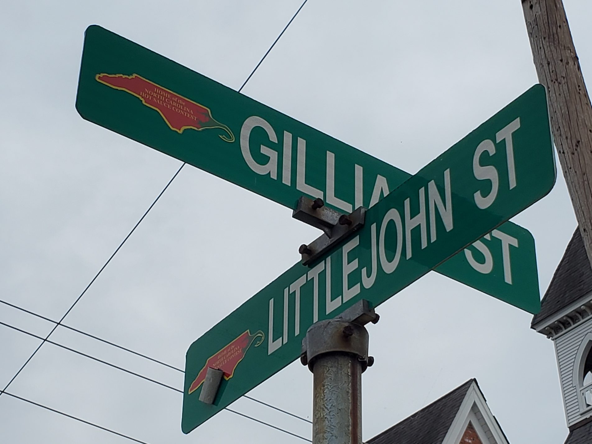
Benton was Granville County’s representative to the State Assembly in 1761 when he purchased 1,000 acres of land and built a plantation home known as “Oxford.” In 1764, the Assembly ordered that this area be known as the county seat, and Benton gave one acre of land where the courthouse was to be built. Not until 1811 did the Assembly authorize the county to buy 50 acres around the courthouse from Thomas Littlejohn and began to lay out the town, selling lots at public auction in 1812, and incorporating the town in 1816.
Through the colonial and revolutionary periods, the county was the home of a number of citizens of considerable social influence in North Carolina. Most notable was John Penn, a landowner in present-day Stovall, who was elected in 1775 to be a member of the Continental Congress. He was one of North Carolina’s three signers of the Declaration of Independence.
In 1860, Granville County plantations and farms had some of the state’s best agriculturists, consistently growing large crops of tobacco with the help of a large slave population. Oxford had become a sophisticated town and was famous as a seat of learning by the creation of several academies and colleges. Although Granville was one of five counties with as many as 10,000 slaves, there was also a sizable community of free blacks claiming dozens of craftsmen, especially masons who helped build the grand homes of the more affluent families.
With the outbreak of the Civil War, several militia companies were formed, among them the “Granville Grays.” It is estimated that over 1,500 Granville County men participated vigorously in many battles until the war’s end.
Bright Tobacco brought business to Oxford. Businessmen positioned themselves to take advantage of this new industry and many merchants, lawyers, and doctors set up shop in town. New schools, churches, literary societies, and two orphanages were formed. By the late 19th century, this thriving local economy resulted in a brick commercial district that included as many as three banks, general and hardware stores, an opera house, various professional offices, and new businesses.
Two world wars and the Depression brought many changes to Granville County. Even with revenues from Bright Tobacco, many Granvillians left the county for larger cities with more opportunities. The establishment of Camp Butner at the beginning of World War II engulfed many of their homes and tobacco fields but spawned what is today a thriving community due to the various hospital and prison facilities situated in the area.
Seeing the need for attracting new industries to the county, several local business leaders formed organizations in the 1950s and 1960s to accomplish this task. By the 1980s, there were 38 major manufacturing industries in the county, principally around Oxford and Creedmoor. After more than two centuries, Granville County no longer has a primarily agricultural economy.
Creedmoor, NC
In 1885, a group of 25 taxpayers of Granville County, including Civil War Confederate veteran Robert Fleming, appeared before the Board of Commissioners for the County of Granville with a petition from the Dutchville Township. The petition made a proposition to subscribe $10,000 to the capital stock of the Oxford and Clarksville Railroad Company.
In 1888, Lyon sold part of his land to the Durham and Northern Railroad for track to run through the town. Linking Creedmoor to Henderson and Durham was a major cause of growth of this town. The old Seaboard train depot building still stands at its location on Elm Street, making it over 120 years old.
Creedmoor was incorporated in 1905, having previously been known as “Creedmore”. Although the town is rich with history (home to four buildings on the National Register of Historic Places), it does not hold the title of a Historic District unlike nearby Oxford and Wake Forest.
Tobacco was extremely important in the early history of the town. Four tobacco warehouses were built in the town in the early 1900s. Tobacco was a cash crop in Creedmoor, and was shipped by railroad to nearby Oxford’s Tobacco Research Facility and Durham’s thriving smoking tobacco industry, with firms including W. T. Blackwell and Company, American Tobacco Company, and Liggett & Myers. At one time Creedmoor was a larger tobacco market than Durham. Area farmers did not limit themselves to tobacco only, but also grew cotton, a profitable crop.
In the wake of the tobacco era, mules came to Creedmoor. About 40 train car loads of mules were pulled into the town each year. Mules were the ideal farm animals because their hooves were smaller than those of a horse. Their smaller feet helped them pass through rows of tobacco without stepping on the crop. In 1906, Jim Netherly and a Mr. Cooper founded the Creedmoor Supply Company, which sold feed, mules, horses, buggies, and even some groceries and seeds to meet the demands of local farmers. G.M. Chappell opened a barn that auctioned mules, horses, and cows from 1938 to 1962. At one point in time, Creedmoor was considered to be the largest mule trading center in the world and was widely referred to as “Mule Town”. By 1940, over $500,000 were traded and spent on mules each year. It was not until the mid-1950s that the town removed the slogan “One of the Largest Retail Livestock Markets in North Carolina” from the official letterhead. By then, the mule trade was no longer a major part of the local economy.
In downtown Creedmoor, you’ll find a few historic buildings, such as Creedmoor Drugs, the James Mangum House, and First National Bank Building.
Cedar Creek Gallery & Pottery The Cedar Creek Gallery (1150 Fleming Rd.) was built in 1968 on what used to be an old tobacco field in the community of Northside. The gallery has grown from one building to more than 10 on the property. This is a must-stop within the county. You’ll find a pleasant garden area outside that is quite inviting in spring and summer. Outside, you’ll also find a variety of plants for sale. Then walk through the doors–and you think you’re walking into a small gift shop–but the gallery keeps going and going, with many nooks and crannies and twists and turns. Enjoy shopping among pottery, jewelry, and various craft displays by local NC crafters throughout the space. We guarantee you’ll bring something home to remember your trip to Granville County.
Oxford, NC
Known today as the Home of the North Carolina Hot Sauce Contest, the town’s history dates to 1761 when local legislator Samuel Benton built a plantation home and called it “Oxford.” The legislature ordered the area around his plantation to be the seat of Granville County. The town was incorporated in 1816.
In 1970, Henry Marrow was shot and killed in Oxford. The killing resulted in a racial protest. The events were chronicled by Timothy Tyson in the book Blood Done Sign My Name (2004) and a 2010 movie with the same name.
A Confederate statue was erected in 1909 by the Granville Grays United Daughters of the Confederacy at a cost of $3,000 and valued in 2009 at $1,327,791.62. The monument was erected in the courthouse square facing away from the courthouse. The base, constructed of granite from Warren County, is 27 feet (8.2 m) tall, and the bronze statue is 7 feet (2.1 m) tall. The monument, a memorial to the Confederate veterans of Granville County that served in the Civil War in the Granville Grays Company D, 12th Regiment, was dedicated October 30, 1909. The statue had not arrived in time but the ceremony continued and the statue was placed at a later date.
Following the 1970 Oxford protests, the city moved the monument from the courthouse square to a site in front of the Richard H. Thornton Library. Since 2009, some activists had suggested moving it to an historic graveyard located down the street. In 2020 the statue was removed and is currently in storage.
Every September, Oxford’s downtown hosts North Carolina’s Hot Sauce Contest. Attracting more than 18,000 visitors, this event is the highlight of the city’s calendar. Featuring three entertainment stages, crafters, kids activities, and food trucks, visitors can taste as many hot sauces as you dare with several blocks’ worth of vendors from all over North Carolina and the United States. Watch competitors in the hot pepper eating contest. The 2019 competitors went through 15 rounds alternating between jalapenos, reapers, and habaneros until the last contestant remained.
In town, you can also visit the Granville History Museum and Sallie Mae Ligon Museum & Archives.
Stovall, NC
The first Boy Scout troop in NC (Troop 1) was founded in Stovall by Luther Connally Wilkerson on Sept. 30, 1910.
Stovall was also home to Declaration of Independence Signer, John Penn, who was born in Caroline County, Virginia, to a family of means. His father died when he was eighteen years old, and though he had received only a rudimentary education at a country school, he had access to the library of his relative Edmund Pendleton. He was licensed to practice law in the state of Virginia at age 22. In 1774, he moved to Granville County, North Carolina, where he established a law practice and soon became a gentleman member of the political community. He was elected to attend the provincial Congress in 1775 and elected to the Continental Congress that same year. He served there until 1777, participating in committee work. He was again elected in 1779, appointed to the Board of War, where he served until 1780. He declined a judgeship in his native state around that time, due to failing health. In retirement he engaged in his law practice and died at the age of 48.
Butner, NC
The Butner Incorporation Bill #986 passed by the North Carolina General Assembly was signed by Governor Mike Easley on July 27, 2007, and the Town of Butner officially incorporated as a municipality on November 1, 2007. The town is the former site of the U.S. Army’s Camp Butner, which was named for Major General Henry W. Butner (1875–1937), a North Carolina native.
Step back in time with a visit to Richmond County, formed in 1779 from Anson County. In 1899, the southeastern part of Richmond County was organized as Scotland County.
The county was named for Charles Lennox, 3rd Duke of Richmond and Lennox, who was an Englishman and a member of the Parliament of the United Kingdom who sided with the colonists in America during the American Revolution. During the 19th century, the county became developed for plantation culture with vast areas of fields and farmland.
Richmond County is well known for its history in auto racing with the advent of the Rockingham Speedway, which opened in 1965. Until 2005, this one-mile race track featured bi-annual NASCAR-sanctioned events in the Sprint Cup and Nationwide Series divisions. The race track also hosted several other events including ARCA, USAR Pro Cup, and UARA Late Models as well as a weekly scheduled series of events for Bandolero and Legends race car classes at the 1/2 mile infield track dubbed the “Little Rock.” As events were moved to other sites, the speedway has sat idle since 2015.
The County is host to Rockingham Dragway (directly across from the Speedway), sanctioned by the International Hot Rod Association. It hosts more than 90 drag racing events per year. Richmond County also hosts lawnmower races. Each weekend from April–October, the Lion’s Club of Ellerbe puts on a weekly show, attracting fans and competitors from surrounding counties and states.
Ellerbe
Development grew around the railroad, built to Ellerbe in 1910, and a depot to form the town of Ellerbe. The rail line remained in service until 1954, and the depot suffered a fire and burned down several years later. The town’s most famous resident was professional wrestling great André the Giant, who owned a nearby ranch/farm. André was known for his extremely tall and large figure due to his affliction with giantism. His heart eventually gave out due to the disease, and he suffered a heart attack in his hotel room in France (where his family originated) while attending his father’s funeral. His dying wish was to have his ashes scattered on his ranch. Since there were no crematoriums in France that could handle a body of his stature, he had to be flown back to the United States to be cremated, and his ashes were spread on his ranch property in Ellerbe, NC.
Benny Parsons, a NASCAR driver and television analyst who won the 1973 Winston Cup Championship and the 1975 Daytona 500, also hailed from Ellerbe.
Rankin Museum of American Heritage Experience the Rankin Museum’s (131 West Church St) displays on geology and paleontology as well as wildlife, arts, heritage, and artifacts from around the globe–even authentic fossilized dinosaur eggs. You will also find a special exhibit dedicated to its most famous resident, the Frenchman André the Giant. Peruse through his memorabilia, including news articles, photographs, a wrestling belt, and a pair of his size 26 wrestling boots. You can also stand beside a life-sized image of André and compare your hand size against his handprint. Admission to the museum is only $4 ($3 with a AAA discount), and they are only open on Saturdays.
The Berry Patch Stop at The Berry Patch (Hwy. 220 N. Exit 25), also known as possibly the world’s largest strawberry, at 24′ tall, for in season fruits and vegetables, canned goods, 20 homemade ice cream flavors, Southern foods, and more.
Ellerbe Springs Inn The Ellerbe Springs Inn (2537 N US Highway 220) is a longtime destination for this community. In its heyday, it attracted numerous guests. As of this visit, the inn is currently for sale and in need of restoration.
Bostick School
Located at 604 Clayton Carriker Road, the Bostick School was an active, one-room schoolhouse for grades 1-7 from 1800-1922. In 1992-1998, the old wooden structure was restored, and it was placed on the National Register of Historic Places in April 2005.
Rockingham
Rockingham is the county seat of Richmond County. The City of Rockingham was named for the Marquis of Rockingham, Charles Watson Wentonworth, a strong friend of the Colonies, who was Prime Minister in 1765. He was in bitter opposition to Lord North and the policy that lost America.
On April 1, 1785, the three duly appointed Commissioners – General H. W. Harrington, John Cole Sr., and Robert Webb, met and bought 18 acres of land from John James, Sr. for about $30, and 32 acres from John Cole for $50. This land was situated on the road that ran from the Mountains to Cross Creek (now Fayetteville). The land was bounded by Falling Creek on the south, and Hitchcock Creek on the North and West – a constricted area.
During the early 19th century, numerous families from here migrated to Middle Tennessee, settling in what is now Nolensville. They quickly established their new community. In 1950, the town fielded a professional minor league baseball team in the Class D Tobacco State League, the Rockingham Eagles. The club won the playoff title in their only season before disbanding with the entire league. Downtown Rockingham is currently being revitalized as a part of a ten-year plan named “Shaping Our Future: 2023.”
While in Rockingham, you can also visit Discovery Place Kids-Rockingham, walk all of part of the 14-mile the Hitchcock Creek Blue Trail, and explore the area’s diverse floodplain forests, historic mills remnants, and rare plants and animals. Hitchcock Creek in Rockingham, North Carolina, is a destination for fishing, boating, and other family-friendly recreation. Leon Levine, founder of Family Dollar, hails from Rockingham.
You’ll find he Richmond County Visitor Center at 101 West Broad Ave. And although there is not an convenient overlook, be sure to drive by the Great Falls Mill ruins along West Broad Ave.
Rockingham Speedway and Dragway
The city is the home of Rockingham Speedway, formerly the North Carolina Speedway, a staple of the NASCAR schedule for nearly 40 years before the race was discontinued in 2004. The Rockingham Dragway (just across the street at 2153 North US HWY 1) offers year-round events that bring thousands of people to our area.
Hamlet Known as “The Hub of the Seaboard,” Hamlet had seven hotels and numerous boarding houses and restaurants catering to transferring rail passengers.
The area in Richmond County which presently includes Hamlet was originally known as Sandhills. In 1872, the land was purchased by John Shortridge, an English immigrant who intended on building a textile mill along a creek. He renamed the locale Hamlet the following year, supposedly in homage to hamlets in the British Isles. He planted a sycamore tree to celebrate the occasion, which stood until 1946. A post office was established in 1876, and that year Shortridge sold a parcel of land to Raleigh and Augusta Air Line Railroad, which completed its own line through Hamlet by the following year. Railway shops were built in 1894 and the town was formally incorporated on February 9, 1897. Seaboard Air Line Railroad decided to establish its regional headquarters there, and Hamlet rapidly grew thereafter. By 1910, the locale hosted two five and dimes, five dry goods stores, and a Coca-Cola bottling plant.
Hamlet’s early growth was sustained by Seaboard, which heavily invested in facilities within the town. By the end of World War I, 30 trains passed through Hamlet daily, and the corporation decided to construct a maintenance shop, a roundhouse, and a shipping yard. After World War II, an $11 million classification yard, the first one in the Southeastern United States, was established. The Seaboard Line carried mostly freight traffic, but also brought tourists through Hamlet on the Orange Blossom Special, the Boll Weevil, and the Silver Meteor. Before sleeping cars became predominant, many rail passengers would stop in Hamlet and board at the Terminal Hotel or Seaboard Hotel. They provided traffic to the businesses on Main Street, which included several banks, a jewelry store, shoe shop, drug store, hardware store, opera house, and a bowling alley. Throughout the early 20th century, Hamlet was visited by prominent persons including Booker T. Washington, Franklin D. Roosevelt, Buffalo Bill, and Jenny Lind. Seaboard provided thousands of mostly-white men with well-paying, secure employment as conductors, engineers, and brakemen. Workers received sick pay, pension plans, and wages negotiated by national unions. As a result, Hamlet developed a large middle class, unlike the nearby city of Rockingham, which was home to many poorer textile mill workers.
Hamlet’s economic situation came under strain beginning in the 1960s, as the railroad faced increasing competition from growing road networks, trucking, and air travel. Seaboard acquired smaller competitors and consolidated its operations, moving workers out of Hamlet. It also froze wages, terminated some positions, and reduced passenger services, diminishing the number of outside visitors to the town. Seaboard became CSX Transportation in 1986. A K-Mart and Walmart were built in Rockingham in the 1970s, providing that municipality with tax revenue and pulling Hamlet’s customers away from their own town. Seaboard laid off hundreds of workers while more national business chains with cheaper prices moved into the region, driving down wages and further reducing the viability of Hamlet’s traditional businesses along Main Street. Racially-charged riots broke out in June 1975 after a Hamlet police officer discharged his gun during an altercation with a black woman. By the late 1980s and early 1990s, many businesses along Main Street and Hamlet Avenue were vacant, and the Terminal Hotel had become a flophouse. Seaboard’s facilities employed less than 600 people, and the Hamlet Depot was only serviced by Amtrak passenger trains twice a day and visited occasionally by railfans. National declines in manufacturing, including textiles, also had a wider stagnating effect on Richmond County.
In 1990, portions of the movie Billy Bathgate were filmed on Main Street, and in June the city was bestowed with the All-America City Award by the National Civic League.
Hamlet is at the junction of three major CSX rail lines, one running north toward Raleigh and south toward Savannah, Georgia, and the second running east toward Wilmington, and west toward Bostic, NC.
On September 3, 1991 the Imperial Food Products chicken processing plant in Hamlet caught fire. Many exits at the plant were locked in violation of fire codes, and 25 workers died. North Carolina’s government imposed a record fine upon the plant owners for the violations and the incident brought negative national attention to the town. You’ll find a memorial plaque for those who perished at the town’s lake.
In addition to the Hamlet Passenger Station, the Main Street Commercial Historic District is also listed on the National Register of Historic Places. Notable people from Hamlet include John Coltrane, jazz saxophonist and composer and the recipient of a Grammy Lifetime Achievement Award.
Hamlet Depot
The Hamlet Depot (2 Main St) is still a fully restored, active passenger depot and is known as one of the most photographed train depots on the East Coast–and is the only Victorian Queen Anne train station in North Carolina. Inside, you can peruse the heyday of railroads through the site’s museum. Outside, you can visit a few trains preserved in the park across the street–and you can wander over to the tracks to see the literal crossing of the north-south and east-west routes. Be sure to visit the Silver Meteor exhibit in the Tornado building.
In 1870, a railroad ran from Wilmington to the Pee Dee River and on to Charlotte and in 1877, a railway was established running from Raleigh to Augusta. The crossroads of these two rails occurred at Hamlet and spurred population growth for this town. Hamlet, incorporating on February 9, 1897, has always been a railroad town with five spurs radiating from the town to Richmond, Wilmington, Atlanta/Birmingham, Savannah/Charleston and Columbia.
To celebrate the importance of this hub for the Seaboard Air Line Railroad, an impressive train station was constructed around the turn of the century. The station was designed in a Victorian Queen Anne style that was popular with railroad architecture in the late 19th century. The long bracketed porches radiate around the corner entry tower that faces the railroad intersection, honoring the reason for its being. For years, the train station served as both a passenger depot and a freight yard.
The depot was added to the National Register of Historic Places in 1971 and was fully restored in 2004. The museum is free to the public.
National Railroad Museum And Hall Of Fame Located only a few minutes from the Hamlet Depot, be sure to stop in the National Railroad Museum and Hall of Fame (120 E Spring St). The museum preserves the county’s rail history as well as a model train display, train equipment, news stories, and many railroad artifacts. The museum is only open on weekends and is staffed by rotating train historians. Be sure to strike up a conversation, as you’ll learn a lot about the local railroad and Seaboard history in Hamlet.
Home to the original school that became Duke University, some of the first European settlers moved into this area of the Piedmont. The county was formed in 1779 from now neighboring Guilford County and part of a then larger Rowan County. Randolph County was named for Peyton Randolph, the first president of the Continental Congress.
In 1911, a new county called Piedmont County was proposed, with High Point as its county seat, to be created from Guilford, Davidson, and Randolph counties. Many people appeared at the Guilford County courthouse to oppose the plan, vowing to go to the state legislature to protest. The state legislature voted down the plan in February 1911.
Level Cross
This community was named for its flat main intersection, or level crossroads. Level Cross is the hometown of the Petty racing family, beginning with patriarch Lee Petty and his sons, driver Richard Petty and engine builder Maurice Petty, as well as Richard’s son, driver Kyle Petty, and Kyle’s son, driver Adam Petty, who died in a car racing accident. Level Cross was also the birthplace of Richard’s cousin, crew chief Dale Inman.
Victory Junction Gang Camp
Built and funded by the Petty family and worldwide donations, Victory Junction Gang Camp is a racing-themed camp facility in the Level Cross area for special needs children. The camp holds weekly-themed camps for different disabilities and has dedicated medical and camp staff for every child’s needs during their stay as well as therapeutic activities and much more. Kids come from around the world to attend this camp.
Climax – Goat Lady Dairy
In the small town of Climax, you’ll find Goat Lady Dairy, best know for its award-winning goat cheese and chevres. Named for its founder, who was lovingly called the goat lady (and has since passed away), Goat Lady Dairy holds open houses twice yearly, in the spring and in the fall with music, vendors, and goat cheese tasting. Be sure to bring a cooler with you and stock up on the incredible goat cheese. It freezes well too. If you miss out, you can always catch them at the farmer’s market in Colfax or in some local grocery stores. Even some local restaurants feature Goat Lady Dairy Cheese on their menus. Oh, and you can also make reservations for one of their community dinners.
P.S. Just a few minutes up the road in Liberty, Rising Meadow Farms (3750 Williams Dairy Rd), a working sheep farm, also holds their spring and fall open houses on the same weekends as Goat Lady Dairy. So, you can stop by both–and enjoy a day in the country.
Liberty
Originally named Liberty Oak, the town was founded in 1809 near the plantation of John Leak. The Liberty Historic District was added to the National Register of Historic Places in 2000. Liberty is home to the famous Liberty Antiques Festival. The movies Killers Three (1968) and Children of the Corn II: The Final Sacrifice (1993) were filmed in Liberty and the surrounding areas. Staley
The Town of Staley, founded in 1889, was named for Col. John Staley, a Confederate officer in the Civil War.
Franklinville
Franklinville’s history dates back to at least the 18th Century when there were Keyauwee and Saponi Native American tribes living along the Sapong River, known now as Deep River. Members of these tribes and settlers crossed Deep River at the well-known Island Ford Crossing.
In 1784, the Earl of Granville granted the land where Franklinville is now located to Jacob Skeen. Christian Morris bought this land in 1801 and built his water-powered grist mill on the river. By 1820, Jesse Franklin was the governor of North Carolina and when Elisha Coffin acquired the land and properties from Christian Morris, the area was named Franklinsville in honor of the governor.
In 1847, the state legislature incorporated the village as a Town, the first mill village government in the state. It was named after former Governor Jesse Franklin of Surry County, a well-known anti-slavery advocate. All of the original stockholders of the mill appear to have been Quakers or abolitionists, and the majority of the inhabitants were Unionists who voted against joining the Confederacy. Under military supervision during the Civil War, the mills made cotton underwear for soldiers. Outside of the mills Franklinville was a center of the Red String, the pro-Union Peace Party, which after 1865 was reborn as the new Republican Party.
Franklinville was incorporated as a town for the first time and was ratified by the State of North Carolina on January 15, 1847. By December 19, 1917, Franklinsville became Franklinville without the “s”. Franklinville has been a manufacturing community since its earliest beginnings in the 1760s. The mechanical power of Deep River as it flows through town sparking the construction of numerous mills and still turns electric generators today. The first cotton factory was started in 1838, triggering the growth of a village where mill workers and their families could live, play, shop, and worship.
Today, the parks and open spaces created by the mill company over a hundred years ago are maintained by the town, and the vanished railroad has become the Deep River Rail-Trail, a hiking and biking greenway and proposed kayak and canoe blueway. The Franklinville Historic District was added to the National Register of Historic Places in 1984
Ramseur
Ramseur was named for Stephen Dodson Ramseur, the youngest Confederate major general of the Civil War.
Millstone Creek Orchards 506 Parks Xroads Church Rd
Coleridge
This community was named for James A. Cole, a local merchant. The Coleridge Historic District was added to the National Register of Historic Places in 1976.
Coleridge was the home of the Enterprise Manufacturing Company, the southern most cotton mill built on Deep River. Its construction in 1882 was the final link in the chain of Randolph County’s water-powered textile industries that had begun to be forged in 1836.
The company was organized by H.A. Moffitt, an Asheboro merchant, and Daniel Lambert and James A. Cole, prominent citizens of southeastern Randolph. The original structure was a two-and-one-half-story, wooden building housing 800 spindles and 26 workers. The facilities of the corporation included a wool-carding mill, saw mill, and flour mill.
The surrounding village was known first as Cole’s Ridge and then as Coleridge, after James A. Cole, who in 1904 sold a majority interest in the company to his son-in-law, Dr. Robert L. Caveness. By 1917, it was said that “R. L. Caveness is at the head of practically everything in Coleridge,” and it was under his influence that the brick mill facilities were built.
The village was Randolph County’s first historic district, and has been placed on the National Register or Historic Places. Its 1970 nomination stated that “the chief appeal of this site is as a picturesque example of a riverside mill seen in one of North Carolina’s oldest manufacturing sections.”
Seagrove
Spend an entire weekend here, and you still won’t see all of the pottery shops! In fact, it would take at least a week to see them all–if you visited 15+ shops every day.
Seagrove was named for Edwin G. Seagraves, a railroad official who was responsible for routing a railroad through the area. According to local sources, after a unanimous decision to name the station after Seagraves, the town name resulted from a sign painter running out of space and simply dropping the ‘s’ from the end of the name. Also the painter misspelled Seagraves as Seagrove. The railroad served Seagrove until December 31, 1951. The old train depot later was adapted as a pottery museum.
The name Seagrove refers to the town proper, and includes several other communities that are part of the pottery tradition along and near the “North Carolina Pottery Highway” (NC-705). Due to the high-concentration clay soil, more than 100 pottery shops are located in Seagrove and the neighboring towns of Star, Whynot, Erect, Westmoore, Happy Hollow, and Robbins. Seagrove is also home to the North Carolina Pottery Center, which was established on November 7, 1998, and has since received visitors from across the continent and around the world.
Plank Road
Construction of Plank Road began in 1849. Plank Road extended 129 miles and was made of planks 8 feet long, 9 to 16 inches wide, and 3 inches thick. The road carried horseback riders, wagons, and stagecoaches. A toll of one cent per mile was charged for a wagon and four horses. Toll revenues declined after construction of the railroad, and by 1862 much of Plank Road was abandoned. Parts of North Carolina Highway 705 follow the Plank Road route.
Seagrove’s pottery tradition dates back to the 18th century before the American Revolution. Many of the first Seagrove potters were Scots-Irish immigrants. They primarily produced functional, glazed earthenware. Due to the high quality of the local clay and transportation access for traders, Seagrove became known for its pottery.
The popularity of Seagrove pottery fell off during the Industrial Revolution and the advent of modern food preparation. For a time whisky jugs were a successful source of income, but the beverage was outlawed. The potteries continued their decline in the early 20th century.
In 1915, Jacques and Juliana Busbee of Raleigh made an effort to revive the industry. Over several decades, the Busbee’s hired Seagrove potters JH Owen, Charlie Teague, and Ben Owen to make signature wares under the name Jugtown Pottery to sell in the Village Shop, which they opened in Greenwich Village, NYC, and later from the Jugtown shop in Seagrove.
Around 1920, a new market developed as the pottery became popular with tourists driving through on their way to Pinehurst, Southern Pines, or Florida buying inexpensive souvenirs. The new tourist industry marked a general change from utilitarian pottery to more decorative ware. After another decline from the 1950s through 1970s, due to the road being replaced with the Interstate, a renewed interest in traditional pottery developed. In 1982, a group of local potters founded the North Carolina Museum of Traditional Pottery and organized the Seagrove Pottery Festival, an annual event held each year the weekend before Thanksgiving in the old bean cannery.
The Cole, Auman, Owen, Teague, and Albright families are eighth- and ninth-generation potters in Seagrove who continue this tradition. Some of the oldest, historic pottery locations still in operation include the “Original” Owens Pottery founded in 1895 and Jugtown Pottery founded in 1921. Jugtown Pottery was added to the National Register of Historic Places in 1999.
Asheboro
Asheboro was named after Samuel Ashe, the ninth governor of North Carolina (1795–1798), and became the county seat of Randolph County in 1796. It was a small village in the 1800s, with a population of less than 200 through the Civil War; its main function was housing the county courthouse, and the town was most active when court was in session. Asheboro’s population only began to grow significantly following its connection to railroads: the High Point, Randleman, Asheboro, and Southern Railroad first served the city in 1889, followed by the Montgomery Railroad in 1896.
Asheboro emerged as a textile production center in the 20th century with the opening of the Acme Hosiery Mills in 1909. After World War II, the city’s manufacturing sector grew to include batteries, wires, and food products. The city’s main tourist attraction, the North Carolina Zoo, opened in 1974.
Asheboro suffered from an economic downturn in the 2000s due to a decline in its traditional manufacturing industries amid increasing competition from overseas; the national news program 60 Minutes described it as a “dying town” in 2012.
Asheboro is known as the center point of NC. Although Asheboro is located in the gently rolling Piedmont plateau region of central North Carolina, far to the east of the Appalachian Mountains, the town and surrounding area are surprisingly hilly. The town lies within the Uwharrie Mountains, an ancient series of ridges and monadnocks which have been worn down by erosion to high hills. As such, Asheboro gives the impression of being in a more mountainous area than it actually is.
NC Zoo
The North Carolina Zoo is the largest and finest zoo in the state, with closest rival being the National Zoo in Washington, D.C. Plan to spend a full day here between the North American and African exhibits, including plains where elephants, rhinocerous, and herd animals roam free. The zoo also has giraffes, zebra, lions, tigers, bears, polar bears, and much more.
North Carolina Aviation Museum & Hall of Fame
Visitors will have the opportunity to see displays of old planes, military artifacts of war events, and civilian memorabilia. This display has its different unique story to tell, dating back to how flight started. Visitors can feel what it feels like to be a pilot in an aircraft as a Boeing 727 is available. Since 1966, the Museum organizes an annual fly-in event on the second Saturday of June. Visitors can see facilities for free like the aircraft displays, Ham radio demonstrations, free mini aeroplane flights for children, aircraft displays, and a racing exhibition. The military face painting is something worth doing when you visit.
Sunset Theatre
The Sunset Theatre is a classically restored theatre in the heart of downtown Asheboro, and surrounded by a multitude of shops, antique stores, and local eateries.
Union Township
Pisgah Covered Bridge
Randolph county is home to one of the last two remaining original covered bridges in the state. The wooden structure, originally built in 1910 for the cost of $40, is listed on the US National Register of Historic Places and carried horse and wagon travelers of the day. The bridge can be seen close to the Uwharrie National Forest and crosses 54 feet over the West Fork Branch of the Little River. In 2003, the Pisgah bridge was destroyed by a flood but was put back in place using 90% of materials retrieved from the disaster. It’s a quiet spot with picnic tables and trails, and you can even picnic on the rocks in the river.
Uwharrie National Forest
American Classic Motorcycle Museum
The American Classic Motorcycle Museum is small, but inside it has a comprehensive arrangement of information on the history of motorcycles and old original bikes. The museum houses the private collection of antique Harley Davidson, and it is one of the most extensive collections in the country. It’s an ideal place for motorcycle lovers. Admission is free.
Richland Creek Canopy Tours
Cox Mountain
Cox mountain is popularly known for its trails amongst hiking lovers with trails through creeks and woods. Visitors will have to cross small lakes and rivers on wooden bridges that are rope-tied.
Randleman
Home of NASCAR’s Petty family and the Victory Junction Gang Camp, Randleman was also the location of the Richard Petty Museum from 2003–2014. The town was originally named Dicks for Rick Dicks, who built a mill there around 1830. Later, a cotton mill was built in Dicks, and the town was renamed Union Factory. Randleman was the next name chosen, in 1866 for John B. Randleman, a mill owner. The town was incorporated as Randleman Mills in 1880; the name was later changed to Randleman. According to The Town of Randleman website, Randleman was named after John Banner Randleman in 1880:
“In 1880 the General Assembly at Raleigh granted paper of incorporation to the City of Randleman, named for John Banner Randleman. When the town of Randleman Mills was created and incorporated a town. John H. Ferree, James E. Walker, James O. Pickard, Romulus R. Ross, Addison W. Vickery, created a body politic under the style of Commissioners of the Town of Randleman Mills.”
The small town thrived, and by 1890 was the largest town in Randolph County. The coming of the High Point, Randleman, Asheboro, and Southern Railroad in 1889 had greatly facilitated the growth, because roads were not good, and the railroad assured the town of quicker freight handling. During this time, three more mills came popped up: Randleman Hosiery Mills, Plaidville Mills, and Marie Antoinette.
The High Point, Randleman, Asheboro, and Southern Railroad was completed in July 1889. In its early days, the influence of this railroad played an important part in the development of Randleman and other sections of Randolph County.
Randleman’s feature event is the annual NASCAR Days Festival, held each fall.
Trinity
The community was named after Trinity College, which later became Duke University. Trinity College started as Brown’s Schoolhouse, a private subscription school founded in 1838. The school was organized by a group of Methodists and Quakers, and was officially started by Hezekiah Leigh, widely recognized as the founder of Randolph-Macon College. In 1841, North Carolina issued a charter for Union Institute Academy. The school took the name Trinity College in 1859, and in 1892, the college moved to Durham.
Sealy Corporation, the world’s largest manufacturer of bedding products with sales of $1.2 billion in 2003, is headquartered in Trinity. Trinity is also home to NASCAR Sprint Cup Series drivers Bobby Labonte, Brian Vickers, and Kyle Petty. The former “World’s Longest Hot Wheels Track” was built at the Kyle Petty Farm in Trinity on May 9, 1999.
Zimmerman Vineyards
For wine lovers, Zimmerman Vineyards (1428 Tabernacle Church Rd) is located on 140 acres at the foot of Mt. Shepherd. They offer weekend tours and wine tastings.
The Neal John Deere Tractor and Industrial Museum 5507 Snyder Country Rd
Davie County is one of the smaller counties in North Carolina, so you can easily traverse the county in one day and hit all of the highlights. We chose Davie County this day because it wasn’t too far from our origination point–and the days are shorter this time of year, of course.
Davie County was formed in 1836 from part of Rowan County. It was named for William R. Davie, Governor of North Carolina from 1798 to 1799. Davie county was initially strongly Unionist. However, 1,147 soldiers from Davie County fought in the American Civil War for the Confederate States of America. Portions of Davie County are located in the Yadkin Valley American Viticultural Area (AVA).
Today the county features many highlights, including Farmington, Cooleemee Plantation House, and Cooleemee Falls as well as towns named Jerusalem, Maine, and Turkeyfoot.
Bermuda Run
The first stop of the day is in Bermuda Run, incorporated in 1999. It may come as no surprise that the name Bermuda Run hails from the island nation of Bermuda. The English colony (now designated a British Overseas Territory) of Bermuda, or the Somers Isles, was settled in 1609 by the survivors of the Virginia Company’s flagship, the Sea Venture. Bermuda quickly became thriving and populous. Its limited land mass, however, meant there were few prospects for many members of its rapidly multiplying working class. So, roughly 10,000 Bermudians would emigrate during the 17th and 18th Centuries, primarily to Virginia, the Carolinas, and Georgia. This included the establishment of the city of Charleston and the colony of South Carolina under William Sayle in 1670. One result of this exodus is the appearance of the name Bermuda in many locations in the American South where Bermudians settled, from Bermuda Hundred, VA, to Bermuda Island, in Albemarle Sound, North Carolina. The name Bermuda Run was also previously used for areas of what are now Colonial Heights and Hopewell in Virginia.
Today, what was once a major cattle and horse farm has become a luxurious retirement community, a private country club and golf course, and the newest town in Davie County.
When Billy Satterfield, a plumber’s helper from nearby Clemmons, found a farm for sale at $1,000 an acre. Armed with artists renderings of what his future club would be, he sold 175 lots for $10,000 each. In the 1980s, the country club was sold with the undeeded land to developers who purchased an additional 234 acres of Lybrook farm (giving Bermuda Run a total of 900+ acres) on the Davie County side of the Yadkin River. The community underwent an expansion that added a plush retirement center, luxury condominiums, and another nine holes of golf.
Tanglewood Park
In the Bermuda Run area, you’ll find Tanglewood Park, best known for hosting the annual Tanglewood Festival of Lights during the Christmas and New Year’s holiday season (usually mid-November through January 1st, 6pm-11pm). Be prepared to wait up to an hour or so just to get in the gate. Once you are past the ticket booth, turn your headlights off and the ride through is pretty smooth. You can stop partway through the tour at the Gift Barn and roast s’mores and enjoy hot chocolate and other goodies. The park also has miles of paths and trails and a large kids playground, hosts golf and community runs, dog events, and other events throughout the year, and is open daily from sun-up to dusk for park visitors.
Advance
Various accounts exist for the origin of the town’s name. Some suggest the name was derived from the name of a popular resident and freed slave, Samuel Vance Allen. Other accounts suggest the community was named by residents who hoped that with the addition of a post office, the community would advance.
Mocksville
Mocksville was incorporated as a town in 1839. The town was named for the original owner of the town site. The quaint downtown features the Davie County Courthouse, Davie County Jail, Downtown Mocksville Historic District, North Main Street Historic District, and Salisbury Street Historic District–all listed on the National Register of Historic Places.
Of note, American folklore figure Daniel Boone lived near Mocksville from 1750–1766. His father, Squire Boone, Sr., was the Justice of the Peace for Mocksville. Squire Boone and his wife Sarah are buried in Mocksville’s Joppa Cemetery. Stop at the top of the short U-shaped drive into the cemetery. Just past the stone wall, you’ll see the gravesite just ahead.
In Mocksville, you’ll also find Main Street Park and Cognition, a children’s discovery place plus several artistic public art wall murals.
The Running of the Horses
If you’ve ever taken a drive down E. Depot Street, or a walk down Main, it is impossible to miss “The Running Of The Horses,” a historic piece with a bright color palette. The piece harkens back to the days of World War II, when gasoline was hard to come by, and farmers would rely on horses for pulling farm equipment. In 2020, William Richardson, son of the blacksmith, recalled the events the piece was inspired by, “During the war years… you couldn’t get gasoline to run tractors… so they used horses on the farms. They would unload them at the depot, run them right up E. Depot Street, across Main Street on the square, and down to where Junker’s Mill is.” The horses in the piece are galloping down W. Depot in the same fashion, and are a reminder of Mocksville’s roots in farming and simple hardworking lifestyle.
The center oak tree in the piece is a nod to the original four oak trees that were in town square for over 90 years. The tree also symbolizes the town itself, with its roots in unity and its limbs reaching out. The roots of the tree serve as the foundation, as unity does with the community. The limbs reach out, symbolizing the growth of the town, and the positive impact its members make. Mother Earth faces both directions as the sun rises in the east and sets in the west, which brings about the energy and life of Mocksville. The entire piece is a representation of where we have come from, and the continued growth and progress throughout the generations.
A Vintage Backdrop
A vibrant vintage piece can be seen on Main Street should you be coming from the Brock. The Horn Oil and Royal Republic gasoline advertisement is a classic piece that captures the essence of the early 20th century. The Horn Oil headquarters has been located at 190 North Main Street in Mocksville since 1923, and fans of classic American designs and early 20th century art are sure to love this retro advertisement.
Mermaid of Justice
If you venture down Water Street and happen to find yourself on the back side of the Bomar Law Firm facing the First Presbyterian Church, you can catch a good look at a mermaid in the window. This artwork depicts a figure similar to Lady Justice, a symbol of a fair judicial system that does not discriminate. Her depiction dates back to ancient Greece, over 2000 years ago. In this rendition, the Mermaid of Justice is holding the scales, as well as a fishing pole in place of a sword. She is wearing her signature blindfold as well, representing blind justice within the court. This aquatic twist on classical art is a signature of Mocksville’s familiar nature, yet unique characteristics.
Greetings From Mocksville
Some art downtown requires a bit more work to seek out, but the effort is worth it. On the backside of the popular downtown hangout, The Station’s brickwall postcard is a colorful welcoming piece that encompasses the landmarks and warm feelings that radiate across the easygoing town. The inspiration for the mural came from an old postcard that The Station’s owner, Suzanne Lakey’s mom, Kathy Miller, found in the Davie County Public Library’s online archives while searching for old photos of the building to use as part of The Station’s decor. By merging both the past and present, Lakey hopes the mural will appeal to the older generation as well as the newer “selfie” generation.
“For me, the goal of the mural was the same as that of The Station, to continue bringing people downtown and keeping the environment lively,” said Lakey.
The Elusive Flying Pig
Even more elusive, the Flying Pig piece behind Attorney Ryan Addison’s Law Firm is a whimsical one. Dressed in War Eagle attire, the Flying Pig daringly leaps from the nearby courthouse. “I have embraced this idea that flying pigs represent how anything is possible,” said Addison, who has an extensive collection of flying pigs in his office. Artist Bruce White made sure to give the flying pig some local flavor, in classic orange and white.
History & Heroes
The most recent mural addition to downtown is on display at the office of Attorney Wade H. Leonard. This historic piece was painted by Todd Donahue from Imagination Works, and is composed of various elements from Mocksville’s rich past. From one of Daniel Boone’s homes, to honoring the soldiers who gave their lives, it’s art full of detail that is best taken in up close.
Time Well-Spent
Downtown Mocksville’s urban artwork is sure to catch the attention of those passing through and residents alike. Some pieces are bold and obvious, while others are more elusive. This dynamic placement engrains itself in the character of the town. Next time you find yourself downtown, don’t hesitate to reflect and take in the detail of the art gallery that is embedded within the roots of Mocksville.
RayLen Winery & Vineyards Stop by RayLen Vineyards (3577 US-158) for a romantic, winding drive to the site’s apex and cupola rooftop building; a glass of award-winning European varietals; and amazing 360-degree vistas across the rolling hills of Davie County and beyond, including a view of Pilot Mountain in the distance in Surry County. See our Surry County blog for details. RayLen hosts daily tastings, shopping, plus other events year round, including musical entertainment.
The property once functioned as a dairy farm for nearly a century until 1988.
Coolemee
Cooleemee’s Textile Heritage Museum
This museum is located in the historic Zachary Holt House (131 Church Street, just off Marginal Street). In the setting of the former mill manager’s large brick home, its exhibits allow visitors to explore just what a cotton mill town was like in its prime.
The Mill House Museum
Just one block down Church Street sits a typical four-room mill house built in 1905. A tour guide takes you back in time to the world of a mill hand’s family in the early 1930s. Hundreds of local period artifacts help tell the story—from iron beds, feather ticks, chamber pots, handmade toys, and a wood cookstove. In the yard, you will find a clothesline, garden plot, and smokehouse.
Cooleemee’s museums are open Tuesdays from 1-4 and then by appointment only.
RiverPark at Cooleemee Falls – “The Bullhole”
RiverPark opens on the riverbank opposite Cooleemee. These 30+ acres on the Rowan County side feature an impressive stone dam and waterfall, a sandy beach deposited there by a flood, and good fishing in the spring and fall. Many bring their bathing suits to swim and “ride” the little rapids. There are scattered picnic tables and benches along its beautiful wooded trails and the picnic shelter can be rented for private events.