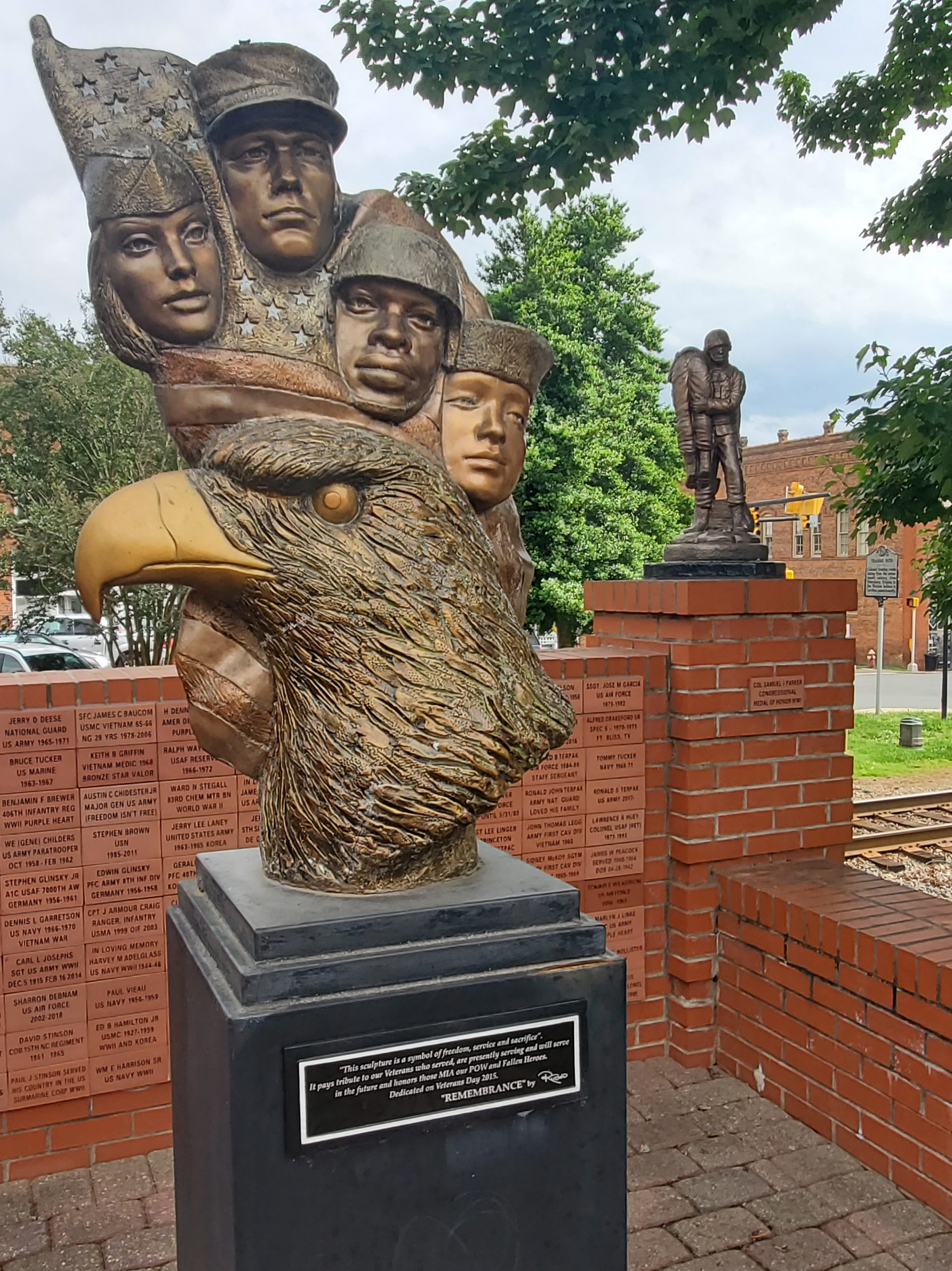
Stokes county was formed in 1789 from Surry County; and before 1770, it was part of Rowan County. The county was named for John Stokes, an American Revolutionary War captain severely wounded when British Colonel Banastre Tarleton’s cavalry practically destroyed Col. Abraham Buford’s Virginia regiment in the Waxhaws region in 1780.
Stokes was most heavily settled from 1750 to 1775. The Great Wagon Road passed through the eastern portion of the county, and this influenced the pattern of European settlement, so that most settlers came from the Virginia Piedmont, and some came from further away in Pennsylvania and other colonies.
During the American Civil War, Moratock Iron Furnace located near Danbury served as a foundry for the Confederate Army. It was destroyed in April 1865 when Union cavalry under the command of General George Stoneman conducted extensive raiding through the region.
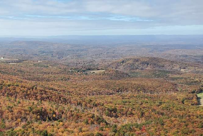
Hanging Rock State Park was formed primarily from blocks of land donated in 1936 and contained 6,921 acres in 2005. Many of the facilities in the park were built by the Civilian Conservation Corps (CCC) between 1935 and 1942. The park is located atop the Sauratown Mountains, and contains a visitor’s center, a manmade lake, and plenty of hiking trails, climbing trails, picnic areas, and primitive campgrounds.
Walnut Cove
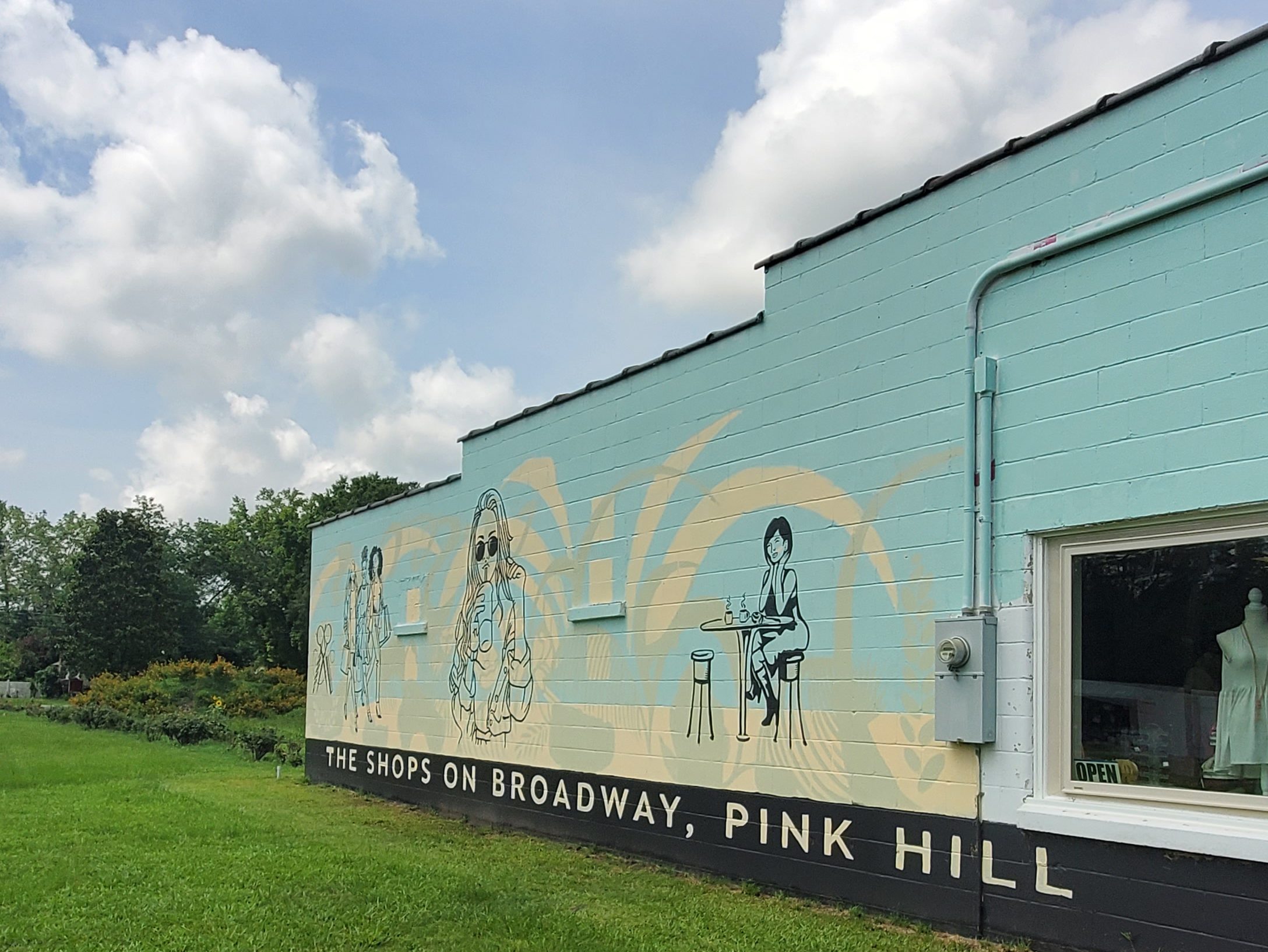
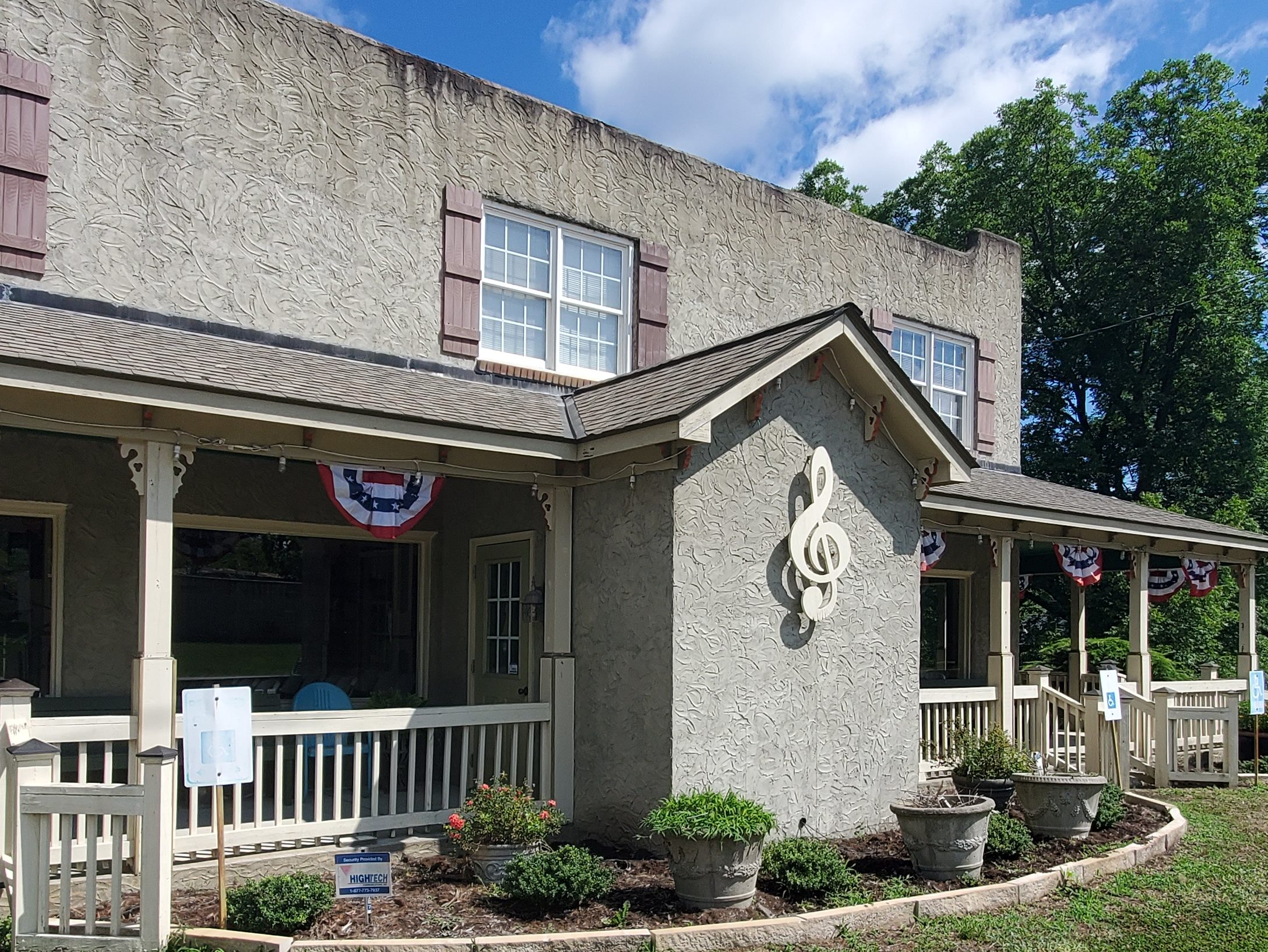
Walnut Cove is the home of Family Pharmacy and the Walnut Cove Springfest, which draws many visitors to the area. Festival organizers marked 1889 as the town’s incorporation date, but the town’s roots date to the mid-18th century when it was known as Town Fork. Town Fork settlers formed a bond with Moravians in Bethania and Bethabara. Eventually, William Lash, a Moravian settler at Bethania, bought land along the Town Fork Creek, which later developed into a large plantation named Walnut Cove. The Town was a railroad center in its former years, and today remnants of the old Train Depot still stand on Depot Street.
Later, a general store was built, and the area was commonly known as Lash’s Store. A windmill was erected to pump water for the plantation (hence, Windmill Street). Along Main Street, the Lash family built an office, a general store, a grist mill, a livery stable, a blacksmith shop, and (reportedly) a bar. The family built four homes along what is now known as Summit Street. One of these homes still remains today.
It is also home to historic Covington House (built in 1821), Fulp-Marshall Home (built in 1836), and Culler Roller Mill (built in 1900), now known as Monitor Roller Mill. Belews Lake and Hanging Rock State Park are located nearby. The Walnut Cove Colored School is listed on the National Register of Historic Places.
These remnants of yesteryear, along with many other historic homes and buildings that line Walnut Cove’s Main Street are a draw to a scenic small town, rich with history, and accentuated by a number of small businesses and restaurants that attract tourists and locals alike. Here, you can visit Cove Square, with a mediation path, and the Palmetto Theater.
Ceramic
Ceramic is a ghost town in Stokes County, North Carolina, United States, approximately 10 miles southeast of the county seat of Danbury, near Belews Lake. Ceramic, as a community, ceased to exist at least six decades ago. The community was started by a ceramic pipe and drain tile manufacturing company, presently the “Pine Hall” brick company. Only remnants of the factory exist; it appears that fire may have caused its demise. The huge clay pits are surrounded by overgrown trees and underbrush and are nearly impossible to find. The only residents are small game and coyotes.
Pine Hall
Pine Hall, a historic plantation house, bearing the same name was listed on the National Register of Historic Places in 1979. In 1922, Flake Steele took over Consolidated Brick Co. and bought hundreds of acres containing Triassic shale. Pine Hall Brick Co. moved its offices to Winston-Salem, North Carolina, two years later. In 2021, the company has two plants in Madison, North Carolina, and two in Fairmount, Georgia, and sells its brick products in 35 U.S. states and in other countries.

Jessup Mill
Behind Jessup Mill (1565 Collinstown Road, Westfield, NC), you can take a short (no more than five minutes) hike along the path to a waterfall dam and fishing hole. In fact, you’ll hear it before you see it… and you’ll be drawn to it. Plus, a bonus is that you can access both sides of the falls.
Danbury
Founded in 1851, Danbury is the county seat of Stokes County and is the “Gateway to Hanging Rock.” Danbury is a popular rest stop for bicyclists, motorcyclists, and driving enthusiasts due to the numerous scenic roads in Stokes County. Danbury also attracts outdoor enthusiasts because of its location on the Dan River and near the entrance to Hanging Rock State Park.
There are no regional or national franchises in Danbury, only local shops like the Danbury General Store, and small restaurants. J.E.Priddy’s General Store, a local historic landmark dating from the late 19th century, is still in business selling goods old and new. It is located about 2 miles east of town on Sheppard Mill Rd.
No battles occurred in Danbury during the Civil War, but it housed and supported the war efforts of the Confederate Army. The Moratock Iron Furnace, which is still found in Moratock Park, was used in the smelting of iron ore. General George Stoneman’s raid passed through Danbury on April 9, 1865, the day of the surrender of Confederate forces at Appomattox Court House, VA. Other historical features in the town include the Wilson Fulton House, the Old Stokes County Court House, and Moody’s Tavern (later McCanless Hotel).
In addition to the Moratock Iron Furnace, the Danbury Historic District, Hanging Rock State Park Bathhouse, and Stokes County Courthouse are listed on the National Register of Historic Places.
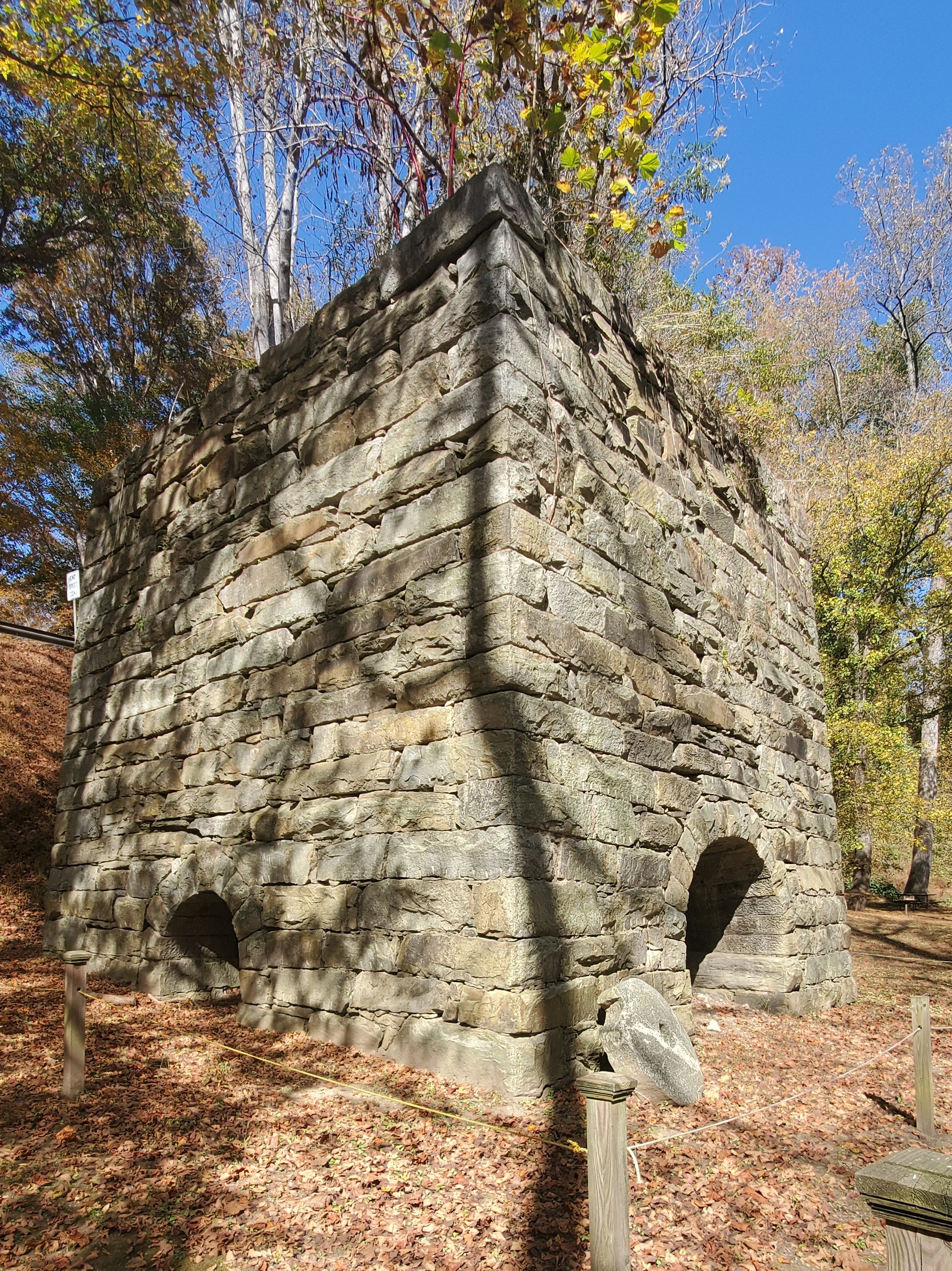
Moratock Iron Furnace – Moratock Park
One of several iron furnaces left in North Carolina (such as the Endor Iron Furnace in Lee County), the Moratock Iron Furnace is located beside the road at 1077 Sheppard Mill Road.

Danbury Historic District
Discover Danbury! Stop at the Danbury Historic District, where you’ll find The Arts Place (across from the Stokes County courthouse and Stokes County jail), an art and gift gallery that sometimes hosts live music and serves coffee and ice cream. (Two scoops seems more like four!)
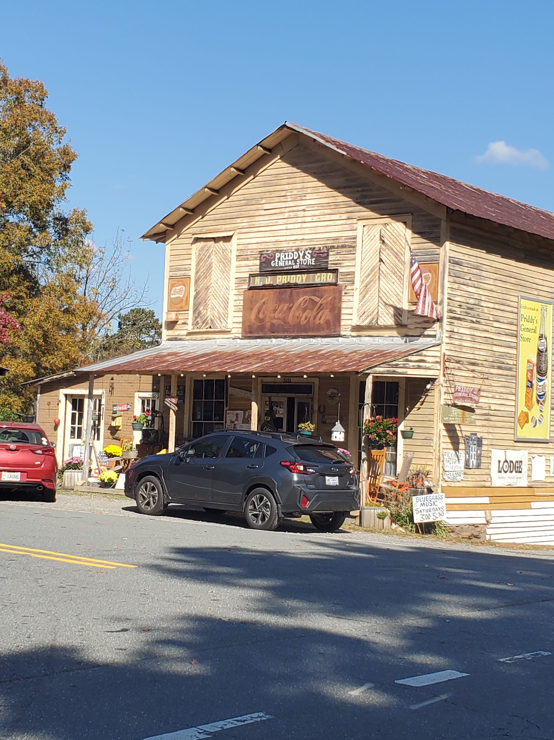
Priddy’s General Store
Not far from the Moratock Iron Furnace, you’ll find Priddy’s General Store (2121 Sheppard Mill Rd.), which hosts live music in February, May, October, and December.
Hanging Rock State Park
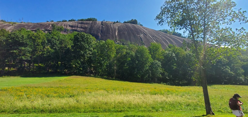
A trip to Stokes County is not complete without a visit to Hanging Rock State Park, one of North Carolina’s top 10 state parks. Located in the Sauratown mountain range, you’ll find shorter and longer hiking trails of all levels — some of them with a reward at the end, as in a waterfall. There are several in this park. Plus, you can take the somewhat strenuous hike all the way to the Hanging Rock, a quartzite formation that juts out over the landscape, offering breathtaking vistas of the Blue Ridge Mountains and the parks below. Rock climbers can tackle Moore’s Wall. Equestrians, there are trails for you too!
Pinnacle
The town was originally known as Culler, named for Emanuel W. Culler who owned the land on which a railroad station was built and served as the town’s first mayor. The present name of Pinnacle was adopted in 1894. Pinnacle was incorporated in 1901 but the charter was repealed in 1903.
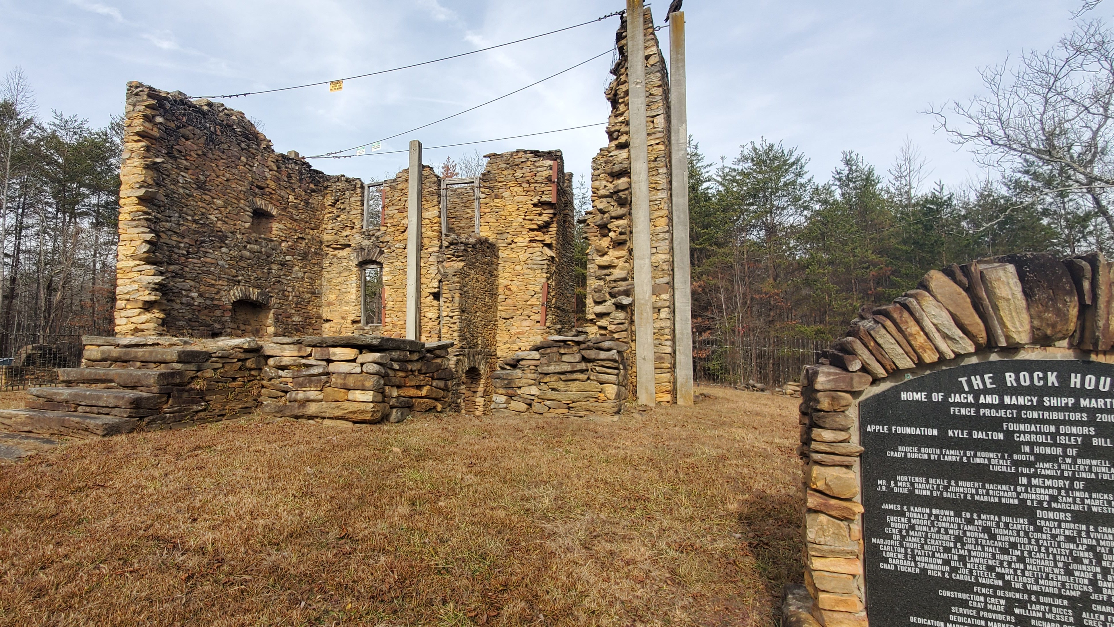
Colonel Jack Martin Rock House
About 20 miles east of Pinnacle on State Route 1186 is the Rock House, the remains of a massive four-story stone structure with three-foot-thick walls built by Capt. John ‘Jack’ Martin (circa 1770), one of the first two settlers of Stokes County, on an 8,000-acre grant from the Crown. The house was built by slaves using local flint stones, with a fireplace large enough to roast an ox, and a stuccoed white plaster on the exterior. The Rock House served as the mustering ground for colonial forces during the Revolutionary War as well as the War of 1812. One of the oldest structures in Stokes County and listed on the National Register of Historic Places in 1975, the house burned in 1890, and only the great rock walls remain. Rock House was acquired in 1975 by the Stokes County Historical Society, which has struggled recently to protect the ruins from vandals. Jack Martin died in 1822, but his tombstone, erected many years after his death, incorrectly reflects 1823. His wife Nancy died in 1841. They are buried in a small family graveyard southeast of the Rock House, which is listed on the National Register of Historic Places.
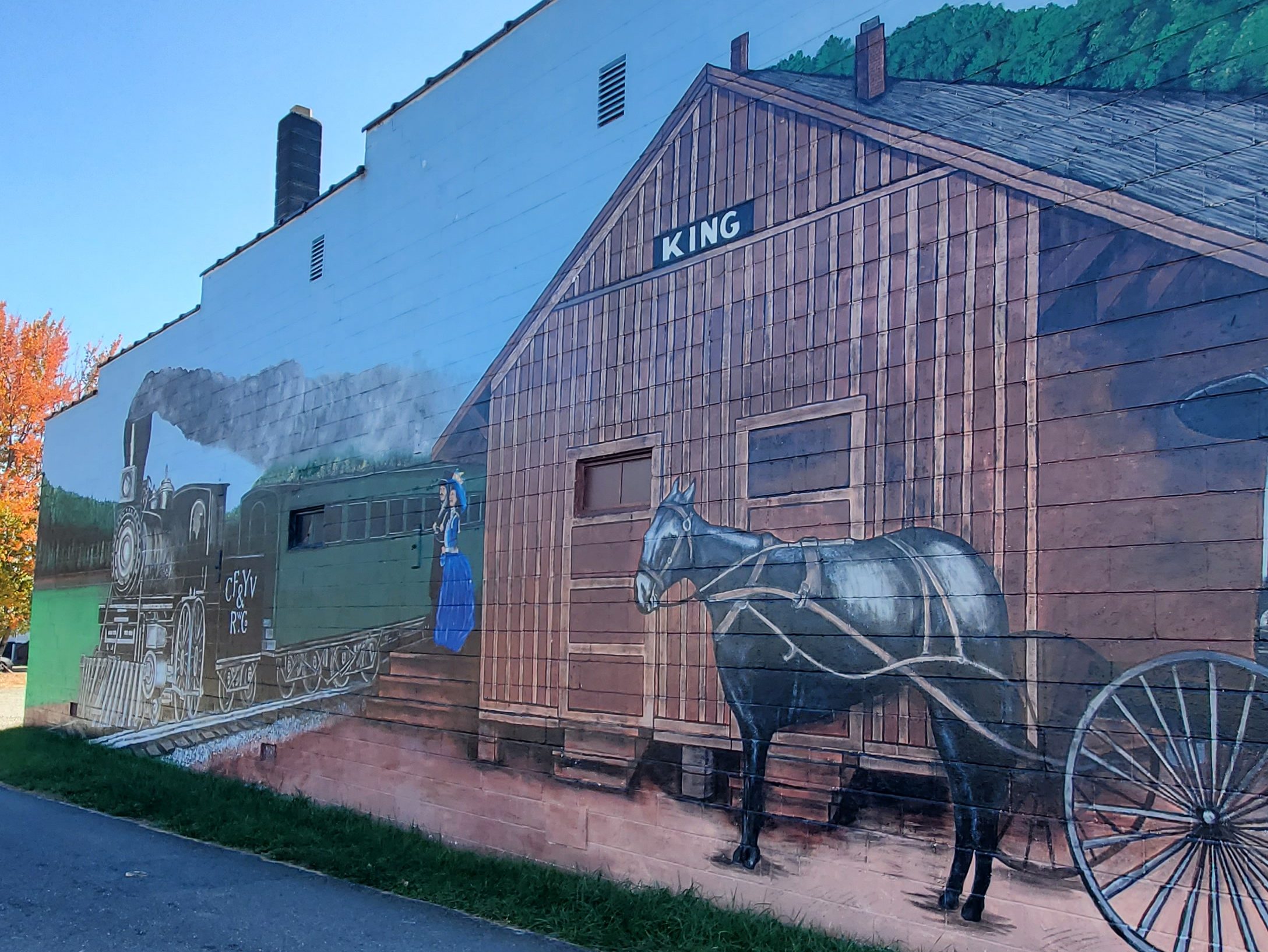
King/King’s Cabin
The town was originally called “King’s Cabin”. Charles and Francis King lived in a cabin owned by Francis’s father for a short time in the 1830s. Being Quakers and against slavery, the King family moved to the free North. According to television journalist and historian Chad Tucker’s book Images of America, King (2006), after the King family left their home it was used by locals as a landmark or reference point in giving directions. Several decades later when a post office was established in 1888, it was named for that reference point, King’s Cabin. The railroad laid tracks a few years later and shortened the name to “King” in its business transactions, and to eliminate confusion the post office followed on September 26, 1894. Charles and Francis King never returned to Stokes County and never knew their former home became the namesake of a town.
According to Tucker, the community grew into an unincorporated town of schools and businesses. With the first automobile arriving by train in October 1911, new highways followed. With new roads, the town’s proximity to Winston-Salem, and a new four-lane Highway 52 built in the 1960s, King opened its doors to growth, turning farmland into subdivisions. Community groups acted as an unofficial town council, providing services such as a fire department, water and sewer. On September 13, 1983, King became an incorporated city, 95 years after the King’s Cabin post office opened.
King is a new town when compared to the others in Stokes County. At one time, there were four tiny villages in all directions from where King is today. On September 11, 1812, John Fulk sold to Frederick Fiscus and Adam Fulk two acres on which they built the Bethlehem Lutheran Church. A school was operated there from 1840 to 1864. The townships first voting precinct was in this vicinity. This area is about one mile north of present King.
Trinity Methodist Church was organized in 1873. Also, near this site, H. C. Coe operated a general store and shoe shop. M. T. Choplin, a dealer in general merchandise, saddles, bridles, etc., operated a large store where Kirby Road comes into East King Street today. This was near the cabin where Charles King and his bride Francers Kiser built in 1826. The land was given to Frances by her father, Harmonius Kiser. This general area was known locally as “King’s Cabin”.
The village of Five Forks, so named because of the five roads that converged there, was a lively place beginning about 1871 when a post office was established there. Five Forks was on the stage coach road from Bethania to the Hollow Road at Trinity Church and northward. The King’s Cabin Post Office opened in March 1888 and the first train came through in June of 1888. S. R. Slate, first postmaster, named the post office “King’s Cabin” because the area had been known by that name for 60 years.
King would only have been a whistle stop on the railroad had it not been for the far sighted planning of the Spainhour, Grabs, Slate and a few other families. They built a depot and sold it to the railroad for $1.00. The railroad changed the name to King and the post office did the same in 1894.
Public spirited citizens and community cooperation have always been an important part of King. Just as the depot was built by local men, so too was the Tabernacle for public meetings. The first school in town was established in 1896. When the County Board of Education granted the request of several citizens for a high school, local men gathered at the two room elementary school and jacked it up and built two rooms beneath it for King’s first high school.
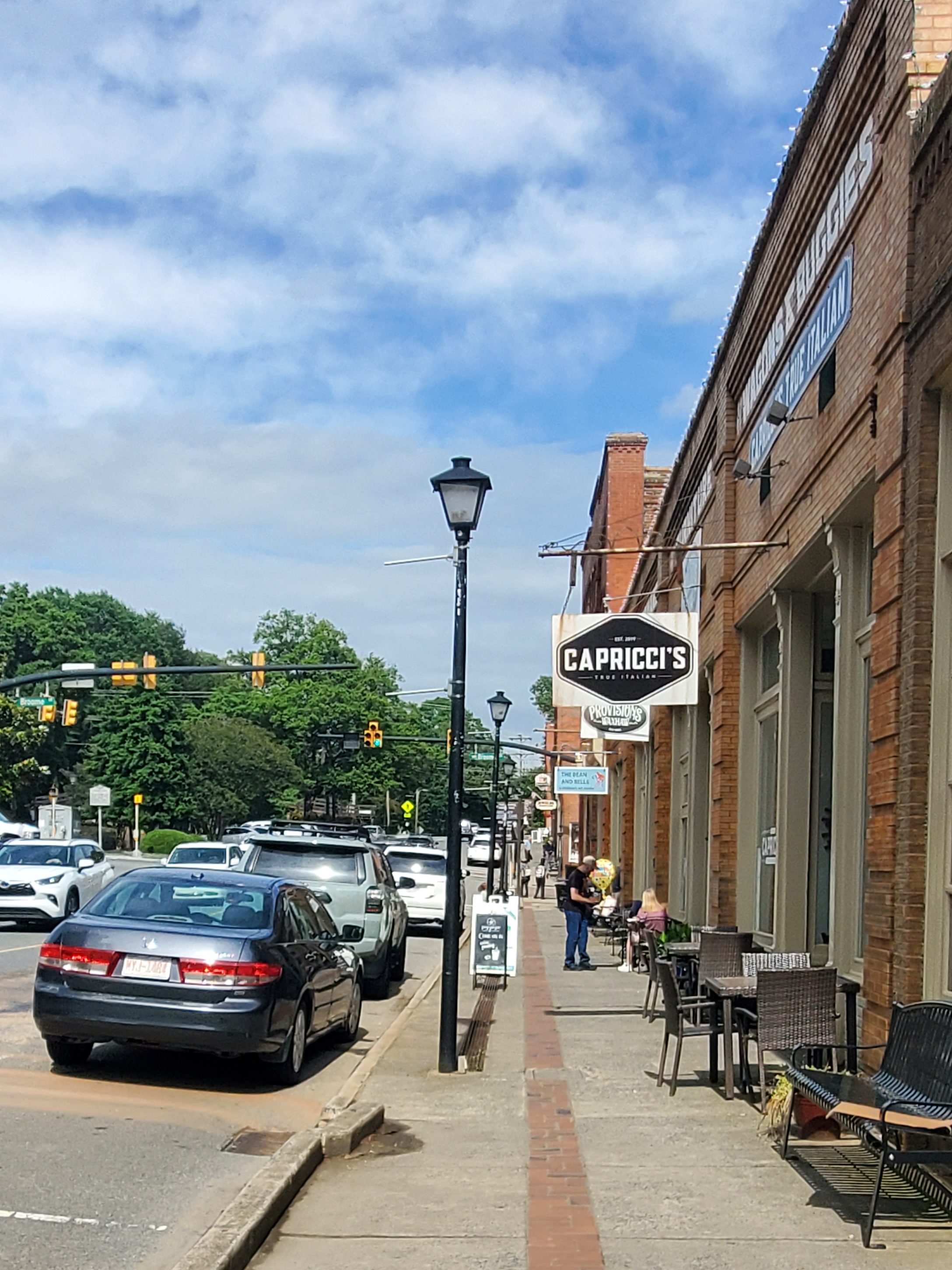
King is a bustling small town today with restaurants and shopping.
Germanton
Germanton was established in 1790 and is the oldest community in Stokes County. The town’s original 23 acres were part of a 700-acre tract that was granted to Jacob Lash by the Earl of Granville in 1762. The town was named after an influx of Germanic immigrants, who had served as veterans of the American Revolution, were given incentives to settle the area. These settlers included both Germans who fought against the crown, and Hessians who had been loyal to the crown.
Germanton is located near the older Moravian settlements of Bethabara and Bethania, which were part of the Wachovia Tract settlement. The etymology of the “Germanton” name is often mistakenly attributed to this proximity. While Wachovia was settled for religious reasons by people originally from what is today the Czech Republic, the settlers of the Germanton area were primarily Lutheran, originally from areas in what is today Germany, and settled the area for non-religious purposes. Early Stokes county settlers were the result of land incentives by the State in 1790 given as a reward to those Germanic people who had fought for Independence. And the use of German as a mother tongue died out by the 1850s. Coal was mined in the Germanton area in the late 19th century but was of low quality.
Next stop… Montgomery County!