While traversing Columbus County, you’ll find frequent roadside produce stands, carrying a variety of local fruit and vegetables, including corn and watermelon. You’ll also see numerous tobacco fields throughout the county. The area is also home to many wetlands and marshy areas, often with the water levels not far from the roadway. So take special care when driving on certain roads, as there may not be much room for error.
The area comprising Columbus County was originally inhabited by the Waccamaw people. Historically, the “eastern Siouans” had territories extending through the area of Columbus County prior to any European exploration or settlement in the 16th century. English colonial settlement in what was known as Carolina did not increase until the late 17th and early 18th centuries. Following epidemics of new infectious diseases, to which indigenous peoples were exposed in trading and other contact, the Waccamaw and other Native Americans often suffered disruption and fatalities when caught between larger tribes and colonists in the Tuscarora and Yamasee wars.
Waccamaw Siouan ancestors retreated for safety to an area of Green Swamp near Lake Waccamaw. As America was colonized by the British, the area encompassing Columbus County was first organized part of the Bath Precinct of North Carolina, established by the British Crown in 1696. In 1729, a southern portion was split off by the General Assembly to create New Hanover County, and five years later Bladen was formed out of part of New Hanover. In 1764, Brunswick County was formed out of Bladen and New Hanover. Throughout this time, the area was largely forested and had few white settlers, though the General Assembly established two roads through the area in 1764. William Bartram, a botanist from Pennsylvania, journeyed to Lake Waccamaw to study the flora and fauna of the region in the 1730s, creating the first detailed written account of the area. At least two skirmishes of the American Revolutionary War were fought on Columbus soil: one near Pireway and another at Brown Marsh.
Columbus County was created by the General Assembly on December 15, 1808 and was formed from parts of Bladen and Brunswick counties and named in honor of Christopher Columbus. The county’s borders were modified several times by legislative acts between 1809 and 1821. In 1810, a community was platted on land owned by James B. White for the purpose of creating a county seat. It was originally known as White’s Crossing before being incorporated as Whiteville in 1832.
The construction of a railroad along the Bladen-Columbus border in the 1860s spurred growth. The laying of the Wilmington, Columbia and Augusta Railroad later in the decade connected Whiteville with Wilmington and supported the development of strong lumber and naval stores industries. The county also produced corn, wheat, cotton, and wool.
Although the county was spared direct fighting during the Civil War, war demands stressed the local labor and food markets, and severe rains in 1863 diminished grain yields. After Wilmington fell to Union troops in February 1865, Union marauders sacked Whiteville. After the war, Columbus County’s economy grew more heavily reliant on corn and cotton production. In 1877, part of Brunswick County was annexed to Columbus.
Tobacco was introduced as a crop in Columbus in 1896, and that year a tobacco warehouse was established in Fair Bluff. It remained a marginal crop until 1914, and at the conclusion of World War I it overtook cotton as the county’s major cash crop.
Chadbourn
A post office called Chadbourn has been in operation since 1882. It was incorporated in 1883, being named after a local family engaged in the lumber industry. In 1895, strawberries were introduced in the Chadbourn area, and by 1907 Chadbourn had become one of the leading strawberry producers in the world.

Chadbourne Depot Museum
The old Chadbourn Depot Museum (201 W 1st Ave.) contains a lot of history about this little town. This museum was once a major transportation hub for trains, which hauled fresh produce across the country — including strawberries. Chadbourn is where the largest one-day shipping of strawberries happened — and one reason why the Strawberry Festival is now celebrated here. Today, the depot museum is a popular gathering and event spot, where celebrations, cookoffs, and other activities are hosted.

Cerro Gordo
Cerro Gordo was incorporated in 1874, taking its name from the 1847 Battle of Cerro Gordo in Mexico. The name Cerro Gordo (Spanish for ‘fat hill’) describes its slightly higher elevation than the rest of Columbus County, although it is located in the Coastal Plains region of North Carolina. Like much of the county, the local economy of Cerro Gordo heavily relies on agriculture and hog production.

Fair Bluff
Fair Bluff got its name from a bluff overlooking the Lumber River, where steamboats used to carry goods and passengers up and downstream. In 1807, plans were made to build a town upon the lands of John Wooton at the bluff to be known as Wootonton. Although the town was established but the name remained Fair Bluff and the community was reincorporated in 1873.
Agriculture has always been a mainstay of the the town’s economy, including tobacco. By the 1980s, tobacco growing subsided. The downtown area continued to thrive until the late 1980s, when a car dealership moved from the business district to another location. Haphazard town planning saw a mixture of residential, business, and industry all over town. Tens of millions in U.S. government grants poured into the city beginning in the mid-1980s and onward. But the town continued to decline and people left for better opportunities elsewhere. The same fate happened with neighboring towns of Tabor City, Boardman, Brunswick, Cerro Gordo, and Chadbourn.
In 1999, Fair Bluff experienced devastating flooding from Hurricane Floyd. In 2012, the Police Chief of Fair Bluff, Marty Lewis, was arrested, tried, and convicted for selling and delivering oxycodone and possession with the intent to sell and conspiracy to traffic while acting as police chief. He was sentenced to a minimum of seven years in prison and fined $100,000. On April 9, 2015, Marty Lewis filled an appeal of his case. On November 3, 2015, the verdict was unanimously affirmed by the North Carolina Court of Appeals, leaving in place the 90 to 117-month prison sentence originally imposed.
In October 2016, the town was again devastated by flooding on the Lumber River from Hurricane Matthew, prompting the evacuation of hundreds of residents. Floodwaters reached the town hall, police department, fire department, a grocery store, and a school.
In September 2018, Fair Bluff was flooded again by the impact of Hurricane Florence, forcing evacuations and leaving the downtown area under water, destroying 72 homes. After Florence, many buildings in the downtown area of the town were left abandoned, with no plans to reoccupy or repair them. The town’s only factory closed several months later, and hundreds of residents moved away. The federal government bought out residential properties in the community, straining the local government tax base. The town government drew up plans to level the historic business district and turn it into a park, and build a new business district further away from the Lumber River.
Fair Bluff celebrates a Watermelon Festival every July.

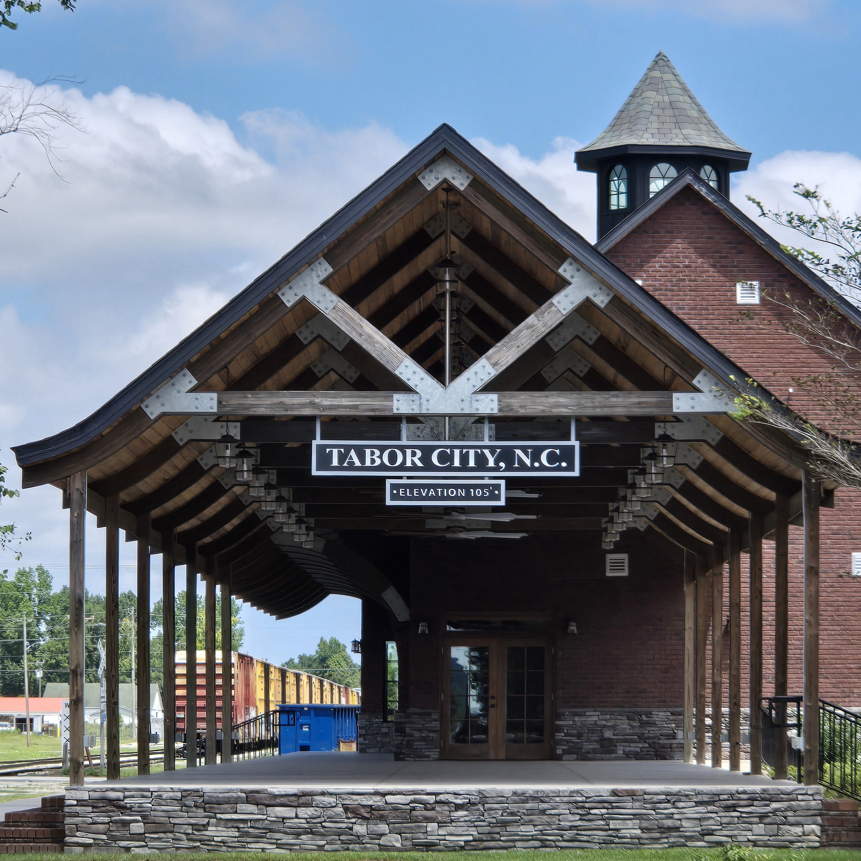
Tabor City
Early settlers in the Tabor City area farmed, raised cattle & pigs, and manufactured naval stores. From the longleaf pine trees come products used in shipbuilding. These products or “stores” are turpentine, rosin, tar and pitch. Pitch was needed to coat the hulls of ships to protect them in tropical waters.
The original community took its name from the first prominent church in the area, the Mount Tabor Baptist Church(now the Tabor City Baptist Church), which itself is named after the biblical Mount Tabor, and was founded in 1838. A village coalesced around the area of the church, which was organized as a town shortly after 1840. The town officially incorporated in 1904.
Business activity started in Tabor City by the mid-1850s, with the development of a saw mill, turpentine still, grocery store and dry goods store. The Atlantic Coast Line Railroad located a station in the town in 1886. The turpentine industry was huge in the area throughout the 19th Century. Many wagonloads of turpentine, rosin and pitch were carried to the rail station in Grist, NC, for shipment to Wilmington, North Carolina and beyond. The town was officially incorporated in 1905. In 1906, William Fowler donated land for the Tabor City Baptist Church.
Strawberries became an important crop in the 1880s when the development of the railroad enabled them to be shipped to markets in large cities. The Anderson Shingle Company made shipping containers for strawberries. Cotton fell out of favor when boll weevils negatively impacted crop production. Then tobacco became the golden crop with the first tobacco warehouse built in 1909.
Originally named Mt. Tabor, many would shorten the name to Tabor when writing correspondence. With mail delivery by the USPS, Tabor would be confused with Tarboro, North Carolina, due to the similarities in spelling. By 1935, US Postal authorities demanded a name change and since Tarboro was much larger, Mt Tabor was told to pick another name. So, Tabor City was chosen.
Due to crimes in the area in the late 1950s and 1960s, especially fights at local bars, Tabor City earned the nickname “Razor City.” Even though many of the crimes occurred just across the border in South Carolina, the Razor/Tabor near-rhyme stuck. An economic downturn and severe recession, plus skyrocketing fuel costs in the early/mid-1970s resulted in business closures and poverty becoming the norm for many families.
By the eighties, tobacco use began declining. Along with global recession, the town and its people took another severe hit. More businesses closed and parts of downtown looked deserted as empty buildings fell into disrepair.
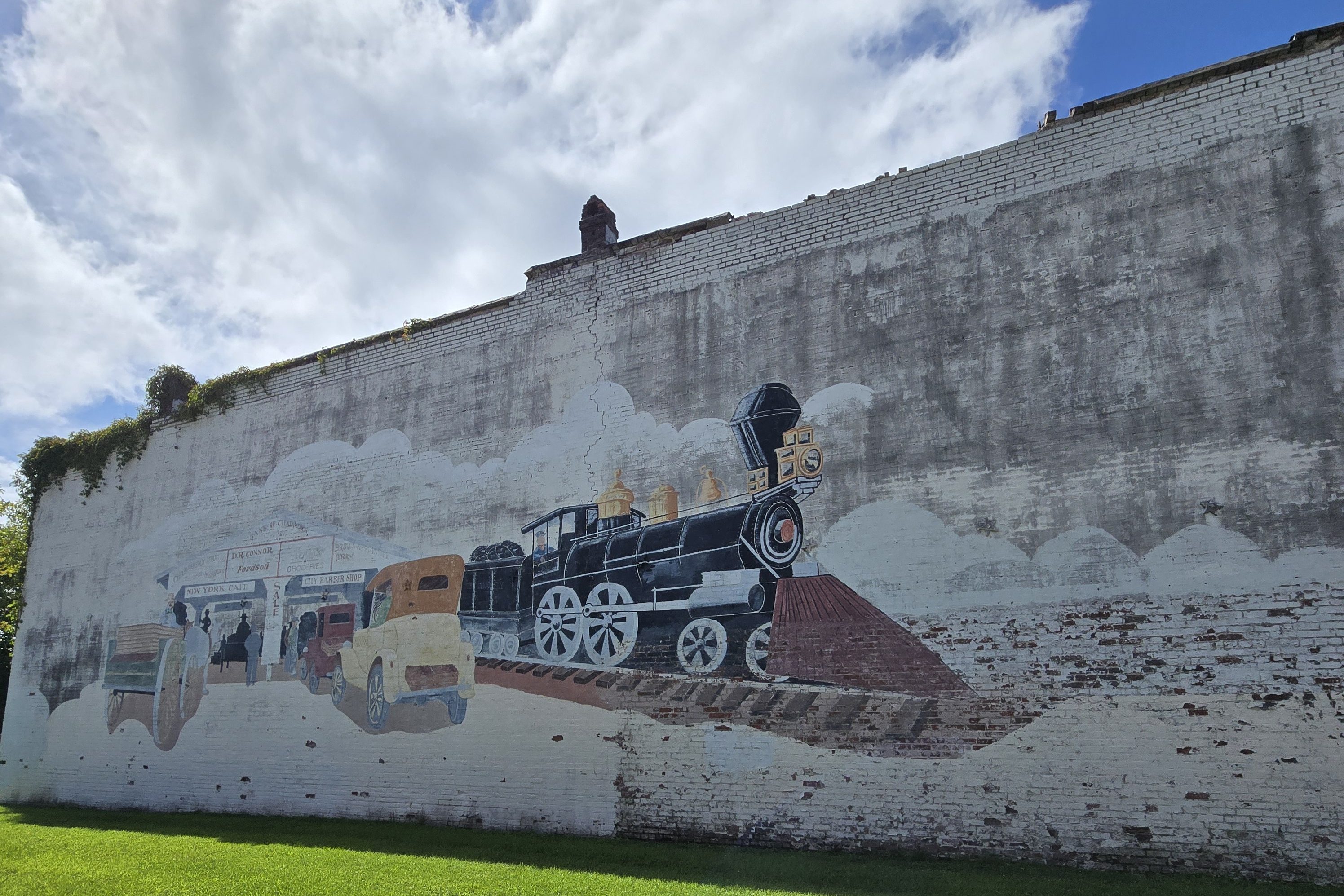
In late 1997, a massive facelift was performed on two blocks of S. Main Street in the downtown area. Southern Living magazine made contact with town leaders about an article they were doing about Christmas celebrations in small southern towns. For many decades, the town traditionally held an annual daytime Christmas parade. Storefronts were painted, new retro lampposts installed, and other aesthetic improvements costing tens of thousands of dollars were made in order to have a nighttime Christmas parade. A photo of the parade and short write-up were included in an article in the December 1997 issue of Southern Living magazine.
Today, the town focuses on agriculture, light manufacturing, retail and tourism. In addition, a large state prison provides many jobs for the area. Being so close to the coastal areas of Myrtle Beach and the Brunswick County beaches has led to a growth in the area housing industry. The Centennial Clock celebrating the town’s 100th anniversary was installed on Main Street.
A local citizen donated the lot containing the ruined front brick wall of the former Ritz theater to the town. Millions in government grants resulted in a complete rebuild effort that was completed in 2014. The former theater is now the Ritz Center, a community center for the arts. Town welcome signs were amended in 2019 to recognize country music legend Stonewall Jackson, a Tabor City native.
Tabor City holds the North Carolina Yam Festival on the fourth Saturday each October. The festival celebrates with crafts, train rides, classic cars and trucks, arts and vendors. Also during the Yam festival, an annual art show is held, and a “Miss Yam Festival” pageant is held for various age groups. The annual parade is considered a highlight of the festival. The annual week-long Spring Fling began in 2013 and celebrates the Town and people of Tabor City.
NC Visitors Center at Tabor City
Tabor City has one of the most comprehensive Visitor Centers (301 East 5th St.) that I’ve seen in the state. I highly recommend stopping by to pick up a variety of rack cards, magazines, maps, and other publications for Tabor City, Columbus County, and all geographic regions of the state. Directly across from the Visitors Center, you’ll find the Mt. Tabor City Schoolhouse. (See below.)
The Garrell Depot
The old Garrell train depot (105 Railroad St.)serves as a small museum that operates primarily during the Yam Festival and inlcudes a retired caboose as one of the displays available for exploration.
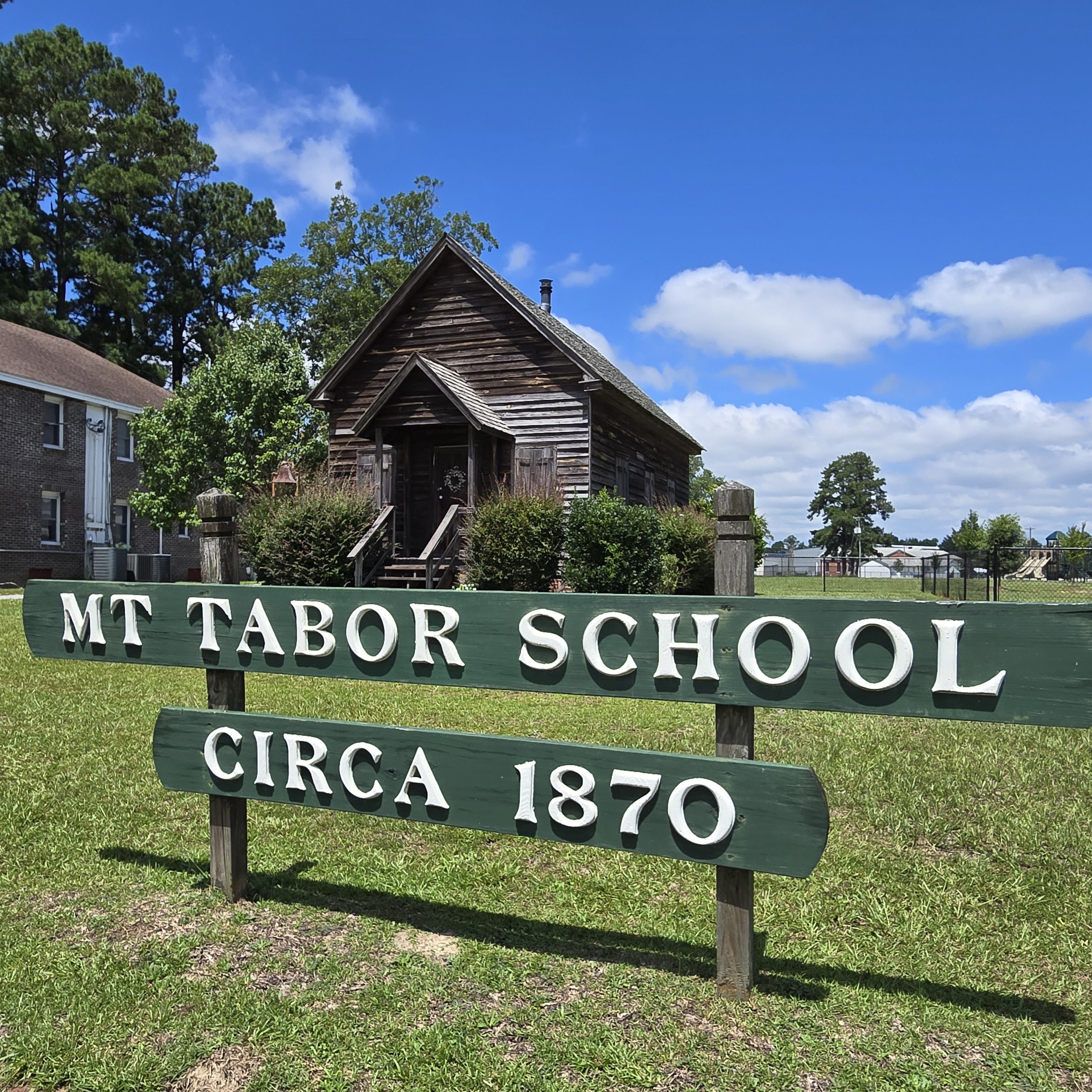
Mt. Tabor City Schoolhouse
A circa 1870 one-room, intact, School House (213 East 5th St.) was restored by the historical society of Tabor City and Columbus County. This facility was purchased and donated to the Town of Tabor City by Richard Wright and still has its original six-inch-side pine floorboards and interior and exterior woodwork. The schoolhouse is located directly across from the Visitors Center.

Whiteville
Whiteville is the county seat and the most populous city in Columbus County, which was created in 1808. In 1810, an act authorized James Bunbury White to “lay off a town on his own lands in the county of Columbus” and appoint five commissioners. The town was sacked by Union forces during the latter stages of the American Civil War. The name Whitesville was officially changed to Whiteville by the U.S. Post Office in 1889.
In 1950, Whiteville fielded a professional minor league baseball team in the Class D Tobacco State League called The Whiteville Tobs; the club lasted only one season before disbanding from the entire league.
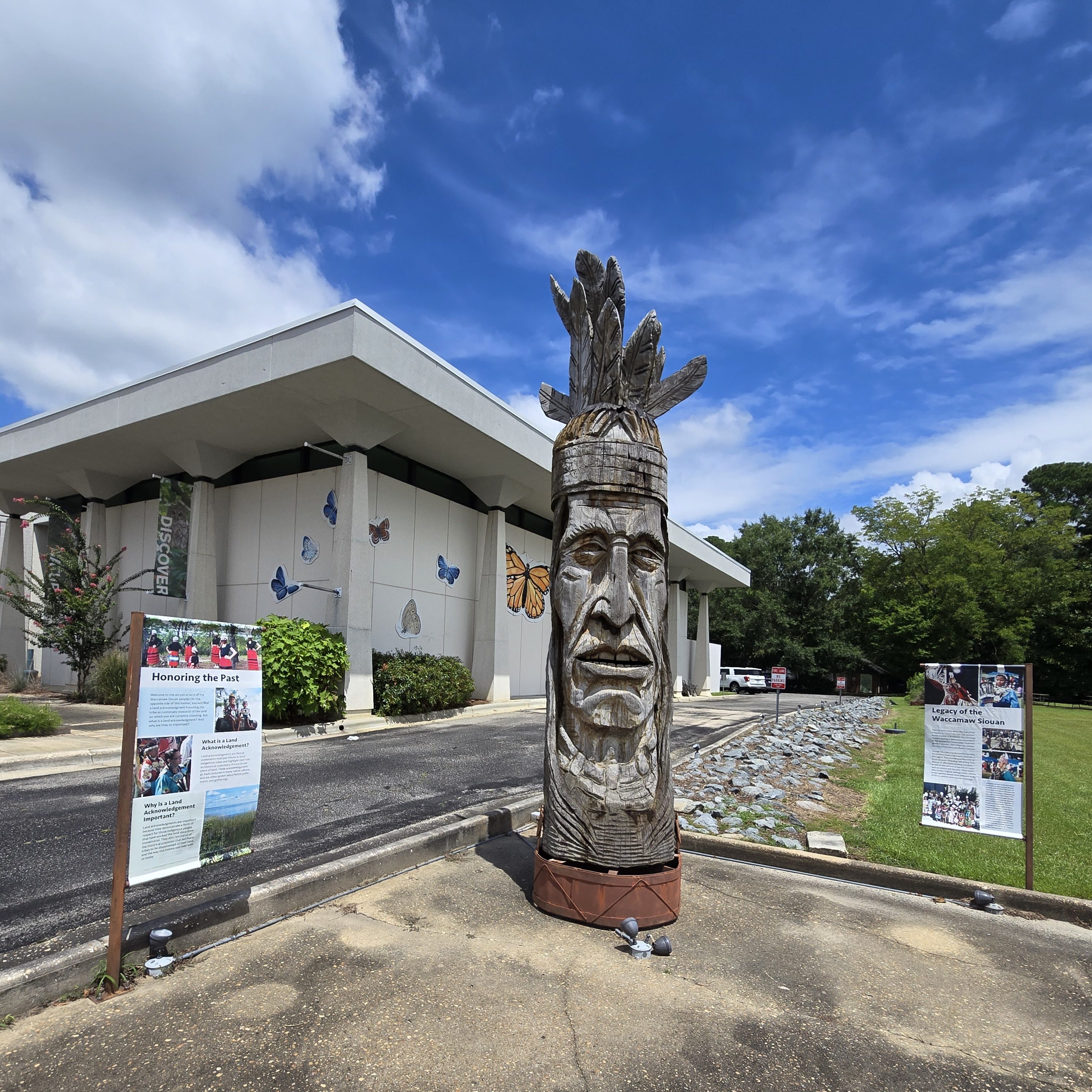
Annual events include the North Carolina Pecan Harvest Festival. In addition, the state-recognized Waccamaw Siouan tribe holds an annual powwow in October with numerous public events.
While in Whiteville, take a scavenger hunt around town and see if you can find all 10 of the butterfly murals in town — all painted by local artist Bess Hinson Taylor.
North Carolina Museum of Natural Sciences at Whiteville
Whiteville is home to the North Carolina Museum of Natural Sciences at Whiteville (415 S. Madison St.), a satellite museum of the North Carolina Museum of Natural Sciences. Inside and outside, visitors can discover through a fossil lab, investigative lab, naturalist center, discovery forest, and more.

Lake Waccamaw
The town of Lake Waccamaw hosts both year-round residents and vacationers and provides many recreational activities, such as birdwatching and hiking, due to the large population of wildlife and mild terrain. Originally home to Native Americans, Europeans later colonized Lake Waccamaw in the 18th century. The Europeans built naval stores and the discovery of turpentine oil led to the Wilmington-Manchester railroad track. The town surrounds Lake Waccamaw, which features 9,000 acres of diverse wildlife and is a major source of revenue for the town. In 2018, a 40-year ban on hunting alligators was lifted.
Lake Waccamaw and the nearby city of Flemington grew slowly with the help of the Wilmington-Manchester railroad, which brought the rural town access to the world. On January 26, 1869, Charles Oscar Beers started his shingle industry along the southern shore of Lake Waccamaw. This shingle company is famed for having supplied the shingles for Mt. Vernon.
Another company also started south of the lake by Henry Bascom Short after Beers started his company. These two companies came together and formed a new company named Short and Beers, which brought more business to the town and created more jobs. Over time, the company went from producing shingles to becoming the North Carolina Lumber Company.
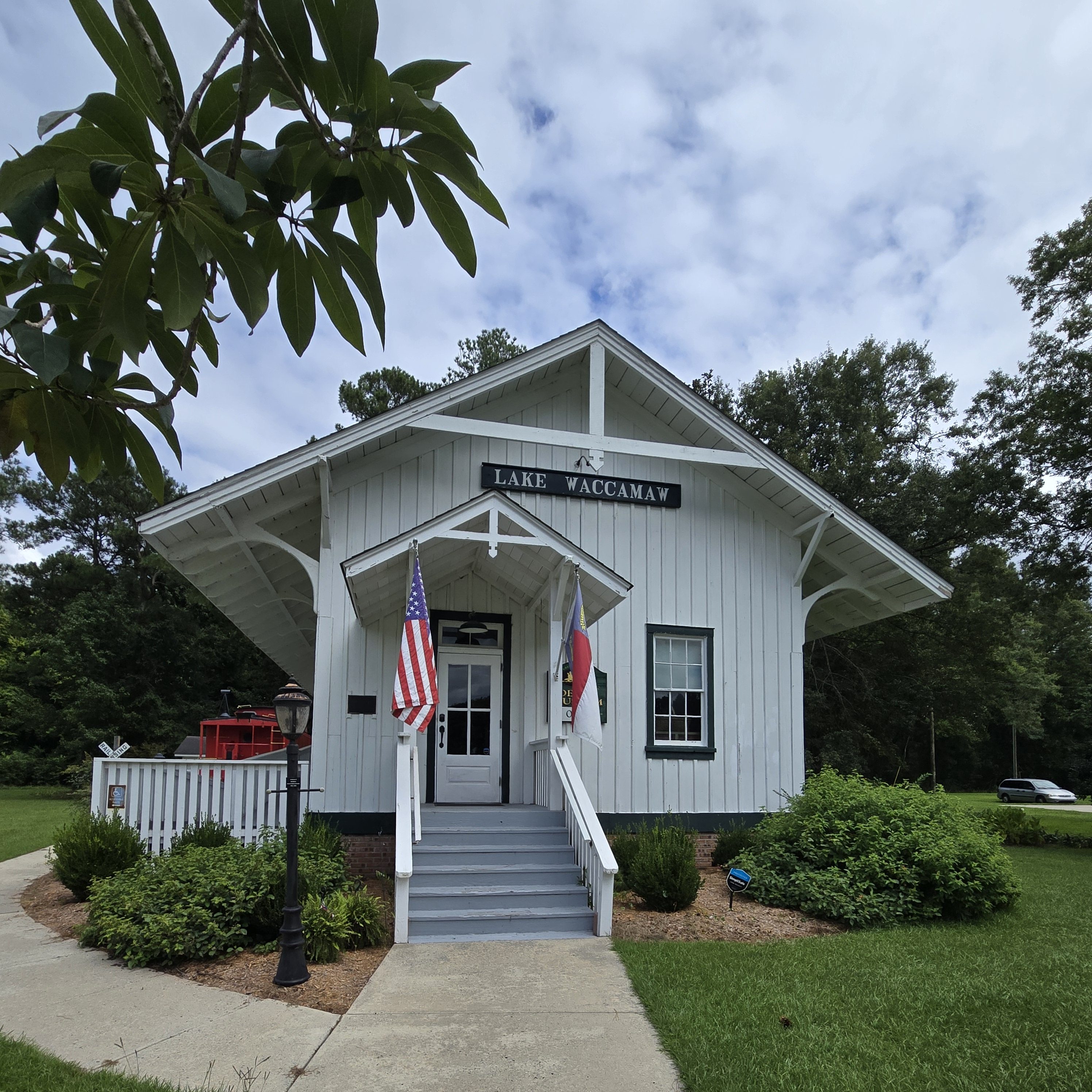
Around 1910, a local group formed the Waccamaw Club. The club served as a gathering place for hunting parties and house parties. The club later disbanded, and the building then became the Waccamaw Hotel. The Lake Waccamaw Depot was listed on the National Register of Historic Places in 1983. The Waccamaw Dam was built in 1926 by the state to prevent the lake from shrinking in dry weather. In 2018, a new bridge that goes over the Waccamaw Dam was finally finished and open for locals.
Lake Waccamaw Depot Museum
While in Waccamaw, stop by the quaint Lake Waccamaw Depot Museum (201 Flemington Dr.), built in 1904, for a peek back into the area’s history, including actual shingles from the local shingle maker as well as a hand-carved, 300-year-old Native American canoe, which was unearthed from the depths of Waccamaw Lake. Inside, you’ll also find a gift shop and outside a restored red caboose.

Lake Waccamaw State Park
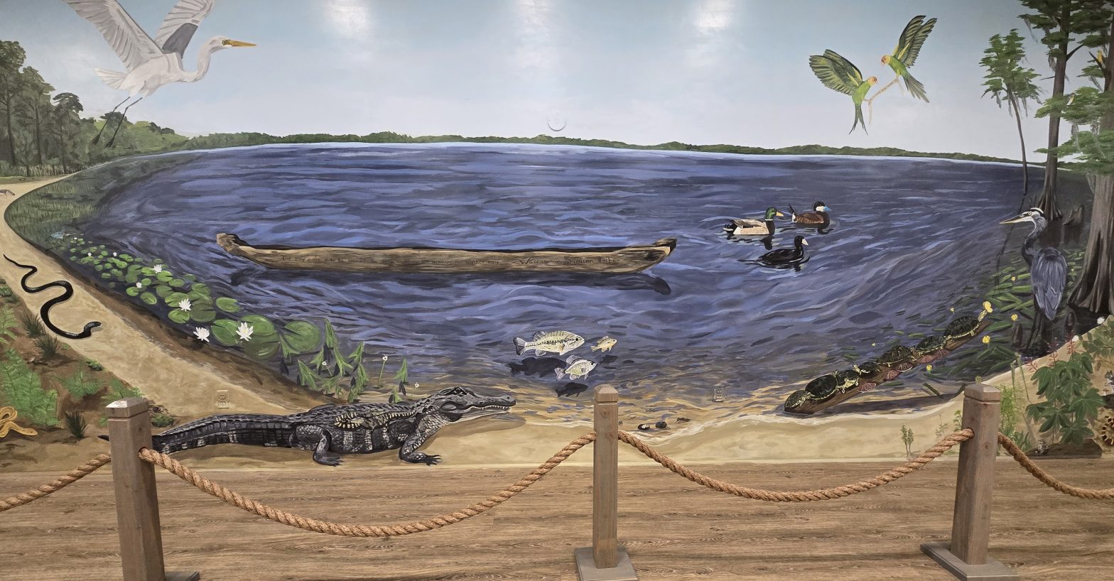
Lake Waccamaw State Park (1866 State Park Dr.) preserves an aquatic system that contains a number of endemic mollusks and fishes found nowhere else on earth! Five species of the state’s rare plant list can be found in the area. And the American alligator also calls the area home. Interestingly, most of the area lakes are quite acidic, but an exposed limestone foundation keeps lake Waccamaw at a nearly neutral pH level. Stop in the visitor center to see the nature displays and the hand-painted mural showcasing 57 of the area’s flora, fauna, and bird and animal wildlife. The mural was painted by local artist Bess Hinson Taylor (the artist that painted all of the butterfly murals in Whiteville) and is dedicated to the memory of Lake Waccamaw State Park Ranger Emily Rebecca Perry, who died by suicide on May 11, 2024. Walk the many trails, including several boardwalks that take you into the surrounding wetlands and to the lake’s edge.
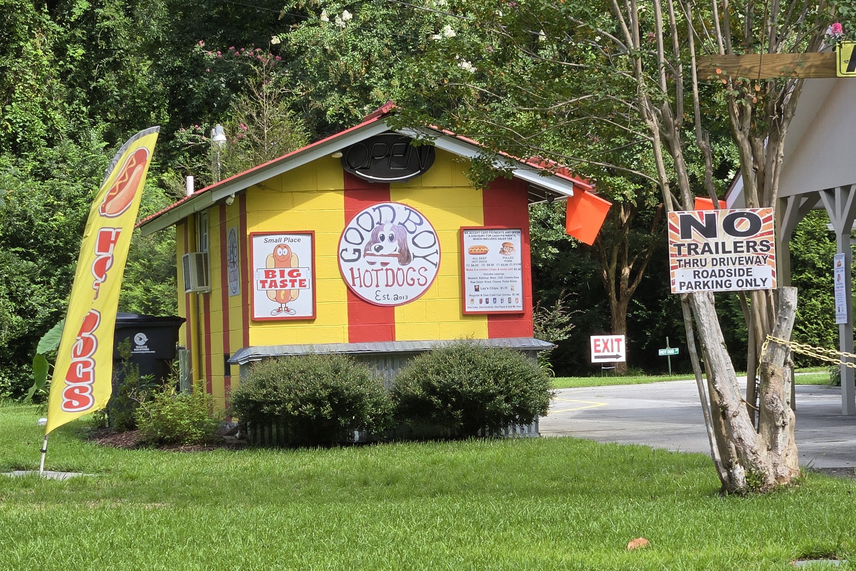
Delco
When passing by or through Delco, stop by for a bite at Good Boy Hotdogs (25985 Andrew Jackson Hwy E.), located right at the side of the road. You can’t miss the yellow signage!
Riegelwood
On November 16, 2006, at 6:21 am EST, a severe thunderstorm warning was issued for eastern Columbus County. At 6:29 am, a tornado warning was issued for the same area. At 6:37, an F3 tornado struck a mobile home park and killed eight people, including two children: Danny Jacobs, 6, and Miguel Martinez, 13. Altogether, 20 people were injured. The tornado was a part of a 3-day tornado outbreak in the South, in which four other deaths were reported. Riegelwood was one of the hardest hit areas.
On Friday, November 17, 2006, a NOAA National Weather Service storm survey team assessed the tornado damage and rated it at F3 on the Fujita scale for nearly a mile in Riegelwood, with winds approaching 200 miles per hour. The maximum width of the tornado was 300 yards where the F3 damage occurred. The rest of the 7-mile damage path was less than 100 yards wide and rated at F1, with winds less than 100 mph extending north across Columbus County into western Pender County. The Columbus County sheriff reported 30 homes destroyed in the F3 damage area. Another three structures were damaged in Pender County, just west of Currie.
Next stop… Robeson County!
