The first inhabitants of the area eventually comprising Montgomery County were Keyauwee and Cheraw Native Americans. And the first European settlers were German and Scottish.
Montgomery County was created in 1779 out of Anson County. It was named in honor of Richard Montgomery, an American Revolutionary War general killed in 1775 while attempting to capture Quebec City, Canada. The law establishing the county also directed a group of commissioners to secure land near the center of the county for the construction of a country courthouse and prison. Many residents were dissatisfied with the location chosen, and after several years of demurring on a decision, a courthouse was erected in the community of Henderson, created at the confluence of the Yadkin and Uwharrie rivers in 1794. In 1816, the old courthouse was sold another was erected at the new community of Laurenceville. In 1841, the portion of Montgomery County west of the Yadkin/Pee Dee River became Stanly County. Two years later, commissioners were selected to move the courthouse to Montgomery’s geographic center, and in 1844 Troy was established as the county seat.
The county’s first paved roads were established in the 1920s. The Great Depression, which began in 1929, had a large adverse impact on the local agricultural and manufacturing industries. By 1933, 30 percent of local residents were unemployed.
Beulah Clark Parsons Davis (born October 31, 1896 in Montgomery County and lived until January 3, 1948 in Durham, North Carolina) was a well-known fortune-telling witch, who lived during the Great Depression. She was interviewed by Omar Darrow as part of the North Carolina Federal Writers’s Project housed at the University of North Carolina Southern History Collection, which was a New Deal program created to document the regional and local history of North Carolina during the Great Depression.
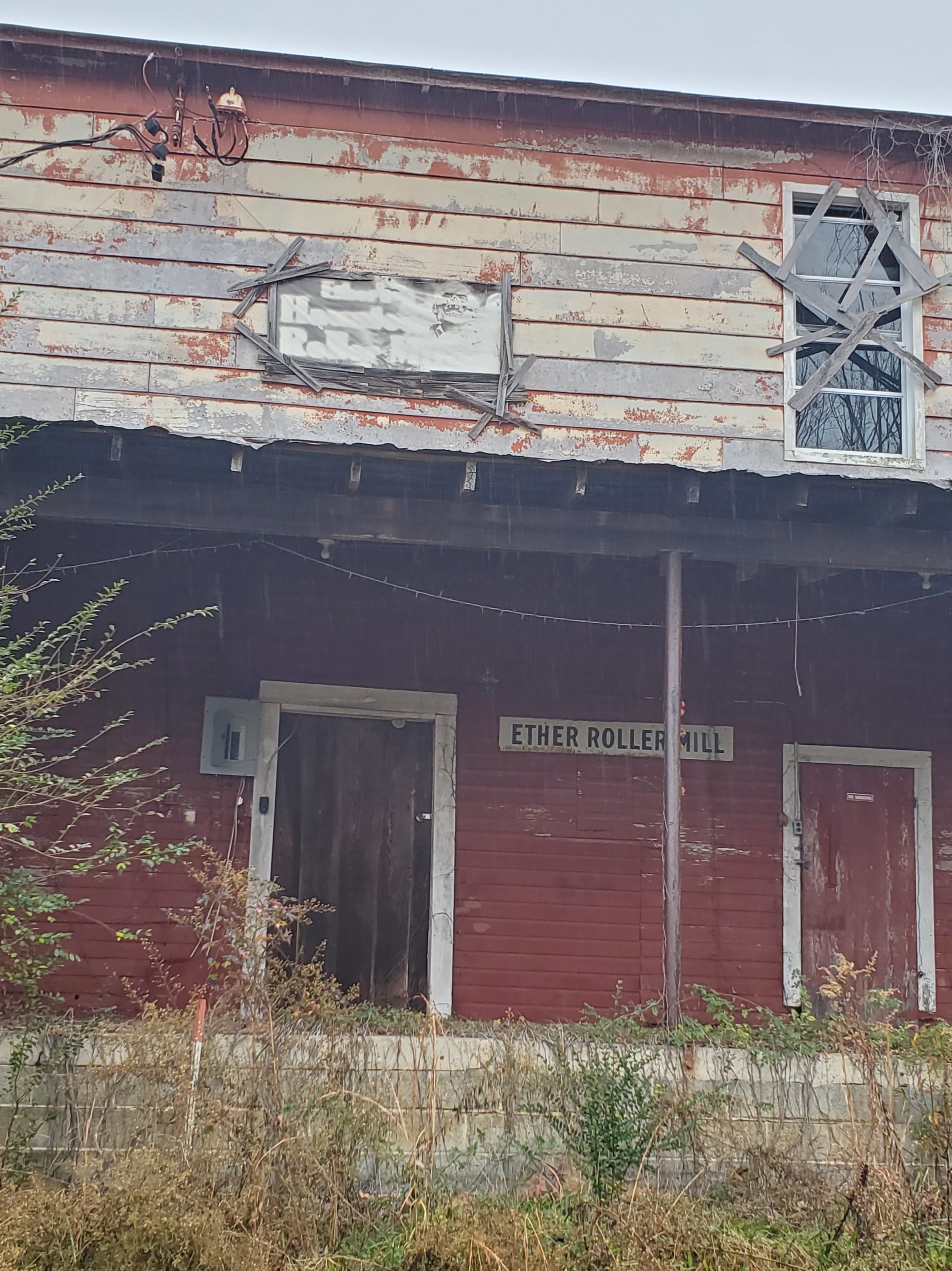
Ether
Ether Roller Mill, a site that tax records place as being built in 1800. This has been used as a local spooky attraction. The building has lost integrity since 2017 when it was left to the elements. A post office (across the street) has been in operation since 1888. The community was named for ether, a drug once prescribed by a local physician.
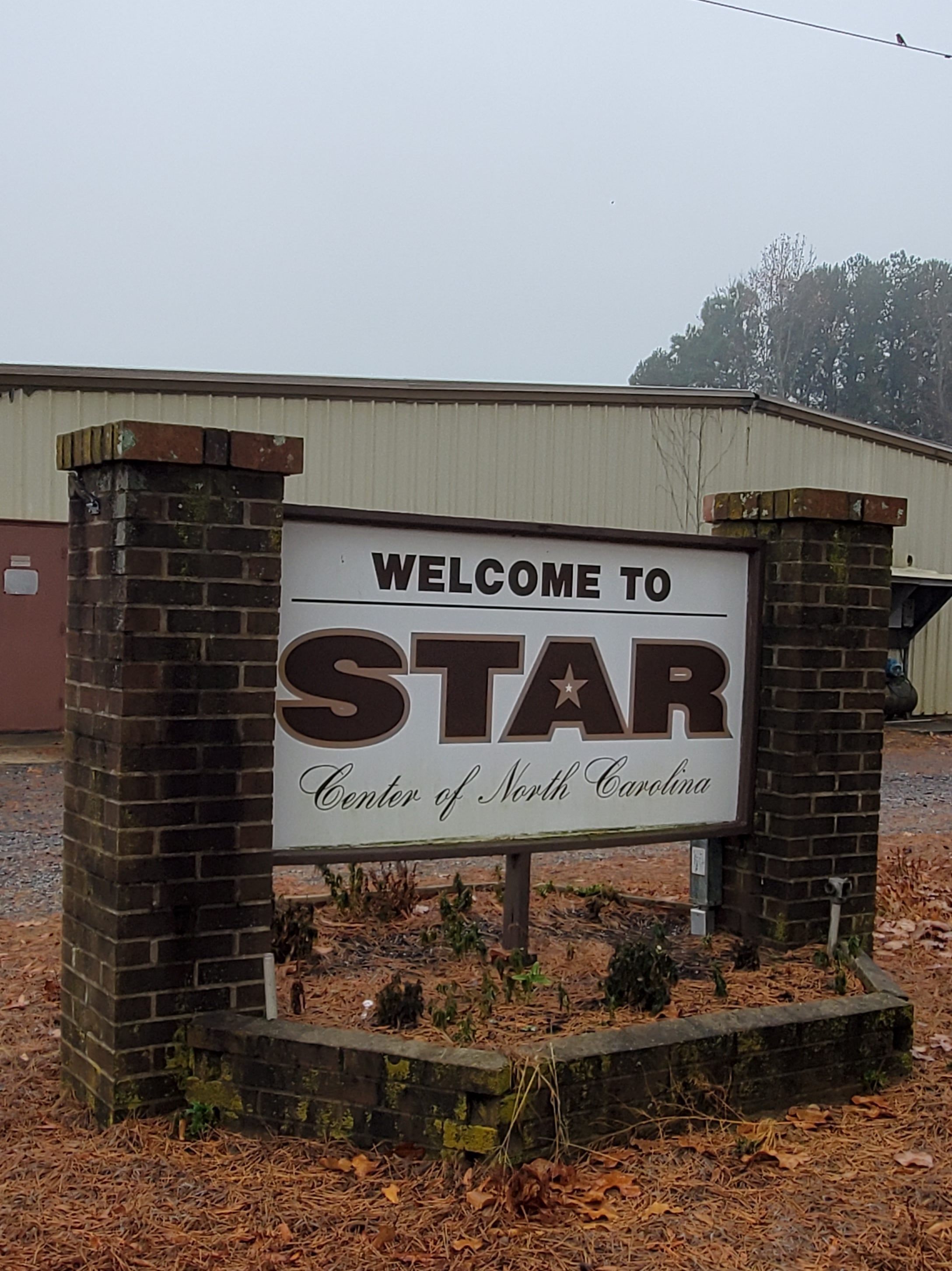
Star
Star is known as the geographic center of North Carolina as measured via satellite, according to the Army Corps of Engineers. A plaque marking the exact center was placed at 35°23′59″N 79°46′00″W (35.399756, -79.766613). The plaque is on private land and not open to visitors. However, conflicting reports show the geographic center actually being in Chatham County, northwest of Sanford.
The town of Star was incorporated in 1897. It was originally called Hunsucker’s Store, after a trading post operated by the original landowner, Mr. Martin Hunsucker. After the Civil War, a man named Angus Leach moved to Hunsucker’s Store and helped to found the present Town of Star, serving as postmaster, hotel operator, and general merchandise store owner. Gold was discovered in the area around 1866, and by 1874 there were extensive gold mining operations in this part of the state, particularly around the Little River area of Star. When the Aberdeen and West End Railroad (owned by the Page family of Aberdeen, NC), completed a branch to Star from Filo, NC (Biscoe, North Carolina) in 1895, it was only a short period later before Star was incorporated into a town.
Star was a major shipping point for lumber, turpentine, and bricks beginning in 1896 with the completion of the Asheboro and Montgomery Railroad, also built by the Page family. In 1896, the Leach Family erected a large wooden hotel to accommodate the travelers and workers of the railroad, and the hotel (The Star Hotel Bed and Breakfast) is still standing today and is owned by Gary Spivey. In 1897, the Aberdeen and West End Railroad merged with the Asheboro and Montgomery Railroad to form the Aberdeen and Asheboro Railroad, thus opening the area to a whole new range of shipping. The timber industry was the first major factor in the growth of Star. The Star Lumber Company, headed by Z.T. Wright, J.B. Shamburger, and W.T. Harper, had built a tramway in 1896 to haul logs to the mills in town. The tramway was removed in 1901 when the Durham and Charlotte Railroad was built to Star.
Around 1900, a bottling plant was established in Star by J.R. Ingrahm to bottle sodas for the area. This company preceded the Coca-Cola Plant in Star, which was later moved to Biscoe, North Carolina. Also in 1900, the Montgomery Roller Mill was incorporated with a capital stock of $4,700 by Braxton Auman, who also operated a whiskey distillery and chair factory. In 1907, Star’s first undertaker, Mr. H.D. Phillips, established a funeral parlor. This was the beginning of a long and successful business for the Phillips family who still operate the Phillips Funeral Home today.
The town saw massive growth between 1912 and 1950 when the Norfolk Southern Railway purchased the old lines of the Aberdeen and Asheboro Railroad and the Durham and Charlotte Railroad. The operation held a depot, water tank, and coal chute in Star. This new era saw the introduction of the hosiery mill industry, a boom in lumber production, various new stores and products, and a huge surge in population. In 1914–1915, Boy Scout Troop 111 was established in Star, one of the earliest in North Carolina. Since that point, the town continued to slowly grow into a prosperous community.
In the 1960s, the town undertook the task of erecting some of the first public housing units in the state. On March 14, 1969, Lancer Inc., one of the nation’s top 50 upholstered furniture manufacturers, started its operations in Star and continues to be one of Star’s largest employers, having expanded its operations six times. Since then, the hosiery mills experienced a decline and eventually left Star. This left hundreds unemployed, and the once prosperous town of Star began to wither away. The buildings that once employed many now mostly sit empty. In September 2013, downtown Star was honored by being listed on the National Register of Historic Places as the Star Historic District.
Today, Star has been designated as a U.S. Postal Service Christmas Town. The Star Christmas Parade is documented as one of the oldest in the State, as well as the longest with the most entries. Central Park NC has its current headquarters in the old Country Life Academy building in Star, now known as STARworks Center for Creative Enterprise. STARworks hosts several annual events including the Annual Glass Pumpkin Patch and FireFest: Community Fueled Art. The town is located at the center of the state of North Carolina. Local and nearby attractions include Uwharrie National Forest, Badin Lake, Lake Tillery, North Carolina Zoo, and Pinehurst.
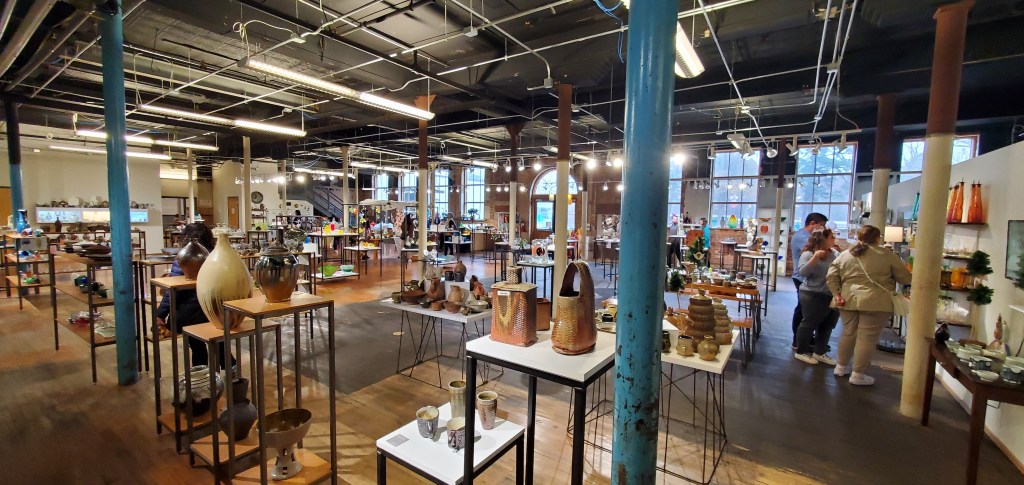
StarWorks
Located at 100 Russell Drive along the railroad tracks as you enter Star, StarWorks [a 501(c)(3) nonprofit that hosts, ceramic, metal, and glass artist residencies and internships] is a large gallery showcasing art in many forms, especially glass. All items, small and large, are available for purchase. They have a School House Gallery, StarWorks Ceramics, and a Cafe & Tap Room. In addition to their regular hours, the gallery hosts several sales and events throughout the years, including at the holidays. They place a high priority on K-12 education, including field trips, classes, demonstrations, and independent studies. 2023 events included GlassFest, FireFest, Hot Glass Cold Beer, Glass Pumpkin Patch, and Holiday Market.
Biscoe
The town is named after Henry Biscoe, an important customer of the local lumber business. The area was formerly called “Filo,” before the current name was adopted in 1895. Biscoe’s past was dependent on the railroad industry, and it was once an important repair center for railroad equipment. The Aberdeen and West End Railroad (owned by the Page family of Aberdeen, North Carolina) completed a branch to Star, North Carolina from Filo, NC (current Biscoe) in 1895. The A & W. E. R.R. was merged into the Aberdeen and Asheboro Railroad in 1897. Biscoe was incorporated in 1901.
Candor
Candor is the home of the North Carolina Peach Festival, which is held every year on the third Saturday of July. The town’s welcome sign reads: Welcome to Candor. Peach Capital. Candor was so named for the settlers’ honest dealings.
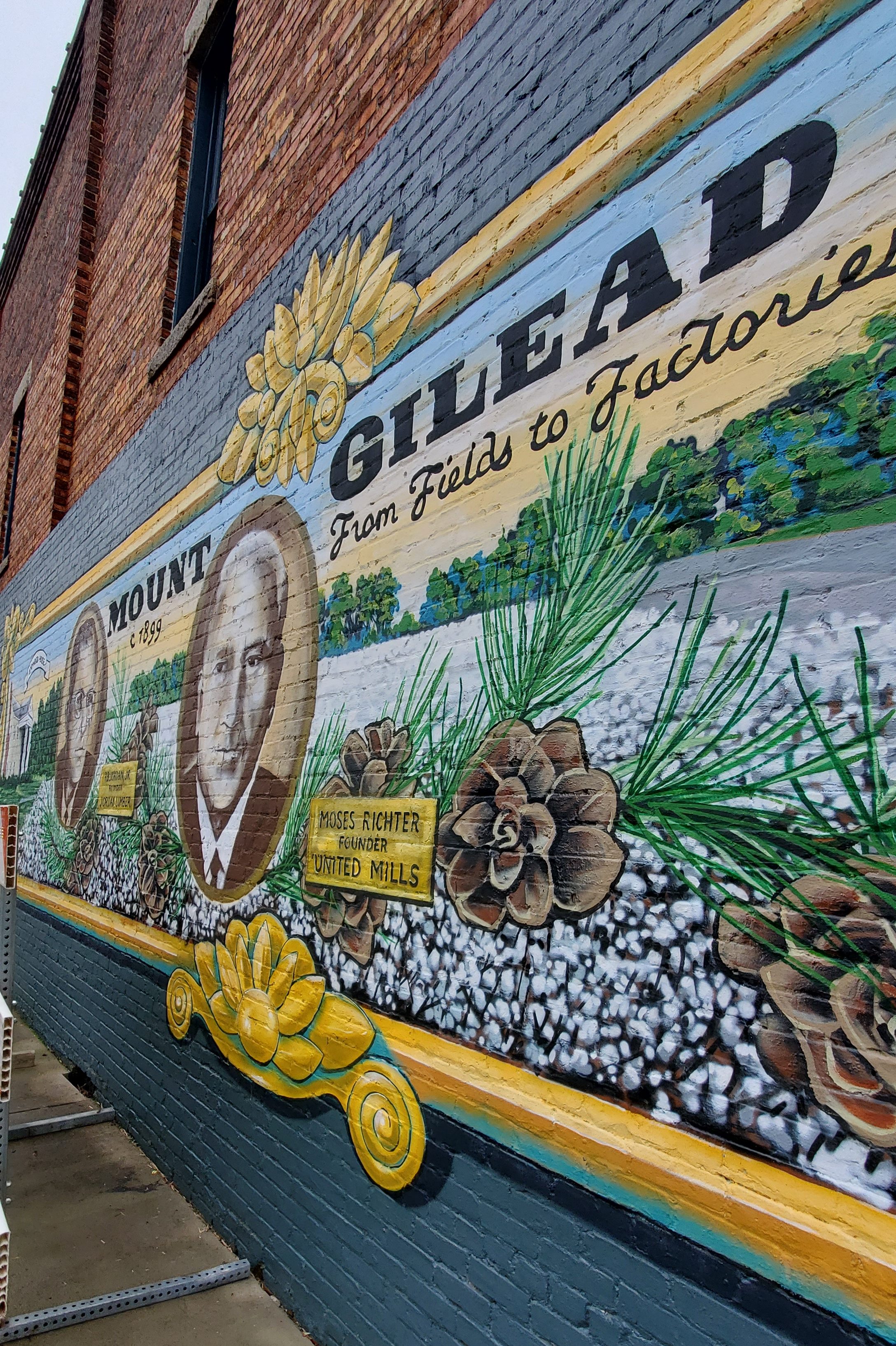
Mt. Gilead
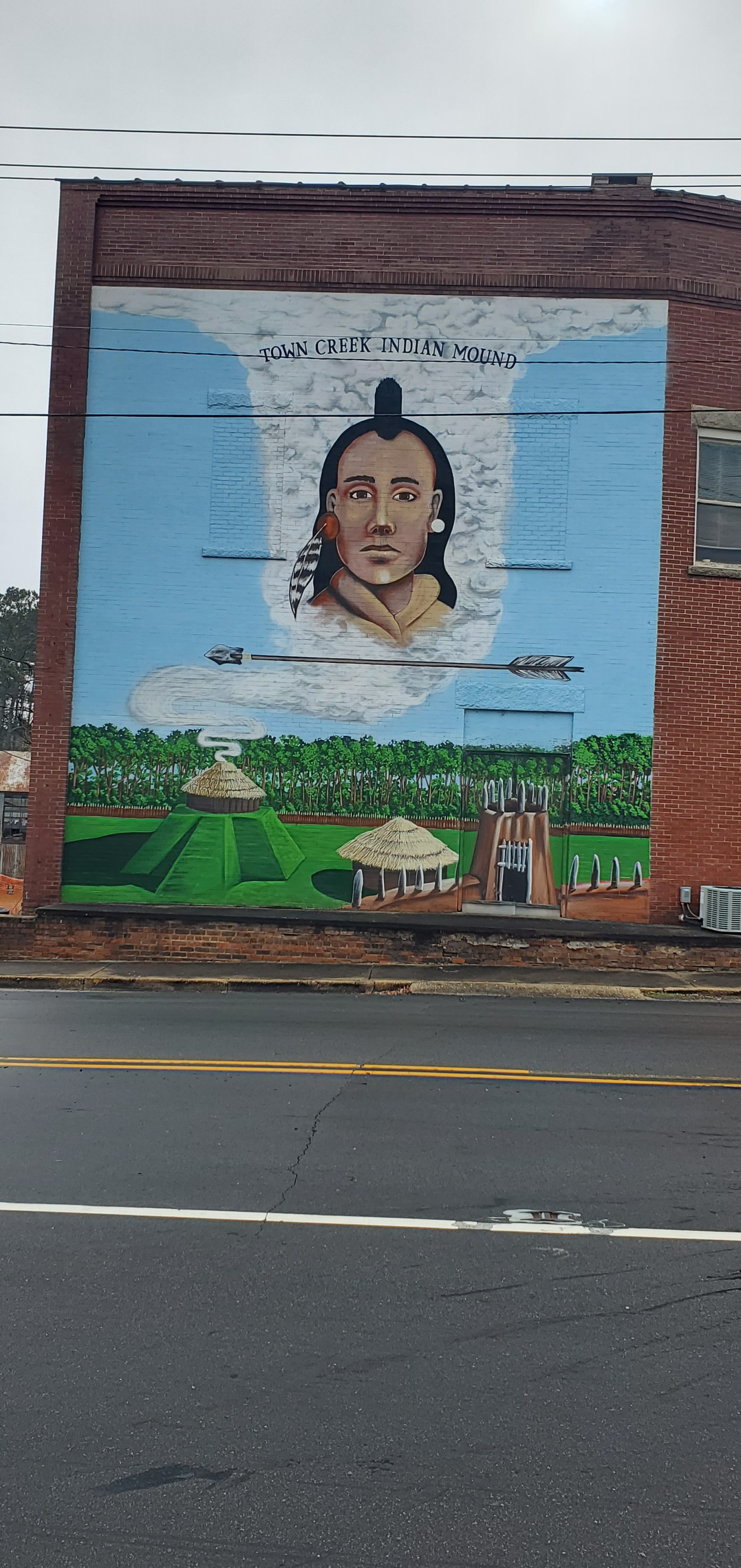
This region was occupied by the Pee Dee culture, part of the Southern Appalachian Mississippian culture, from about 980 to 1150. They built the earthwork platform mound and other structures at Town Creek Indian Mound, which has been designated a National Historic Landmark since 1966. It is the only Native American site in the state to be designated as a national landmark. In the 21st century, the Pee Dee are based in South Carolina, where the state has recognized several bands as tribes.
Mount Gilead was incorporated in 1899 as the textile industry built mills in the Piedmont section of the state. They processed the commodity crop of cotton, which had been important to the South since before the Civil War. The textile mills provided jobs to white residents of the region, later also employing blacks and supporting relative prosperity in the region. Since the late 20th century, many textile jobs moved offshore in a restructuring of the industry as it sought lower labor costs. Like many small southern towns, Mount Gilead suffered economic and population decline following the loss of these textile jobs.
The town’s Historic District was listed on the National Register of Historic Places in 2005. Mount Gilead was selected to participate in the N.C. Small Town Main Street Program (co-sponsored by the National Trust for Historic Preservation) and received a S.T.E.P. (Small Town Economic Prosperity) grant of $220,000 to help revitalize the downtown area and create jobs.
Most buildings in town were built late-nineteenth and early-twentieth century. Mount Gilead had an abundance of timber, clay, stone, and slate to provide for any sort of construction that was needed or desired by owners and builders. Several structures incorporate local sandstone used in door and window sills and lintels.
Mount Gilead Museum
The Mount Gilead Museum is located in a restored 18850Victorian house near the downtown area, that belonged to the McAulay family, who played an important role in Mount Gilead business, church, social, and civic life. The museum houses many documents, photographs, and historic artifacts that tell the story of Mount Gilead’s past. (Open only Sundays by appointment)
Town Creek Indian Mound
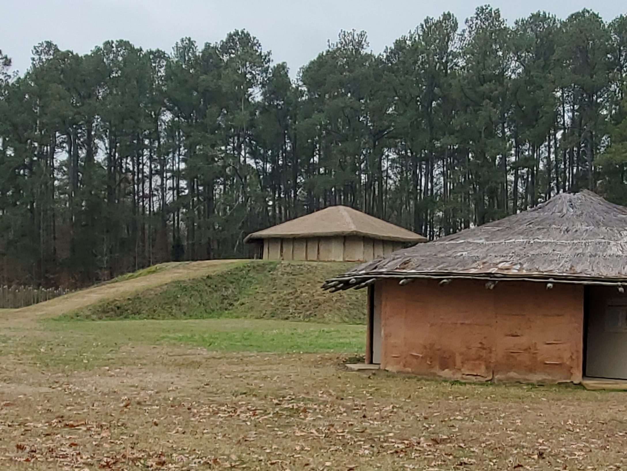
Town Creek Indian Mound is a prehistoric Native American archaeological site located near Mount Gilead. The site, whose main features are a platform mound with a surrounding village and wooden defensive palisade, was built by the Pee Dee, a South Appalachian Mississippian culture people. They thrived in the Pee Dee River region of North and South Carolina during the Pre-Columbian era. The Town Creek site was an important ceremonial site occupied from about 1150—1400 CE. It was abandoned for unknown reasons. It is the only ceremonial mound and village center of the Pee Dee located within North Carolina.
The Pee Dee people shared the Mississippian culture that was characterized in part by building large, earthwork mounds for spiritual and political purposes. They participated in a widespread network of trading that stretched from Georgia through South Carolina, eastern Tennessee, and the mountain and Piedmont regions of North Carolina. The Town Creek site is not large by Mississippian standards. The earthwork mound was built over the remains of a rectangular-shaped earth lodge. The site was declared a National Historic Landmark on October 15, 1966.
The site is the only national historic landmark in North Carolina to commemorate American Indian culture. It is owned by the North Carolina Department of Natural and Cultural Resources and is operated by the Division of State Historic Sites. Today the Pee Dee people are based in South Carolina, where the state has recognized four bands and one group.
The state has developed several facilities at Town Creek Indian Mound (509 Town Creek Mound Rd.) that are open to the public. It built a reconstructed ceremonial center, restoring the platform mound and reconstructing a temple on it. It also reconstructed a minor temple and the mortuary. The visitor center houses interpretive exhibits, audiovisual programs, and a gift shop. The visitor center, minor temple, and mortuary are handicapped accessible. Several trails and outdoor monuments are located on the property. Fourteen picnic tables are located on the grounds
Pee Dee
The community was named for the Pee Dee people, who built the nearby Town Creek Indian Mound.

Troy
Troy lies in an area once known for its vast longleaf pine forests. Much of the town’s early development came from the harvesting of those trees for lumber and turpentine. Originally known as West Old Fields, the name was changed to Troy in 1843 when the county seat of Montgomery County was moved there from Old Lawrenceville. The town was incorporated in 1853.
The coming of the Asheboro and Aberdeen railroad as well as the gold mining industry surrounding the town accelerated growth in the late 19th century. By the 20th century textile mills and lumber mills were contributing heavily to Troy’s economy. The Hotel Troy, Montgomery County Courthouse, and Troy Residential Historic District are listed on the National Register of Historic Places.
This newly constructed amphitheater is located at 225 Smitherman Street within the Capel Centennial Park. The Town of Troy holds free concerts at the TownStage from April through October, and movie nights are held here during the summer months of June, July, and August.
TroyFest is the Town of Troy’s annual Independence Day Celebration with daytime and evening events. Daytime activities include a parade, music, family entertainment, kid games and rides, and vendors. The evening extravaganza includes music, family entertainment, and vendors, plus a fireworks display at the Park.

Capel Rug Outlet
In Candor, you’ll find the Capel Rug Outlet, showcasing high-quality rugs by the well-known brand in many styles and price points — from smaller 18″ x 36″ rugs to the super large 18-foot rugs.
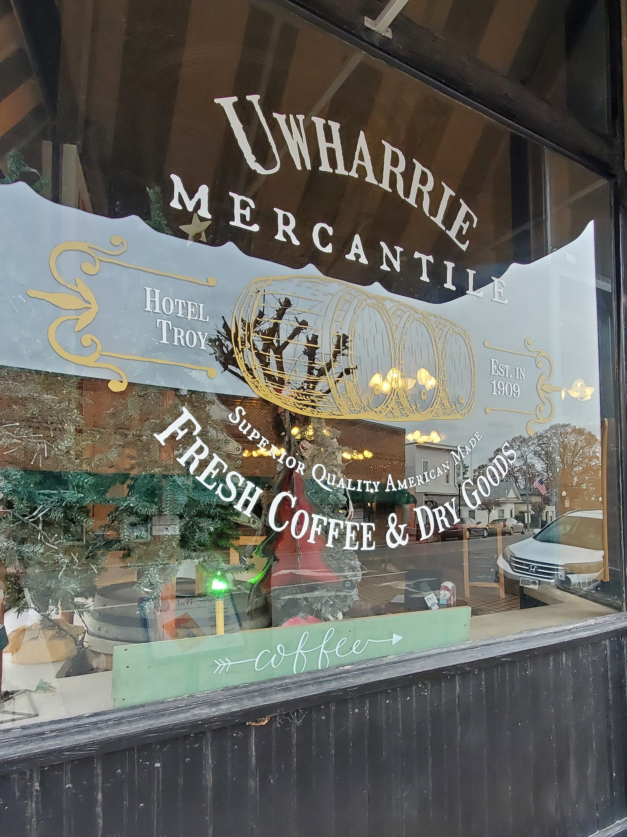
Uwharrie Mercantile
Located on the ground floor of the old Hotel Troy (401 N. Main St.), Uwharrie Mercantile serves up lunch during the week and coffee every day, plus you can shop through their dry goods and gifts for yourself or someone else, including some work by local artists. Definitely stop here while in town and stroll through the other local shops as well.
Okeewemee
In the early 19th century, small schools had sprung up in Montgomery County. One of those was the Forks of Little River School, later called Crossroads. By 1891, the school had assumed the name of Okeewemee in honor of the community and its first Post Office which had it start in the home of Elizabeth Coggins and John L. Allen.
The Carter Mine is one of the oldest mines in North Carolina. It is described as being on a vein that contained much lime carbonate and a rare telluride of gold. The mine is said to have produced $100,000 or more from workings less than 100 ft. deep. Gold-bearing quartz was found in a vein that averaged 3 ft. in width and contained some very rich steaks. Rock found on the dumps in 1934 included “sugar” vein quartz.
Eldorado
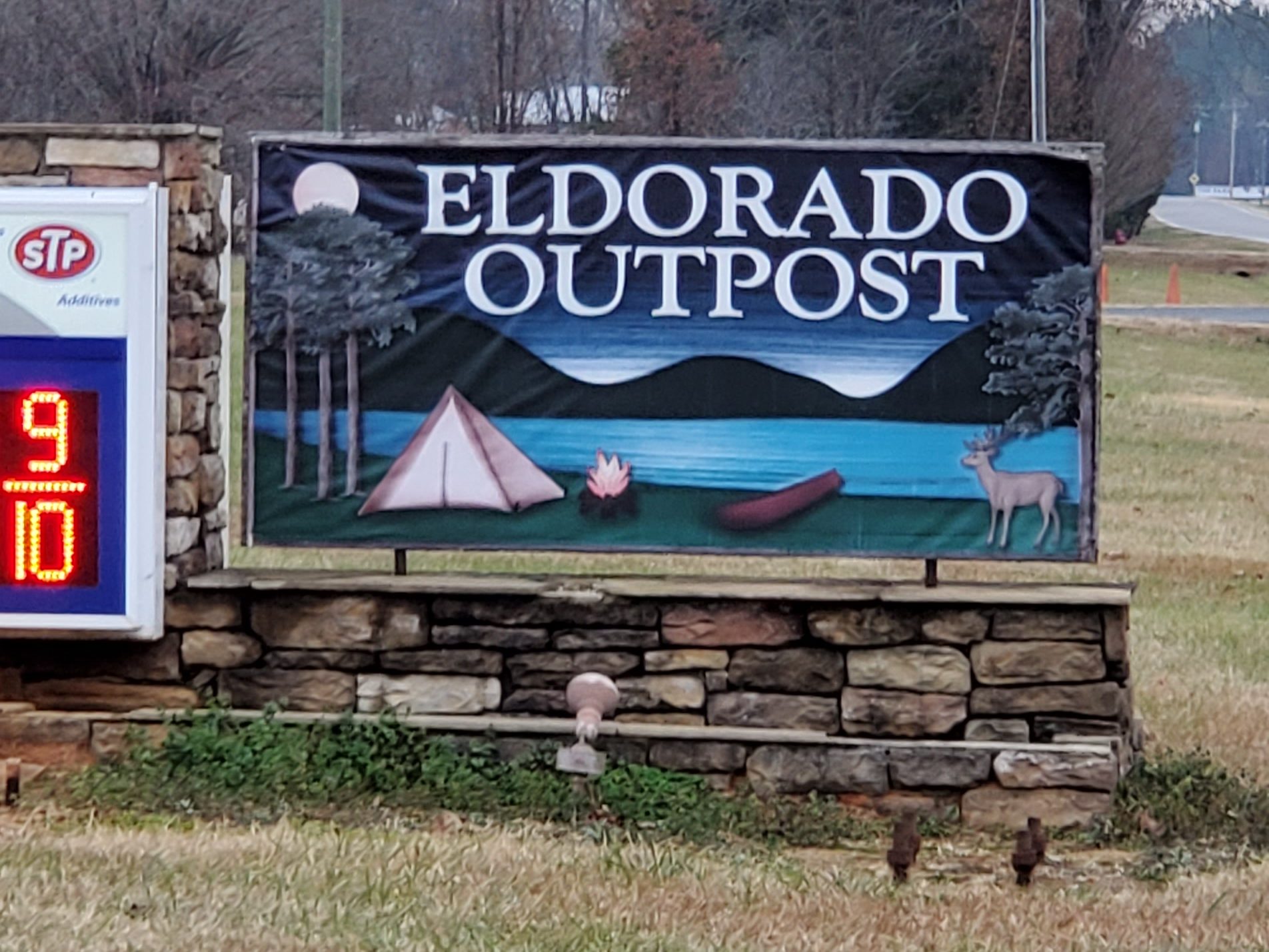
Eldorado Outpost
The Eldorado Outpost (4021 NC Hwy 109N) is frequented by hunters, fishers, hikers, and others visiting the nearby Uwharrie Forest, known for a few Big Foot/Sasquatch sightings. You’ll find most anything you’ll need for the day here, along with Big Foot merchandise too.
Ophir
Ophir is located in the heart of the Uwharrie National Forest in the Uwharrie Mountains. There are numerous campgrounds and hiking trails, hunting and fishing spots, and recreational services nearby for the outdoorsman’s comfort. Badin Lake and Lake Tillery are only a few miles away, and the Uwharrie River runs through it.
Ophir was named after Ophir, the biblical region where gold was produced for King Solomon’s temple. The small community was settled during the mid-19th century, during the gold boom in the state of North Carolina. Very little mining was done in Montgomery County during the Civil War. Manpower was short. Men were away at war and those left at home were focused on taking care of the farms and their families. In 1891, there were 35 mines in operation in the county, but a short while later in 1896, the NC Geographical Survey named only 18 mines in use. In the northwest corner of the county there were many regional mines, including several in the Ophir area. These mines all had a major impact and played important roles in the county’s mining history.
The Russell Mine, one of the larger producers in Montgomery County, had a total production of around 15,000 ounces of lode gold. This mine included several open pits and underground workings that attained a depth of over 200 feet. The largest pit, “Big Cut”, is about 300 feet long, 150 feet wide, and 60 feet deep. As a whole, material excavated from this pit is said to have averaged $2.00 to the ton in gold. The entire mass is gold-bearing but only certain parts of it are rich enough to work, and even these parts are of low grade except for rich seams that appear and disappear abruptly.
The Steel Mine is located just west of Ophir along the Uwharrie River. It was a lode gold mine. Gold is said to have been discovered here about 1832, and the mine appears to have been worked extensively before 1853. Someone said that at this mine, gold digging amounted to mania for farmers were locating gold in almost every hill. The only year for which production data are available is 1887, when $150,000 (about 75,000 ounces) in gold was produced. In 1876 the property was purchased by an English company, and until 1884 the ore was treated in Chilean mills. Today, the Steel Mine is nearly inaccessible and the 1832 structures are in total ruins.
Next stop… Alamance County!

The Capel rug outlet is in Troy, not Candor.
LikeLike