Union County was formed in 1842 from parts of Anson County and Mecklenburg County. Its name was a compromise between the Whigs, who wanted to name the new county for Henry Clay, and the Democrats, who wanted to name it for Andrew Jackson. The Helms, Starnes, McRorie, and Belk families were prominent in the town as well as in Monroe and Charlotte.
For the first half or more of the twentieth century, cotton was the “king” crop for farmers. Two cotton gins operated 24 hours a day during harvest season. Country stores throughout the community served as popular gathering places as well as sources for gas, various sundries, and penny candies.
The county also as a ghost town called Gibraltar, but we were unable to find it.
Fairview
Fairview is located in the foothills of the Uwharrie Mountains. Tyler Knob is the highest point at 849 feet at its peak, sitting on the Fairview-Unionville town line. The Rocky River runs through Fairview along the higher foothills of the Uwharrie Mountains. An area in the southwest quadrant near Crooked Creek called Red Field, may have served as a Native American encampment site as evidenced by an abundance of arrowheads.
Unionville
The town of Unionville was originally chartered by the North Carolina General Assembly in 1911. Unionville is known for its community spirit. For more than 70 years, the annual Unionville Barbeque, held at Unionville Elementary school, has served as one of the largest fundraisers for a school in the state of North Carolina. Other community events held annually include an annual 4th of July parade, Christmas parade and tree lighting ceremony, and community concerts (Concerts in the Park) held on the grounds of the community center.
The Unionville Town Seal was created by Mr. Eric Hinson of Unionville Elementary School with the assistance and input of a team of students: Greg Felker, Michael Herman, Abigail Jones, and Janine Sanchez.
New Salem
New Salem is the home of Polk Mountain, which is the southernmost high peak of the Uwharrie Mountains at 861 feet (262 m). New Salem is also the site of Eastview Speedway, located on NC 205.
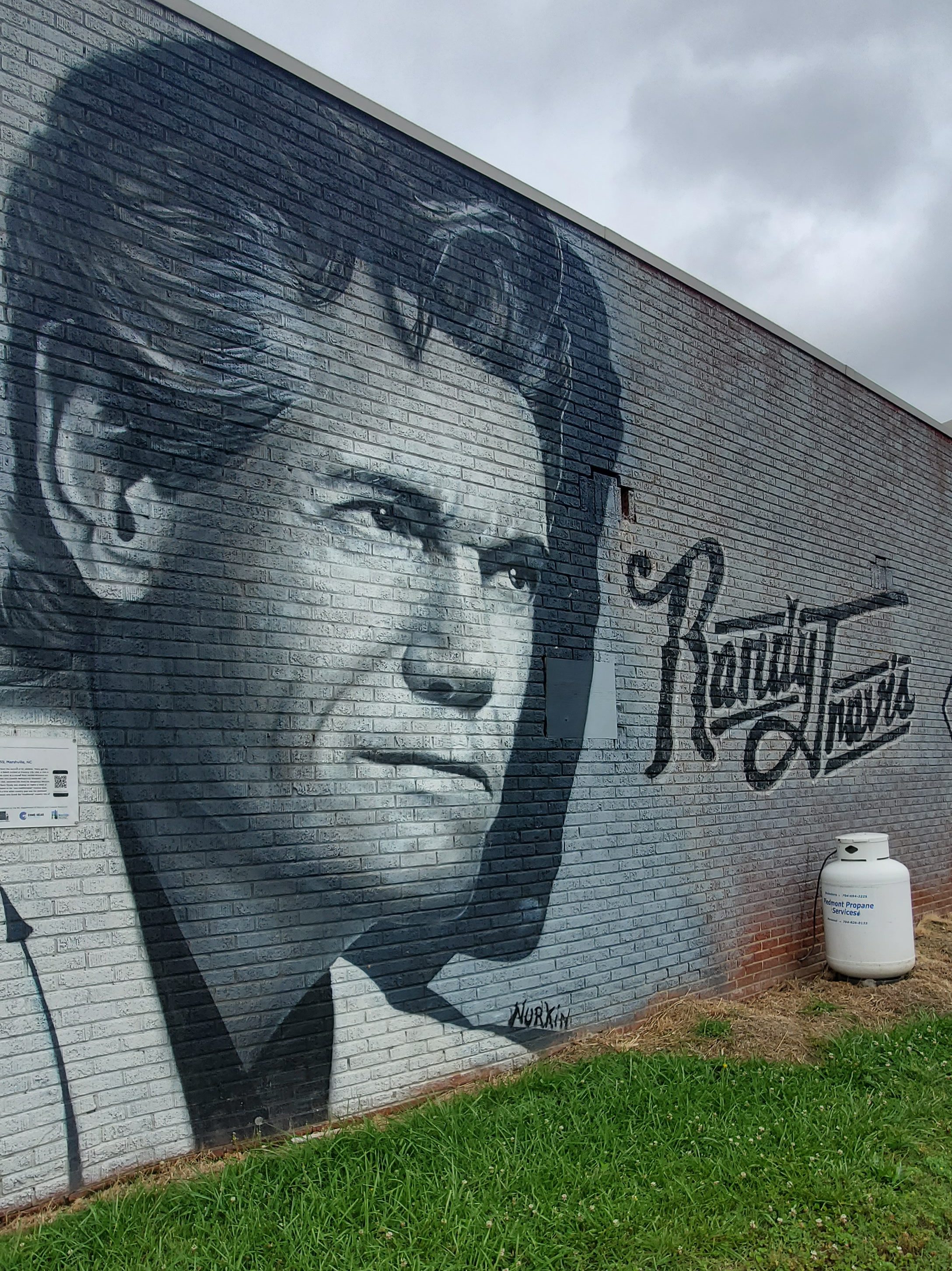
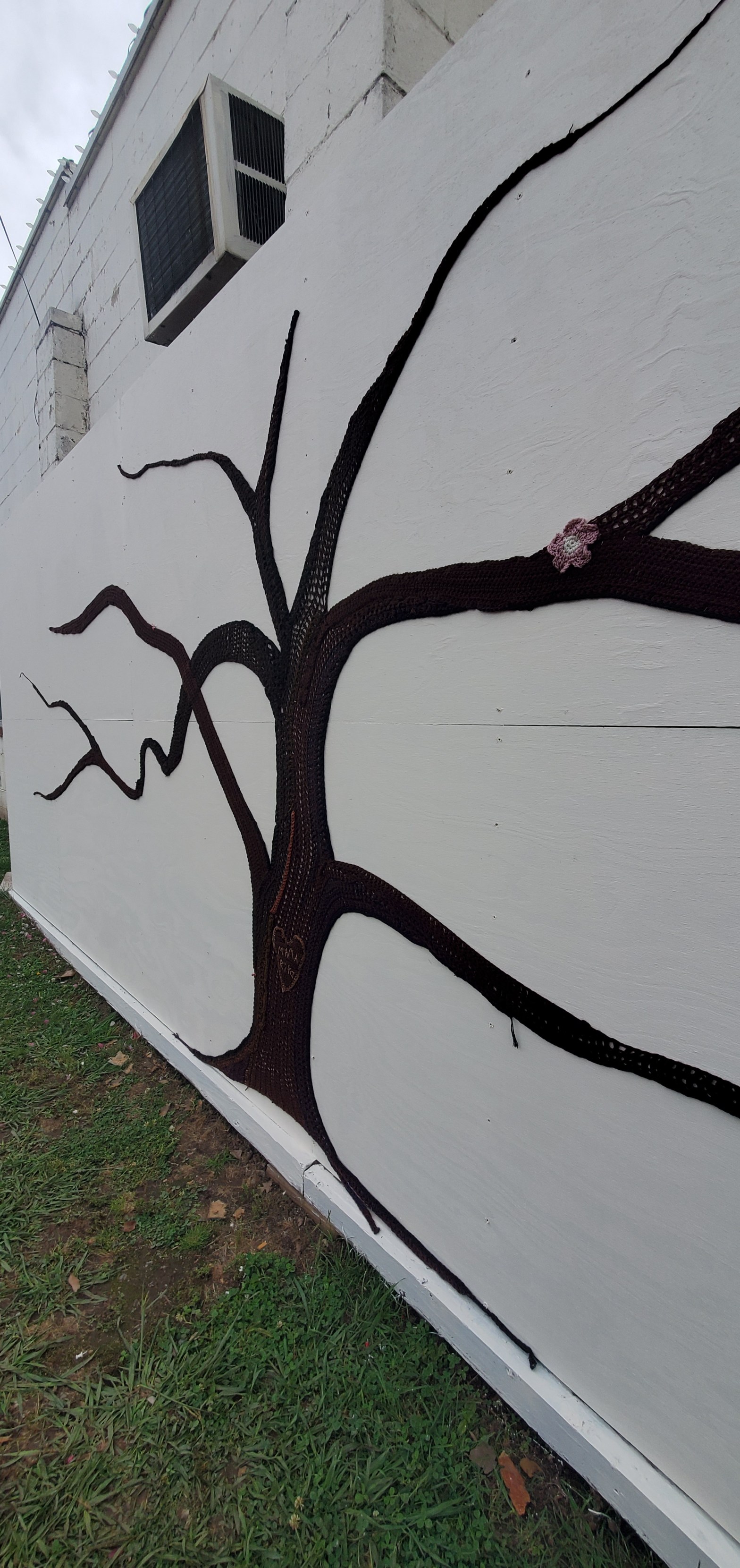
Marshville
Marshville is known as the birthplace of country music singer Randy Travis. Marshville is also the site of the Randy Travis Festival, an annual street fair and carnival that takes place every fall. Parts of the 1985 Oscar-nominated movie ‘The Color Purple’ were filmed in Marshville. The movie was directed by Steven Spielberg and its cast included Oprah Winfrey and Whoopi Goldberg.
In June 2012 the Marshville Museum And Cultural Center was opened with exhibits on the history of Marshville, the surrounding area, and its residents. Marshville is also the site of the Boll Weevil Festival, an annual street fair and carnival that takes place each fall. Marshville is said to be infamous for the highest water bills in the county, though we are unable to corrobarate this.
On the day of our trip (May 20, 2023), the town of Marshville was celebrating their first ever town festival!
Marshville Museum and Cultural Center
Stop by the Marshville Museum and Cultural Center (201 Main St) for some local history. Kids can have a scavenger hunt at the museum and turn their sheet in for a prize.
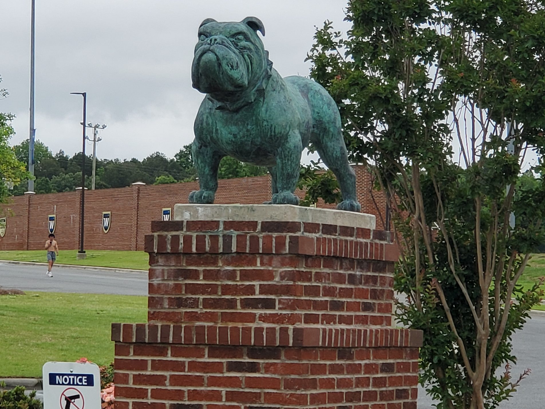
Wingate
In Wingate, you will find the Jesse Helms Center (3910 US Hwy 74 East) as well as Wingate University (211 East Wilson St), including The Batte Center (403 N Camden Rd). Take a drive through campus or stay for a performance.

Monroe
Monroe was founded as a planned settlement. In 1843, the first Board of County Commissioners, appointed by the General Assembly, selected an area in the center of the county as the county seat, and Monroe was incorporated that year. The town was named for James Monroe, America’s fifth president. It became a trading center for the agricultural areas of the Piedmont region, which cultivated tobacco. Monroe was home to the Starlite Speedway in the 1960s to 1970s. On May 13, 1966, the 1/2 mile dirt track hosted NASCAR’s ‘Independent 250.’
Monroe, the county seat of Union County, also became a focal point during the Civil Rights Movement. In 1958, local NAACP Chapter President Robert F. Williams defended a nine-year-old African-American boy who had been kissed by a white girl in an incident known as the Kissing Case. A second African-American boy, aged seven, was also convicted and sentenced to live in a juvenile reformatory until he was 21 for simply witnessing the act. The former First Lady, Eleanor Roosevelt, talked to the North Carolina governor to urge restraint, and the case became internationally embarrassing for the United States. After three months, the governor pardoned the boys.
During the 1960s, the city had a population estimated at 12,000; the press reported an estimated 7,500 members of the Ku Klux Klan gathering in the city, many coming from South Carolina (only 14 miles from the state border).
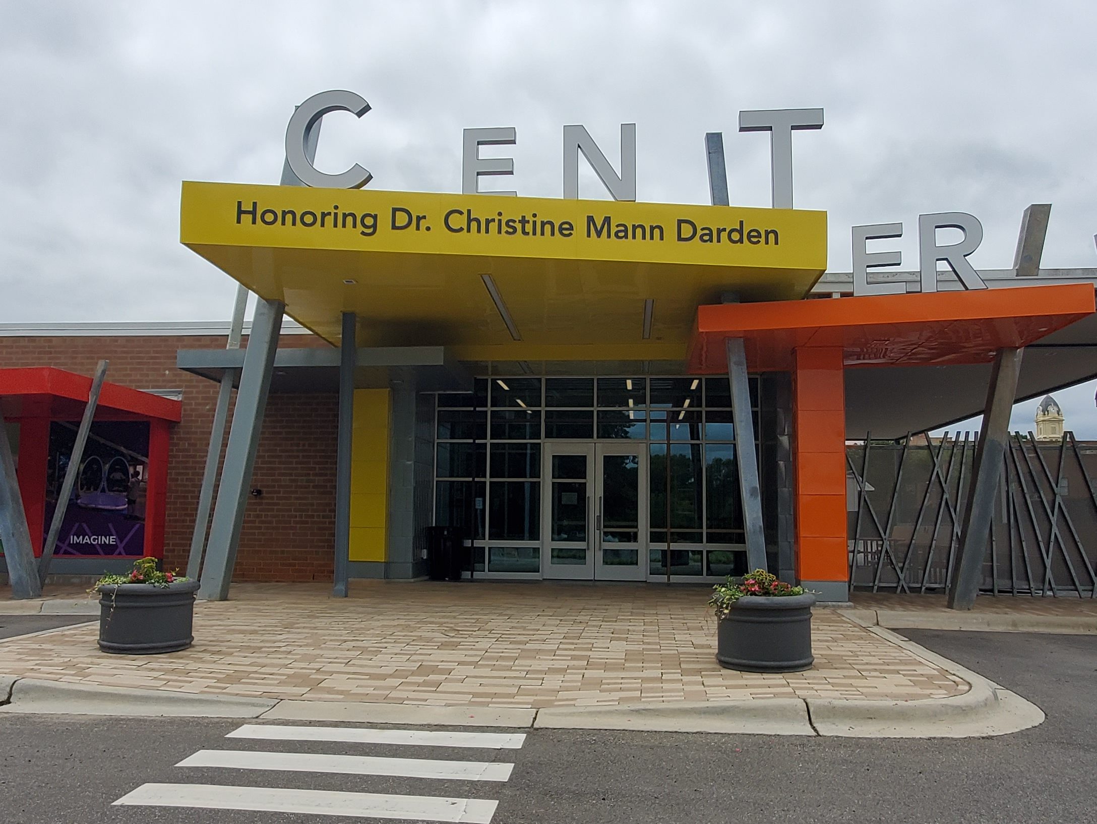
The Jesse Helms family was prominent among the white community during these years. Jesse Helms Sr. served as Police and Fire Chief of Monroe for many years. Jesse Helms, Jr. was born and grew up in the town, where whites were Democrats in his youth. He became a politician and was elected to five terms (1973–2003) as a U.S. Senator from North Carolina, switching to the Republican Party as it attracted conservative whites. He mustered support in the South, and played a key role in helping Ronald Reagan to be elected as President of the United States. Through that period, he was also a prominent (and often controversial) national leader of the Religious Right wing of the Republican Party. The Jesse Helms Center is in neighboring Wingate, North Carolina.
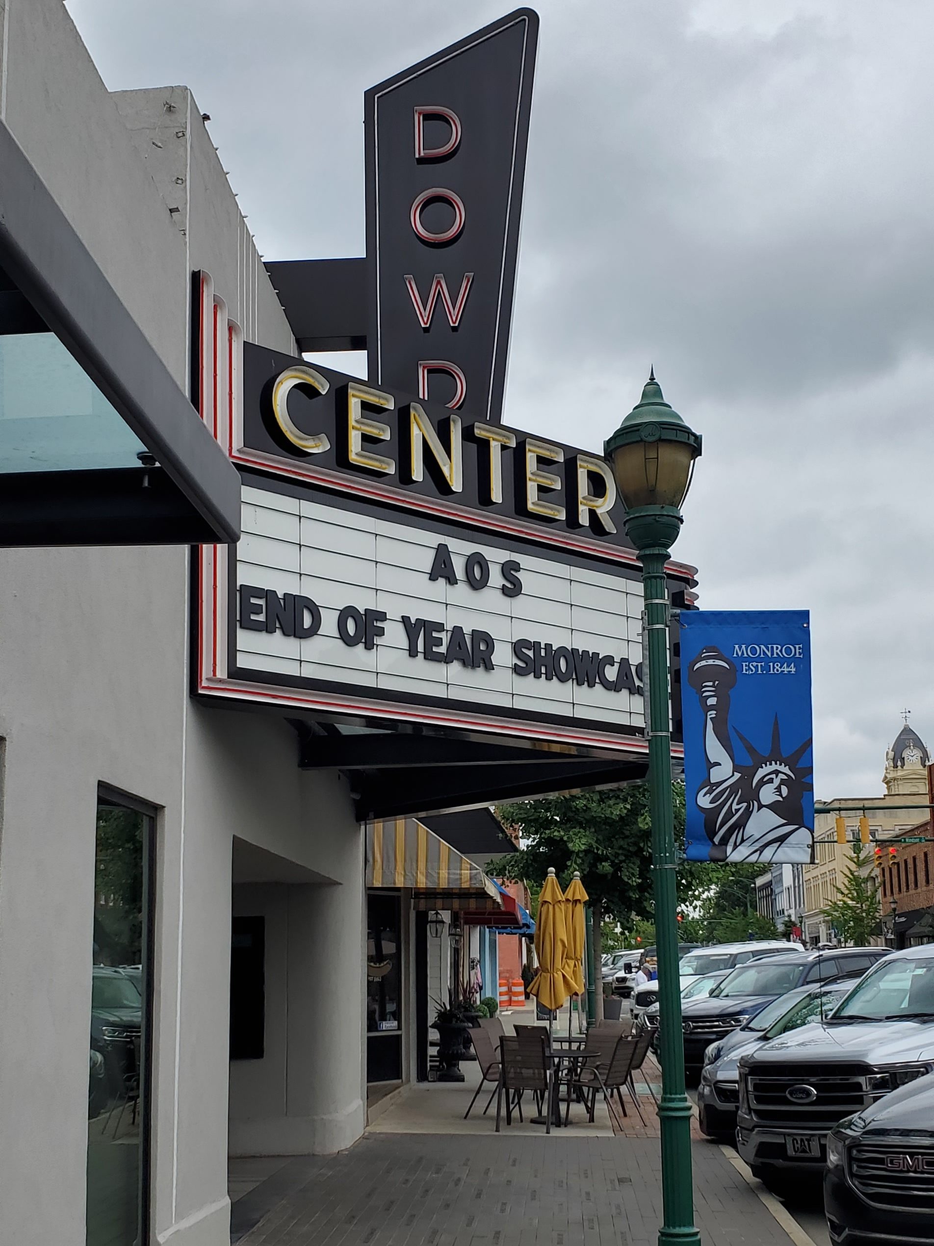
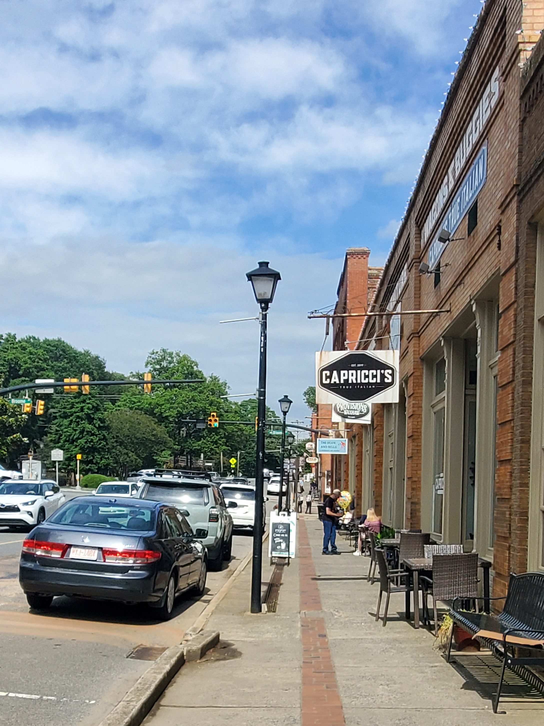
Monroe has a wonderful, walkable downtown area with shops and restaurants. Locals recommend Main Street Bistro, Southern Roots Bar & Grill, and the Oasis among other restaurants. Visit the Dowd Center Theatre and the Monroe Science Center (for kids). We also recommend stoping by Bela Nature, a gardening and gifts boutique. Each November, the town hosts the Warbirds Over Monroe Air Show.

Treehouse Vineyards
The lovely Treehouse Vineyards (301 Bay St) has three treehouses on the property: two for overnight stays and designated for just a date night. Only one treehouse is visible from the parking lot, while the other two stay well hidden. These treehouses stay booked, so get your reservation in as soon as possible!
Dowd Center Theatre
Monroe Science Center
318 E Franklin Street

JAARS
The town of Jaars, capitalized as JAARS on some maps, is a census-designated place (CDP) in Union County. The population was 597 at the 2010 census. The region’s name comes from the JAARS Center (7405 Jaars Rd, Waxhaw), a non-profit organization that that leads the effort in worldwide Bible translation. The group has translated the Bible into countless languages around the world, including for indigenous tribes. It’s a fascinating place to visit, including the JAARS Museum, the Museum of the Alphabet (6409 Davis Rd, Waxhaw), and the Mexico Cardenas Museum (6403 Davis Rd, Waxhaw). The Night at the Alphabet Museum is a monthly event.
Waxhaw
This town is a must-see and is high on our list of places in North Carolina to return to! With it’s proximity to the Charlotte area, Waxhaw center has become a bustling place for antiques, fine dining, culture, and more.
The original inhabitants of the Waxhaw region were a Native American people group known as the Wysacky or Waxhaws. The area was first settled by colonists in the mid-eighteenth century. Most settlers were of German and Scots-Irish origin. Settlers became subsistence farmers and were known for being independent. Andrew Jackson, who later would become the seventh President of the United States, was born nearby in 1767, prior to the American Revolution. There is some disagreement as to which of the Carolinas was his birthplace because of the proximity of the border between the two. However, there are historical marker signs around Waxhaw, North Carolina describing Andrew Jackson’s early connection to the area. His relationship to the area also is documented at the Museum of the Waxhaws. Andrew Jackson State Park is minutes from downtown Waxhaw, which has a memorial and other information about Andrew Jackson
The arrival of the railroad in 1888 created access to the markets in Atlanta and helped the town reach prosperity. The railroad tracks were laid through the center of town to show the importance of the railroad system to the community. Beginning in the late nineteenth century, the community began to develop cotton mill factories for manufacturing textiles. The railroad helped increase access for the products of this industry. Cotton manufacturing was important to the region through the 1940s. Postwar changes in the economy, with shifts of the textile industry to jobs in other areas of the country and out of the country.
Waxhaw has done an amazing job of creating vibrant shopping and dining district with a large variety of storefronts, a brewery, plus architecturally significant houses are made easily accessible on both sides of the train track that runs directly through the center of town. Its Small Town Main Street committee is working on an integrated approach to developing and marketing the historic center of town. Stores on both sides of the tracks as well as green areas and convenient parking are connected by a footbridge over the railway tracks. We recommend stopping by the Funki Monki Home Furnishings shop for decor and gifts as well as Waxhaw Candles and several antique shops too. At the right time of day, you can stand atop the bridge as the train runs underneath!
Also stop by the Museum of the Waxhaws (8215 Waxhaw Highway), the Waxhaw’s Farmers’ Market (27283 Waxhaw Parkway) and take a Waxhaw Historical Walking Tour too!
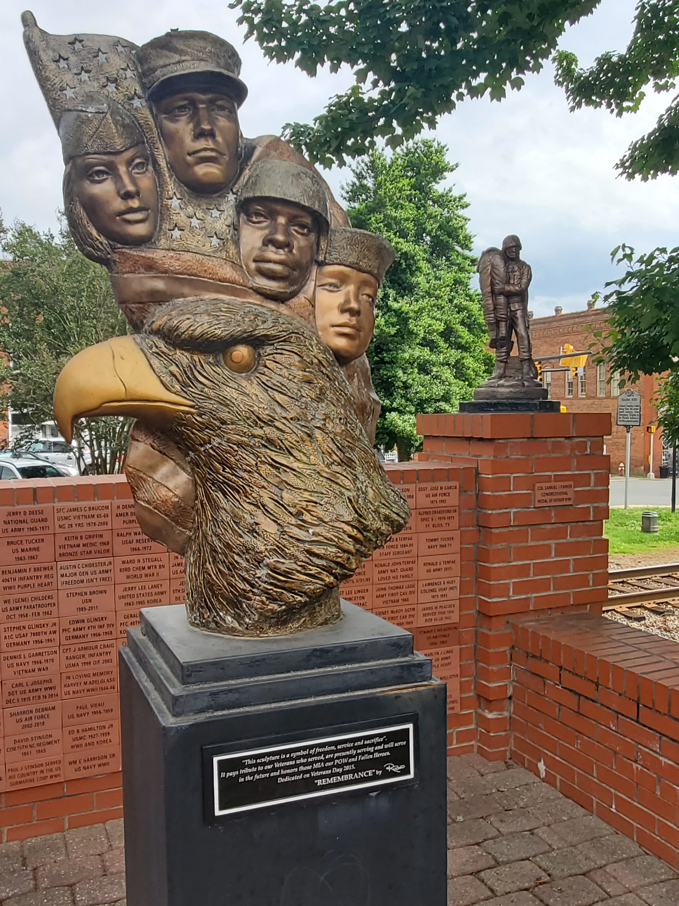
Military Wall of Honor
100 N. Block of Main St
Waxhaw Events
- Spring Kaleidoscope Fest: Kaleidoscope Fest is held each year in downtown Waxhaw in the Spring and celebrates all things art from the fine arts, musical and performing arts, culinary arts, martial arts and more.
- Jammin’ by the Tracks: Kick the summer off right with some great tunes downtown by the tracks on the First Friday night of the month May – September.
- Independence Day Celebration: Waxhaw’s Independence Day Parade takes place on Main Street in Waxhaw beginning at 10 a.m. and is attended by over 10,000 people.
- Autumn Treasures: Second Week of October – There is something for everyone during Autumn Treasures. This event features the Kansas City Barbeque Society sanctioned “Grill’n & Chill’n’” BBQ cook-off. In addition, the town offers live entertainment and booths with various arts and crafts. A kid zone and array of concessions are enjoyed by participants as well.
- Holiday Festival of Lights: The holiday season begins the first Saturday in December when downtown is lit up with lights adorning downtown trees, buildings, park and streetscapes. Musical entertainment, carriage rides, a visit with Santa Claus and more are sure to put you in the festive mood.
- Christmas Parade: The Waxhaw Christmas Parade is a little slice of Americana. School marching bands, hundreds of parade entries, and a visit by Jolly Old St. Nick bring Christmas spirit to all who visit.
Mineral Springs
Brooklandwood (6103 Waxhaw Hwy) is a large 260+ acre farm and estate within the Town of Mineral Springs and an adjoining 44+ acres outside of the town for a total of 305 acres. Brooklandwood is the site of the Queens Cup Steeplechase, one of steeplechase horse racing’s major annual events. The day consists of 5-6 jump races, and is held the last Saturday of every April. The schedule of events also features a Jack Russell Terrier judging contest. 12,000-18,000 people descend on Mineral Springs from all parts of the country but primarily within the seven county region of Charlotte, to take part in this day-long event of races and other activities.
Wesley Chapel
Wesley Chapel was officially incorporated as a village of Union County in 1998. The village of Wesley Chapel’s existence can be traced back to the establishment of Wesley Chapel United Methodist Church, one of many United Methodist churches to be named after Methodism founder John Wesley’s chapel in London. The Wesley Chapel church was founded in 1832 on the remains of an abandoned campground outside nearby Mineral Springs known as McWhorter Campground.
The village was originally known as Price’s Mill, named after the family of Joseph Price and his son James Newton Price. The Price family began as farmers but acquired a significant portion of the land of Wesley Chapel and contributed to much of the village’s early development.
Marvin
Marvin was founded on July 1, 1994. The area known as Marvin today was settled and inhabited by elements of the Waxhaw Indian tribe, who lived near the present day border between North Carolina and South Carolina. The Waxhaw gained their name from the type of waxy reed which grew near the swamps of the Waxhaw forests. In 1700, John Lawson, Surveyor-General of the Colony of North Carolina made first contact with the Waxhaw Indians, and the native land of Marvin. He noted that “the land was being so fertile that no labor of man in one or two ages could make it poor.” Lawsons thoughts about the land were confirmed 300 years later with numerous farms scattered around the Marvin area, giving its semi-rural suburban atmosphere. In 1741, an epidemic of smallpox was introduced into the community, and many of the Indians were killed or were forced to abandon the area. Settlers began to exploit the fertile land to grow craps such as soy and tobacco.
Old Steel Creek road was used as a transport of slaved cotton, which was destroyed by General Cornwallis during the American Revolutionary war, and currently is the site of Highway 521.
Weddington
The areas of Weddington and Indian Trail, both located on the western edge of Union County near Mecklenberg County, lie just on the outskirts of Charlotte. The drive through these areas is quite beautiful as you weave through many high-end and gated communities. Undoubtedly, many who work in the neighboring Charlotte metro call this area home.
Indian Trail
Every Fourth of July the town holds an annual parade, which is one of the biggest parades in the Charlotte area.
Founded on March 12, 1861, the town holds a history of traders traveling along the “Indian Trail,” which ran from Petersburg, Virginia, to the Waxhaw Indians and gold mining areas. Indian Trail was first a farming community; however, German and Scot-Irish and Irish settlers began to move into the area due to its geographical location. In 1874, the Seaboard Coast Line Railroad was built between the cities Charlotte and Monroe. The railroad, which runs through the town, brought prosperity to the area. Indian Trail was incorporated as a town in 1907, with established city limits based upon a one-half mile radius from the intersection of Indian Trail Road and the Seaboard Railroad.
Stallings
Stallings was incorporated as a town in 1975, but its history dates back to the early 1900s when Matthew Thomas Stallings, a prominent farmer and merchant who lived near Harrisburg, moved to Union County and bought 200 acres of land on the Mecklenburg County line northwest of Indian Trail.
From the turn of the century until the Great Depression of the 1930s, Indian Trail and Stallings were trading centers for cotton farmers as far away as Wesley Chapel to the south and Stewart’s Mill to the north. In 1910, the Seaboard Railway built a depot and furnished passenger service—as well as, freight service for several years. The depot gave the town’s residents and merchants easy access to suppliers. With the Depression, the trains stopped running and the depots in Stallings and Indian Trail were both closed. The depot in Stallings had closed earlier because the train could not get up steam fast enough to climb the grade into Matthews, if it stopped in Stallings.
Giant Bradford watermelons grew well in the sandy soil and were sold in Charlotte by the truckloads or shipped to New York by rail. When the Depression came, blight killed the watermelons, boll weevils feasted on the cotton, and the Depression made peasants of everyone. After the Depression, a new four-lane highway, U.S. 74, was built and passed through Stallings from Monroe to Charlotte. Growth and population grew quickly in the 1960s and early 1970s. The town was incorporated on June 24, 1975.
Lake Park
The Village of Lake Park is a hybrid “Traditional Neighborhood Development” or TND and conventional planning. The guidelines are focused on practical uses of open areas and placing buildings and spaces in a manner that invites people to spend more time outdoors. The movement has also been called “neo-traditionalism,” the “village concept,” and the “New Urbanism.”
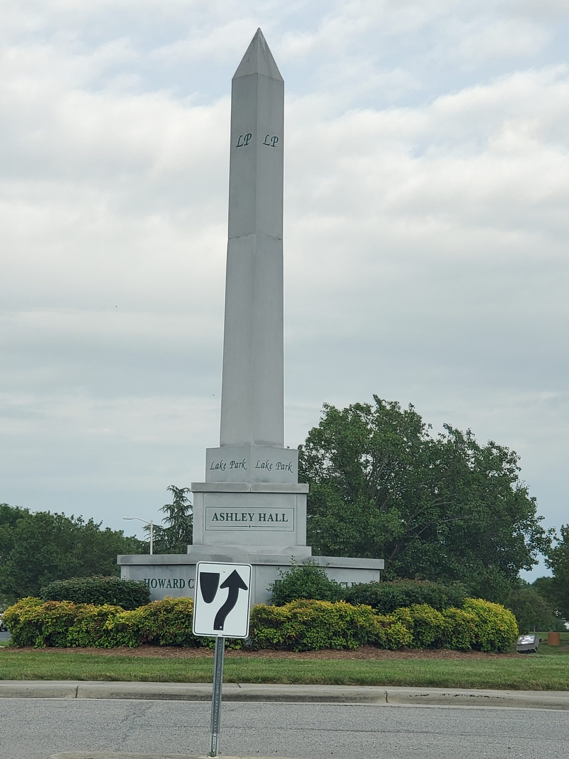
In 1994, the Village of Lake Park received its charter for the State of North Carolina. By 1996, development had begun on Lake Charles and NorthGate, providing a mixture of homesites a well as the creation of Lake Park’s north entry. In 1997, the bronze sculpture of a child flying a kite was dedicated, and in 1998 a 35-foot granite obelisk anchoring Howard Circle was dedicated. The development of Ashley Hall followed NorthGate as the first two development plans in North Carolina to include a traffic circle at the intersection of two main streets. Howard Circle is named in honor of Lake Park’s first Mayor, Scott Howard. It included a time capsule that will be opened in 2023.
Next stop… Warren County!
