
Stanly County was formed in 1841 from the part of Montgomery County west of the Pee Dee River. The county was named for John Stanly of New Bern (1774–1834), who served several terms in the North Carolina House of Commons and two terms in the U.S. House of Representatives.
The county was originally populated with by small tribes. Artifacts and settlements have since been discovered, dating back nearly 10,000 years. Large-scale European settlement of the region came in the mid-18th century via two primary waves: immigrants of Dutch, Scots-Irish and German descent moved from Pennsylvania and New Jersey seeking enhanced religious and political tolerance, while immigrants of English backgrounds came to the region from Virginia and the Cape Fear River Basin in Eastern North Carolina.
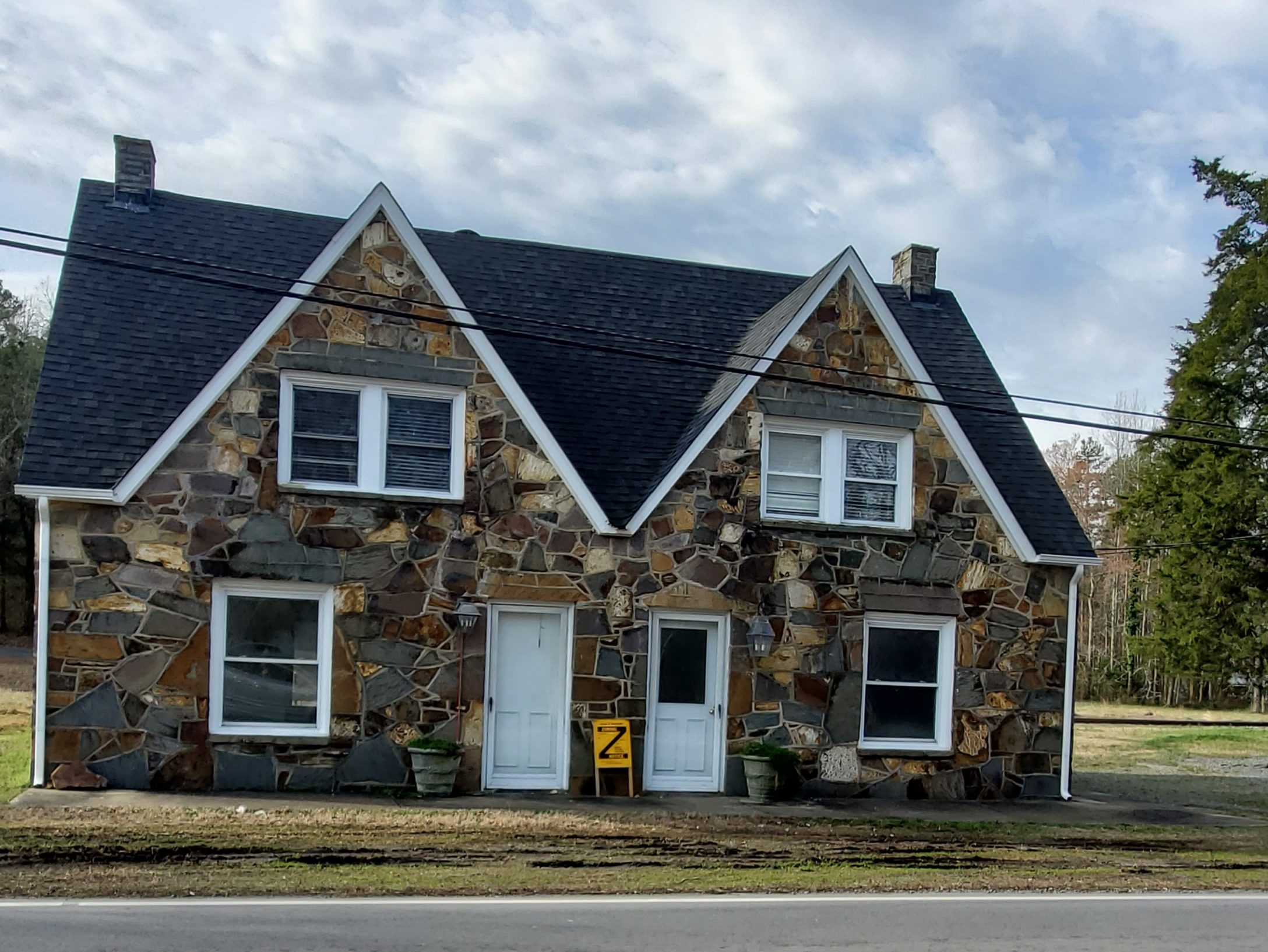
Today, Stanly County is largely rural with hidden gems, including the historic charm of many original stone houses and buildings that still dot the area. The Misenheimer and Richfield areas produced quality stone workers who worked on projects all over the state. You’ll find a number of residential and commercial buildings in these areas, which exhibit the period stone work. Nearby Albemarle Mountains has been a concentrated region of many supposed Big Foot sightings. So, you may stumble upon Sasquatch-related statuary and signage.
Misenheimer
In 1825, Matthias Tobias Barringer discovered gold nuggets along a section of Long Creek that ran through his farm. He found $8,000 worth of gold, and eventually the country’s first gold vein in quartz. Newspapers in 24 states reported the find, and North Carolina’s gold rush began.
In the late 1800s, Misenheimer was a stop called Gladstone on a railroad spur that served a nearby early tourist destination, Misenheimer Springs. At the time Gladstone was home to Gladstone Academy and the old original school building still stands. The Barringer Gold Mine, which began operations in 1825, was also located in Gladstone. The place drew the interest of the Mitchell Home School as it sought a new location. In 1909, when the Mitchell Home arrived, industries such as mining had largely disappeared from the area.
In 1909, the community was renamed Misenheimer, so that the visitors to the springs would not be confused by the name at the train stop. Mitchell Home evolved into what is now Pfeiffer University.
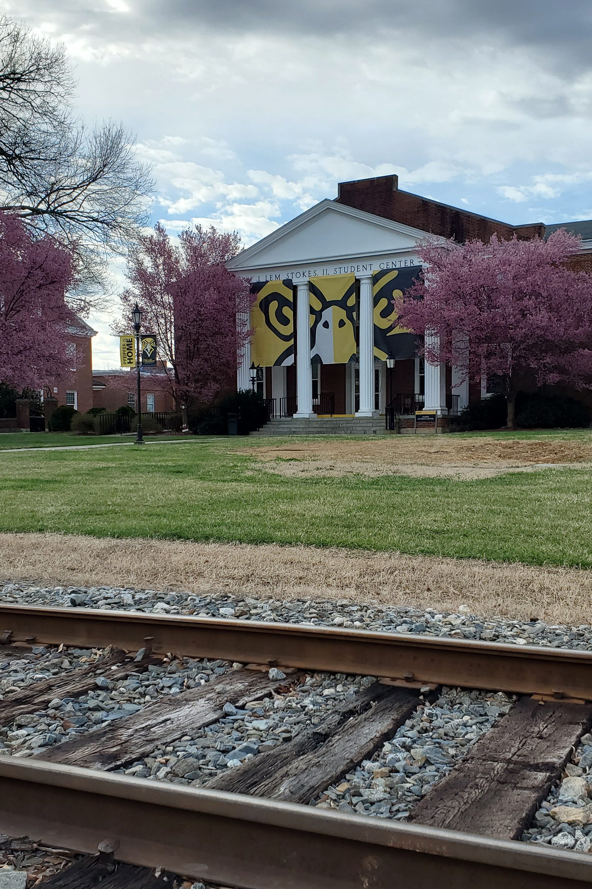
Pfeiffer University
Founded in 1885, Pfeiffer University campus is divided by train tracks. Take a walk through campus and stroll past buildings built in the late 1930s that are on the National Historic Buildings Register.

Gladstone Academy
Located about 0.5 miles from Pfeiffer University, the Gladstone Academy (Wesley Chapel Road) was established in the mid 1880s as a finishing school for young women. The school was run by the Episcopal branch of the United Methodist Church. In the early 1890s, the Academy Building that now exists on Wesley Chapel Road was built. The building served as a school until 1916 when Mitchell School (now Pfeiffer University) came to the area. The building was then converted to a church and served as such until the 1930s. It then began to be used for different purposes and then fell into disuse. The building was purchased by the Village of Misenheimer a few years ago and the Village has spent considerable money to stabilize and improve the building. It is a work in progress.
Richfield
Richfield was originally called “Ritchie’s Field,” for the prominent Ritchie family who established the post office, sawmill, roller mill, cotton gin, and streets of the settlement. The town of Richfield began as a settlement of German immigrants in the late 1800s. The town was chartered in the 1890s as Ritchie’s Mill. Cicero Ritchie laid out the streets, which ran one half mile from the square in each direction. On September 30, 1893 Postmaster George Ritchie opened the new post office and the town was renamed Richfield.
Sadly, many local buildings were destroyed by fire over the early years, so in 1956 the community purchased it’s first fire truck. Richfield celebrated its first centennial in September of 1993.

New London
New London was founded as the unincorporated settlement of Bilesville, north of Albemarle, circa 1830, and named after Thomas “Uncle Tommy” Biles, a local landowner and farmer. At the time, the land was part of Montgomery County until Stanly County was formed in 1841, and Thomas Biles, Jr. and Elizabeth Betsy Sides Biles had moved to their farm at the highest elevation in then Montgomery County. Near the area where the first Carolina Gold Rush took place, gold was found near Bilesville and the first mine was opened in 1859, though it closed during the Civil War.
In 1923, less than three years after the adoption of the Nineteenth Amendment granting women the right to vote, the town elected Mrs. T. V. Staton as their mayor, becoming the first female mayor, as well as the first female to serve in municipal government in the state. The mine was reopened for a time starting in 1934, and throughout the 1920s and 1930s, modern amenities such as telephone service, electrical service, paved roads, and a state highway were built in town. Town sewer and water service was only completed in 2002.
At the outbreak of the Civil War, the mine lay undisturbed until sometime in the 1870s when an English mining company known as New London & States Co., Ltd. purchased the mine property. The English company sent Capt. William Nance to be in charge of the operation. With the gold and other industries going full speed, W. A. Judd from England, now in charge of the mining operations suggested the name be changed from Bilesville to “New London.”
Mr. Judd impressed a community gathering as he described how he thought this rich settlement could grow as big as his native London, England, as the residents were already building large fine homes. With the coming of the railroad, industry would increase and be more productive. The state legislature was petitioned for a change of name, the request was granted and New London was officially incorporated March 25, 1891.
Another of New London’s large businesses, Culp Lumber Company, was begun when John L. Culp came from Cabarrus Country and started a large livery stable and later began the lumber operation. Then when Parker Gold Mine became too expensive to operate in 1894, the English sold the property and returned to England.
While in New London, be sure to visit the New London Park and New London Museum (226 South Main Street), housed in a building built in 1920 as a bank.
Albemarle
This place-name is derived from the English surname Albemarle. According to a 1905 publication by the United States Geologic Survey, based on research by University of North Carolina-Chapel Hill, it was named specifically for General George Monck, the first Duke of Albemarle and one of the original proprietors of the colony of Carolina.
The Albemarle region’s early economic growth was fueled by agriculture (with cotton as the primary crop), regional mercantile trade and a short-lived gold rush in the nearby Uwharrie Mountains, all later supplanted by textile manufacturing.
The Yadkin Railroad began rail service to Albemarle from Salisbury in 1891. In 1911, the Winston-Salem Southbound Railway (WSS) constructed its own line through Albemarle to support the booming textile and market, eventually driving the Yadkin Railroad into obsolescence. The WSS still provides freight service through Albemarle, but since 1933 there has been no passenger service to the city. The Old Market Street Station on the WSS line has been restored, and is now the site of a popular local farmer’s market.
Albemarle was recognized by the National Trust for Historic Preservation as a National Main Street City in 1993. The town is also known as the home of Kellie Pickler of American Idol fame.
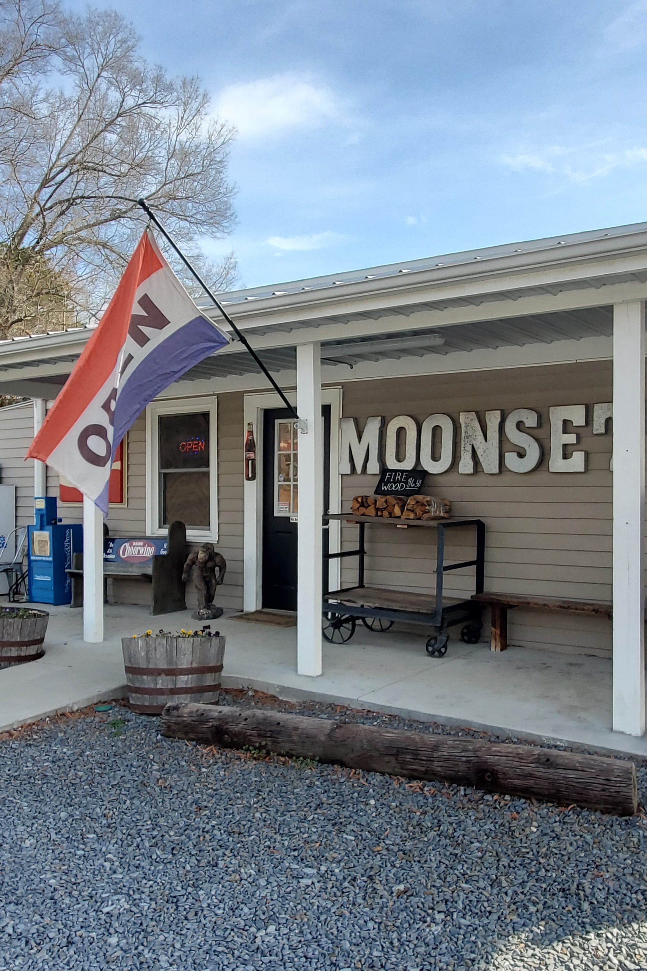
Moonset General Store
32254 Valley Drive, Albemarle

Morrow Mountain Scenic Vista
49104 Morrow Mountain Rd

Carolina Treetop Challenge
114 Rock Creek Park Drive

Stony Mountain Vineyards
26370 Mountain Ridge Rd
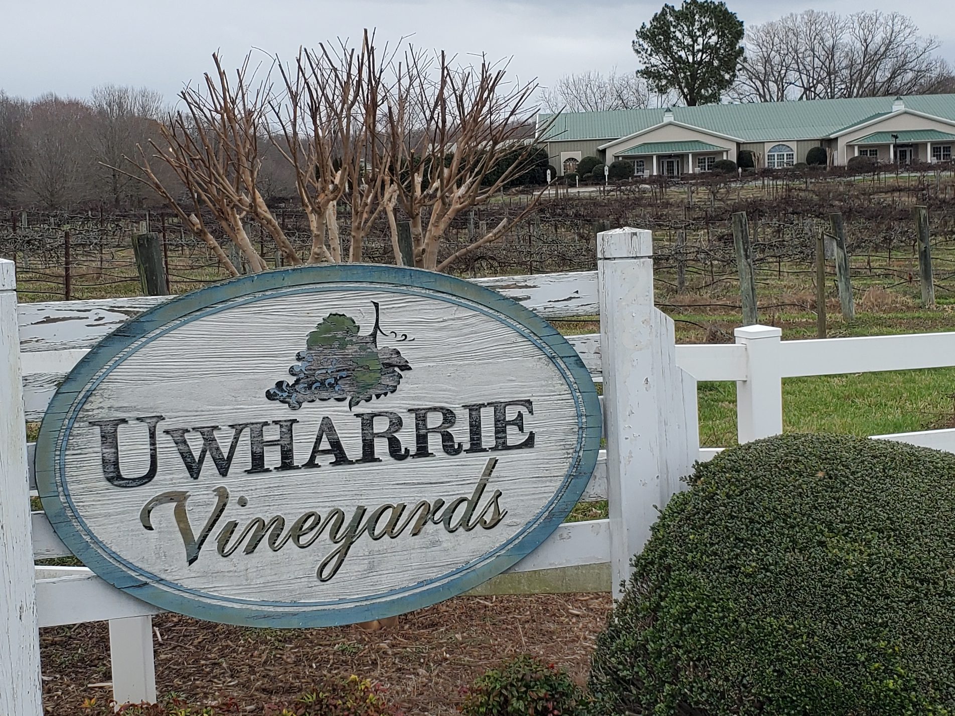
Uwharrie Vineyards
28030 Austin Rd
Red Cross
The name “Red Cross” came from the slick and red clay making it hard to travel during wet weather. Dan Hinson owned one of the largest stores at the crossroads of Hwy 205 and 24/27 (Red Cross Road), built in the early 1900s, and it’s still standing today. The store built in the early 1900s.

Locust
The city of Locust is one of my all-time favorite discoveries and hidden gems in the state. If you’re every travelling through Stanly county, a visit to Locust should be a must on your list.
The City of Locust was established in western Stanly county in the late 1860s by German, Scotch Irish, and English immigrants. The community was known as the “Crossroads”. Many travelers came through on the way to Cabarrus, Anson, and Mecklenburg counties. A central well was dug close to the locust tree to serve the citizens of the community as well as travelers and their livestock as they were traveling through. As many as 25 families would do their washing there in a single day, since it was the only source of water.
In 1869, the population in the “Crossroads” community had increased enough to warrant an application for the establishment of a post office. The community members held a meeting to decide a new name, and a young girl in the community, Miss Maggie Howell, happened to look out at a wooded plot where a large locust tree was in full bloom. Beyond the locust tree, plowed fields laid flat and the reddish clay dirt of the Charlotte Road stretched out level. Miss Powell suggested the name “Locust Level”. And so it was called until May 29, 1894. Then ‘Level’ was dropped, and the town is now called Locust.
Upon entering locust, you’ll be greeted by a larger-than-life metal horse sculpture. Today, Locust (“A City with a Soul”) is a quaint community with a new housing development built around the town’s central green and shopping district, complete with a few retail shops, a craft brewery, and an ice cream shop. Walk around the shops and drive through residential areas… you may find yourself drawn to the quaint, peaceful surroundings.
Locust Historical Society Museum
2884 Officer Jeff Shelton Dr, Locust NC
Stanfield
In 1912, the railroad line between Charlotte and Raleigh was completed, and the town of Stanfield was established. The town was named after an engineer who helped complete the railroad through the present day town.
Stanfield had a Community Song to the tune of “Carolina In the Morning”.
“In 1914 railroads passing through and forming the Town of Stanfield,
Bringing with them ways for folks to travel and to build a new town, Stanfield.
Schools and churches, stores and business thrived in those days.
People moved to be a part of new ways.
Nothing could be finer than to be in Stanfield now when it is growing.
A small town deep within the country and a lot of hospitality.
Building plans for future growth to make our life all happy, wise, and healthy.
So if you’re looking for a place that you can call home. Come on out to Stanfield, you’ll nevermore roam.
You will like our country town – we have interests all around in Stanfield.”

Oakboro
The town of Oakboro began at a natural salt lick called Big Lick. When the railroad passed through in 1913, the town moved closer to the railroad and became “Furr Town”. In 1915, the name was changed to Oakboro. The Oakboro Cotton Mill was a major employer in the 1940s and 1950s while cotton was still “king” of the South. Today Oakboro is known for its annual Independence Day parade and for hosting a classic car cruise-in on the fourth Friday of every month. Bruton Smith, CEO of Speedway Motorsports, is from the area.
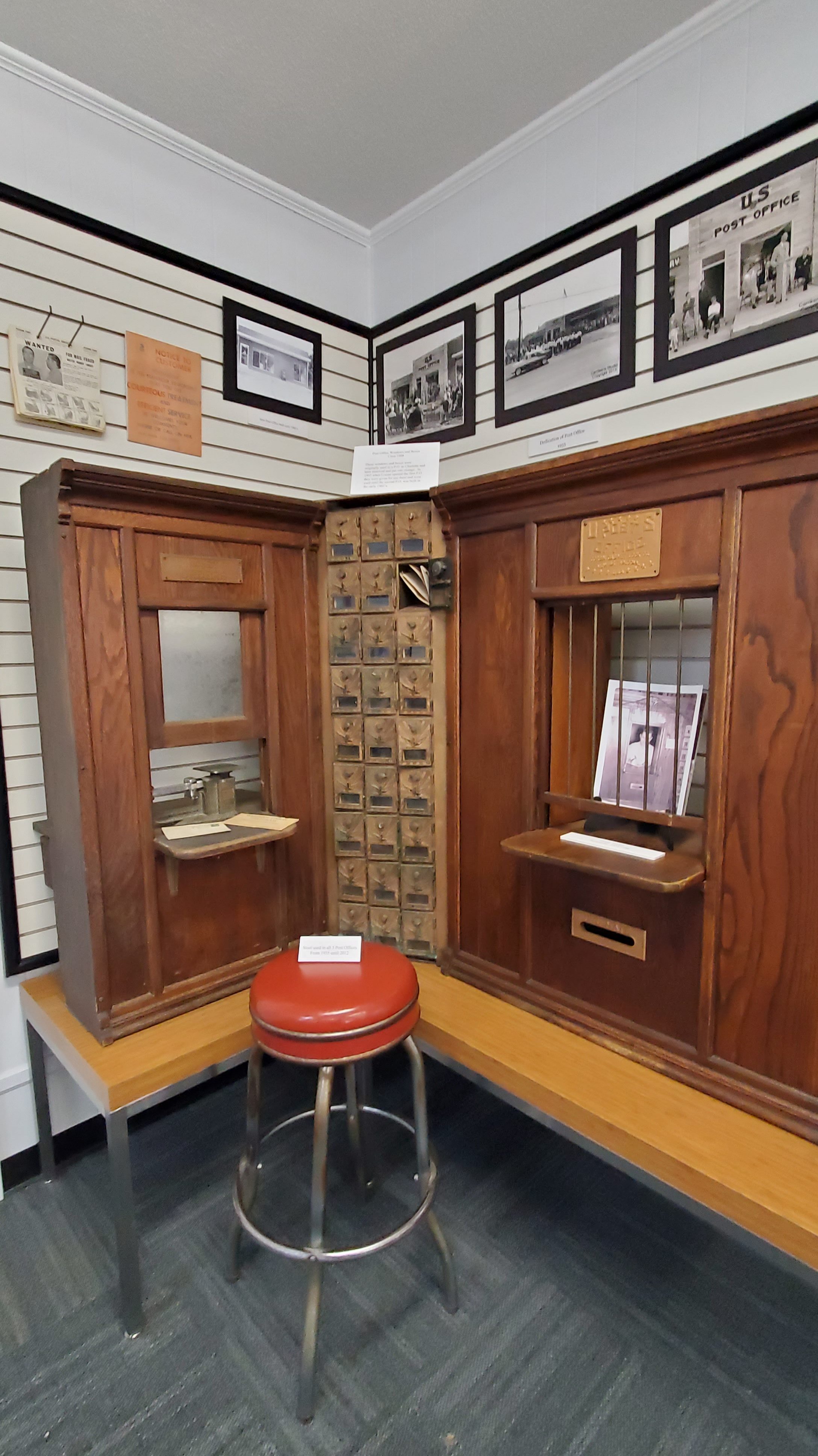
Oakboro Regional Museum of History
231 N. Main Street
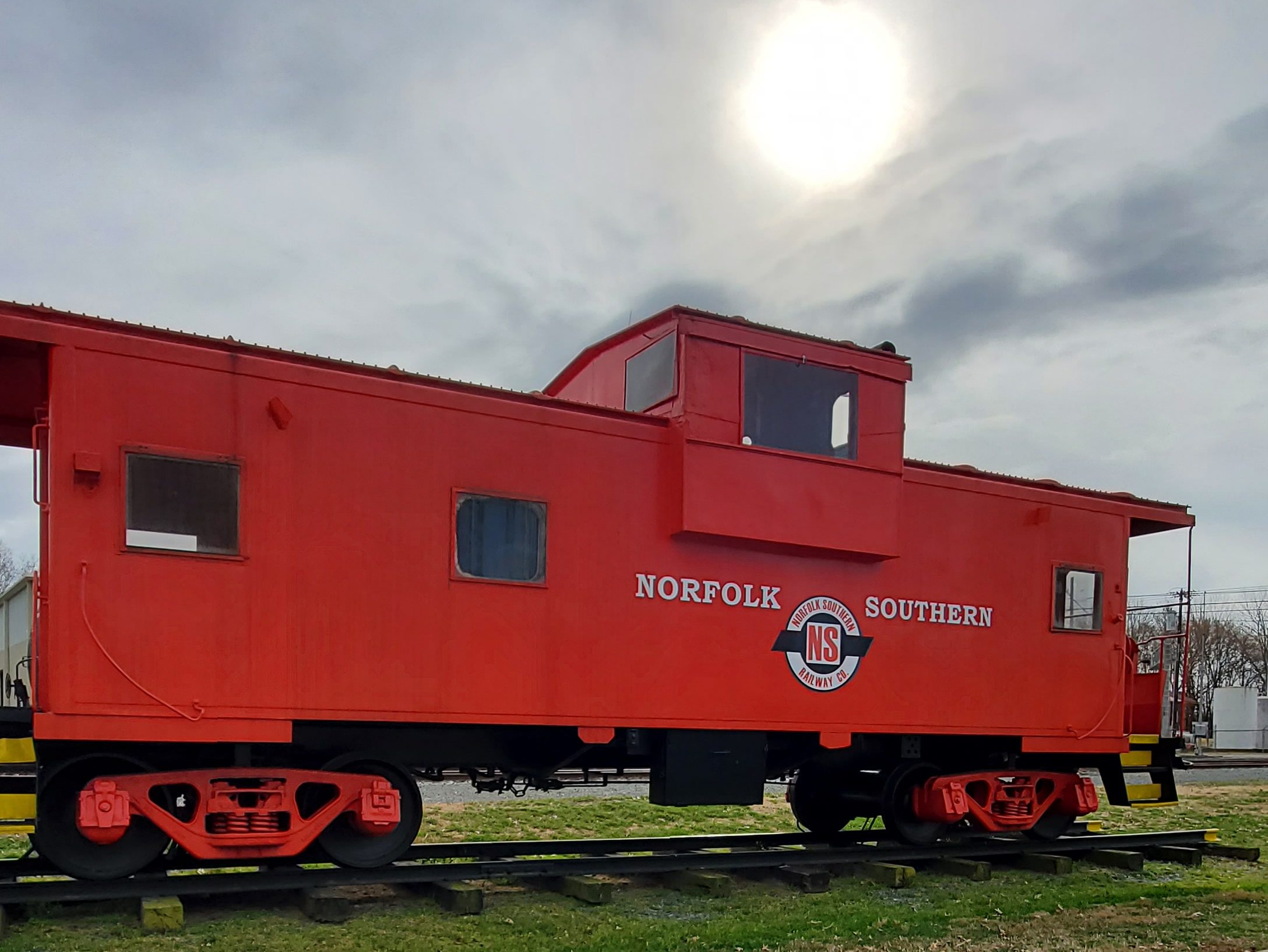
Oakboro Railroad Museum
128 Aquadale Road

Badin
Badin is called ‘The Town Aluminum Built.’ The town was originally built for the sole purpose of making aluminum, with the falls of the Yadkin River providing the 24/7 power needed for the French Southern Aluminium Company.
In the spring of 1913, French company, L’Aluminium Français, began work on a dam at the narrows of the Yadkin River, which becomes the Pee Dee River a few miles downstream, to provide power for an aluminum smelter. At the time of construction in 1913, the Narrows Dam was the highest spillway dam in the world and the largest dam in North Carolina, and it had the largest hydroelectric units in the world.
The small town, designed to house both company workers and engineers, was built along the newly formed lake and named for company president Adrien Badin. The project was abandoned at the start of World War I, and picked up a few years later by an American company (ALCOA), which finished the project.
Badin also boasts the Hardaway Site, and national historic landmark (1990) overlooking the Yadkin River, is the site of numerous archeological digs with some artifacts, such as arrowheads and other tools, found as much as four feet deep. Removal and cataloguing began in 1948.

Badin Museum
60 Falls Rd.
Badin Quadraplex Museum
64 Falls Rd
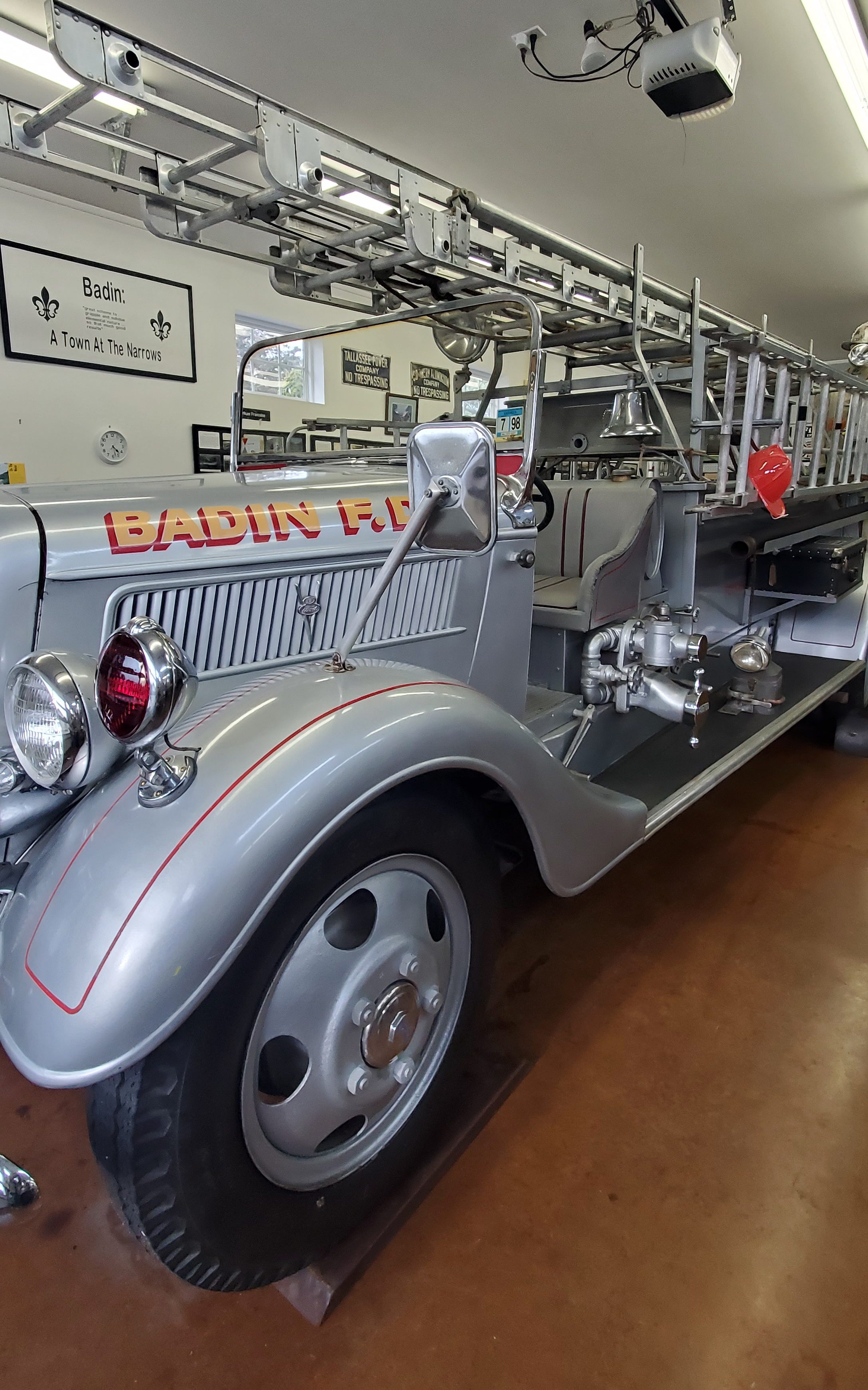
Badin Firehouse Museum
60 Falls Rd

Norwood
Norwood is nestled in a beautiful area between the Pee Dee and Rocky Rivers next to the Uwharrie Mountains and beside Lake Tillery to the east. Celebrations throughout the year include Arbor Day in April, Picnic in the Park in October, and the annual Christmas parade. The nearby Fork Stables host Outdoor Heritage Days and two weeks of equestrian cross country, dressage, and show jumping competitions.
The first settlements in the Norwood area began in the 1740s with settlers from Delaware and other middle Atlantic colonies following Indian trails and rivers. The town of Norwood was incorporated in 1881 and named after the Norwood brothers’ store, an early establishment in the Center community that housed the area’s post office.
As with many communities, railroads changed the face of Norwood. The arrival of the Yadkin Railroad in 1891 allowed greater access to larger markets across the state and nation. Eventually, two new railroads would serve Norwood; the original Norfolk Southern and the Winston-Salem Southbound. Until 1928, one could ride from Norwood to Albemarle and Badin in a rail car on the Yadkin Railroad. The Winston-Salem Southbound in the early 20th century saw a large number of passengers until improved roads and competition from the automobile ended the service in 1933.
In the early 20th century, Norwood’s business district suffered a major disaster. A downtown fire spread up the east side of Main Street consuming all of the wooden buildings until it stopped at the two-story brick building housing Harris-McAulay Mercantile (now M. B. Irvin Unlimited). The fire was so intense that it blew out all the showcase windows of the U.B. Blalock building across the street (where the Family Dollar building now stands). When the downtown was rebuilt most buildings were built in brick.
The Great Depression affected the town into the 1940s. Businesses and farms failed, and property was sold at the courthouse steps for delinquent taxes. Norwood’s only bank at the time also failed.

Norwood Museum
205 Pee Dee Avenue
Next stop… Vance County!
